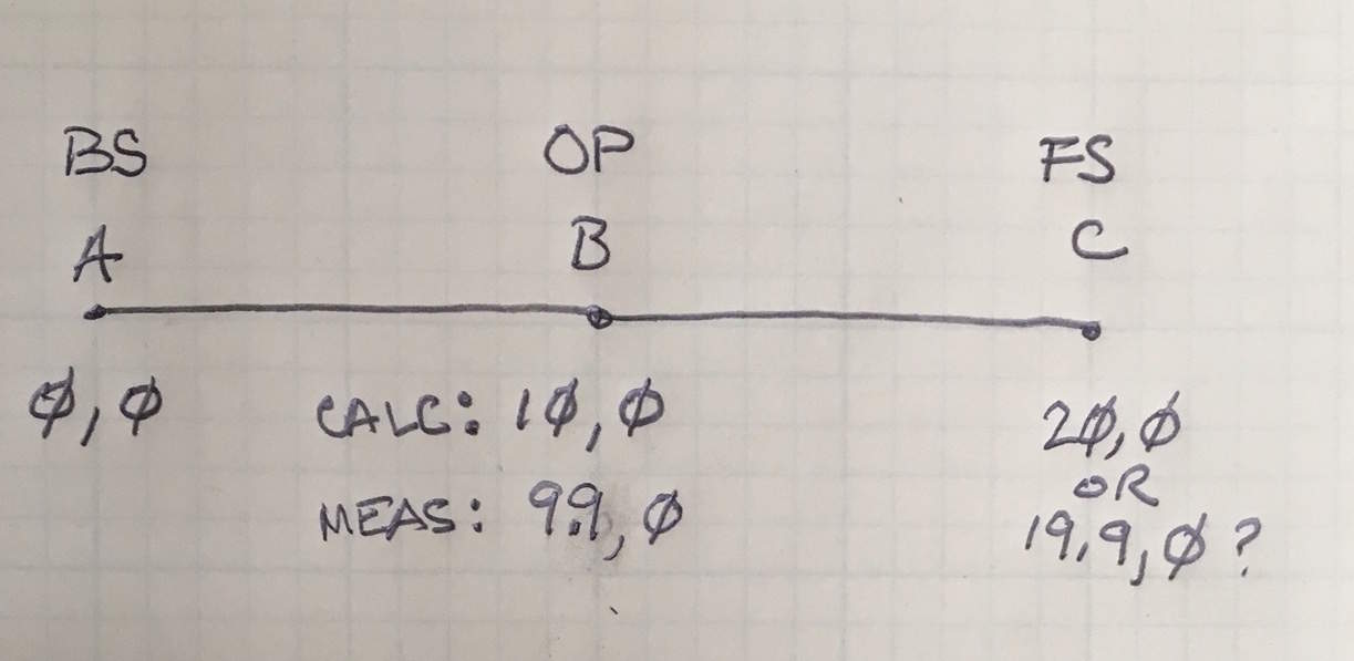
In a recent thread regarding troubleshooting the .rw5 file for an extension of a control network, I received varying advice on whether to measure and record the distance for the Back Sight as well as the azimuth. What I've been doing is: after extending the network and bringing it into CAD, I output an ASCII file with all the new points in it. I bring that into SurvCE and it saves it as the Control .crd file. Then I setup on the last point (say "B", backsight with the last, backsight to the next from last ("A"), The coordinates for both of which are selected from the Control file (when you're in the "Backsight" screen.
If I set a prism up on the Back Sight, and measure both the distance and azimuth, I get the notice screen telling me that it calculated the distance as xxx and measured it as yyy. I say OK (as long as the differences aren't of blunder size, and look to the foresight ("C"). See here:

So the question is :
Are the coordinates of C based on what you measured, or what the software calculated? If A, B and C are in a straight line, each 10' apart, and you look at the coordinates in the resulting file, will C be at 20,0 or at 19.9,0 (because the location of B was based on what was measured)? Does all DC software work the same way?
Your control coordinates will stay the same, unless you deliberately overwrite them. The new position at C would be calculated from the control coordinates you originally input. Most data collector software will hold your control coordinates fixed, unless you take action to overwrite their values somehow.


