I tested a baser/rover combination against a rover/smartfix (Leica's network RTK solution in NZ) today.
The base and rover were separated by about 50m horizontally.
I recorded one point a second for an hour on both rovers. They were both fixed in position for the duration of the test.
Both rovers with Leica GS14, The base was a GS15.
The Z values varied about plus/minus 20mm on both rovers. I was expecting better from the base/rover as the baseline is virtually "zero". I am pretty sure I have had much better results before. This would have been in the UK wit Trimble equipment.
Does anybody else think the errors on the base seem high? I can post the full results. The standard deviation was nearly the same for both setups.
yes, my R10's will be less than 7mm vertically doing that kind of test.
We could rerun the same test using our Trimble gear - give me a call if you're keen
Had a look at satellite numbers/geometry for the time of the obs?
Might be some clues in your raw data, pdop figures etc.
I quickly configured the base and I didn't check Glonass was enabled. Maybe that it is it. I will have to check tomorrow.
The location was not completely open for the rovers (both of them). I wanted to get a more typical scenario. The base was totally open to the sky though.
I will conduct the test again in the wide open if I can;t find anything else.
Keen to check against Trimble gear if I can;t find what's wrong. Thanks Jim. Would ideally need three units though. One on VRS now or whatever it is called in NZ.
If you weren't in the open then I would say those numbers are totally believable. Vertical suffers more than horizontal in the presence of multipath in my experience.
Elevation mask might be worth checking, not all receivers default to 10 degrees. Had this happen with hired Hemisphere kit on a hydrographic survey, it either defaulted to or was set to 0 degrees which gave an impressive number of satellites but definitely degraded performance.
squowse, post: 425639, member: 7109 wrote:
Keen to check against Trimble gear if I can;t find what's wrong. Thanks Jim. Would ideally need three units though. One on VRS now or whatever it is called in NZ.
Can do - maybe this weekend? - Would also be cool to use a fourth unit and check against Trimble's virtual base station system
Not a zero baseline test, as that involves a single antenna feeding multiple receivers...so lets just call this a short baseline test.
The gear is a Javad Triumph LS rover, and a Triumph 2 for the base.
The location was wide open farm land. Base and Rover were about 15 feet apart. During this test, static data was recording on the base, and the rover while points were measured. You can clearly see that rather short static measurement times can be quite successful.
The test began with the Ohio RTN to determine the base location. The LS was placed on the tripod, which will be the location of the base in a few minutes. I logged 10 points, for 60 seconds each, and used the result for my own base location.
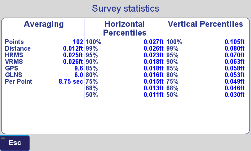
I then switched to base/rover mode, and collected 100 points, each comprised of 45 epochs. My base was at 5hz, so each point was accomplished in about 9 seconds.
This screen shot is the result of the RTK only solution. 
This screen shot is of the same points, based upon the very short 9 second long static files which I post processed on the LS, after downloading the static file from the base. 
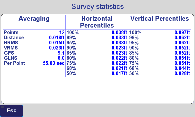
Still using base/rover mode, I collected 72 points, each being 180 seconds. My base was at 2hz.
This screen shot is the result of the 180 second RTK only solution. 
This screen shot is of the same points, based upon the 180 second long static files which I post processed on the LS, after downloading the static file from the base. 
John Evers, post: 425911, member: 467 wrote: This screen shot is of the same points, based upon the very short 9 second long static files which I post processed on the LS, after downloading the static file from the base.
John, did you have both the base and rover aligned to north?
Yes on the base, doh! on the rover.
John Evers, post: 425987, member: 467 wrote: Yes on the base, doh! on the rover.
You should repeat your test with the LS aligned to north too (display to the north, compass reading 180). I think this may be why you are seeing the vertical post-processed results not being as good as the RTK results.


