
On my Tunnel Project I ran a GPS session on a Benchmark in the middle of the project. I got 0.082 meters difference. GEOID12B quite OK, eh?
Here is the OPUS return and the Datasheet. I highlighted the ortho height in each. This is on the top of the mountain.
FILE: 54412221.DAT OP1439338544981
NGS OPUS SOLUTION REPORT
========================
All computed coordinate accuracies are listed as peak-to-peak values.
For additional information: http://www.ngs.noaa.gov/OPUS/about.jsp#accuracy
USER: LRDay....... DATE: August 12, 2015
RINEX FILE: 5441222a.15o TIME: 00:16:42 UTC
SOFTWARE: page5 1209.04 master91.pl 022814 START: 2015/08/10 00:36:00
EPHEMERIS: igr18571.eph [rapid] STOP: 2015/08/10 17:31:00
NAV FILE: brdc2220.15n OBS USED: 45260 / 45727 : 99%
ANT NAME: TRM41249.00 NONE # FIXED AMB: 136 / 138 : 99%
ARP HEIGHT: 1.4 OVERALL RMS: 0.011(m)
REF FRAME: NAD_83(2011)(EPOCH:2010.0000) IGS08 (EPOCH:2015.6065)
X: -1807031.146(m) 0.001(m) -1807031.998(m) 0.001(m)
Y: -4601014.910(m) 0.004(m) -4601013.610(m) 0.004(m)
Z: 4021969.290(m) 0.007(m) 4021969.199(m) 0.007(m)
LAT: 39 19 18.52304 0.003(m) 39 19 18.53921 0.003(m)
E LON: 248 33 27.97307 0.002(m) 248 33 27.92015 0.002(m)
W LON: 111 26 32.02693 0.002(m) 111 26 32.07985 0.002(m)
EL HGT: 3077.894(m) 0.007(m) 3077.142(m) 0.007(m)
ORTHO HGT: 3094.281(m) 0.020(m) [NAVD88 (Computed using GEOID12B)]
UTM COORDINATES STATE PLANE COORDINATES
UTM (Zone 12) SPC (4302 UT C)
Northing (Y) [meters] 4352582.611 2109741.840
Easting (X) [meters] 461880.549 504981.379
Convergence [degrees] -0.28023346 0.03700642
Point Scale 0.99961789 0.99993867
Combined Factor 0.99913542 0.99945604
US NATIONAL GRID DESIGNATOR: 12SVJ6188052582(NAD 83)
BASE STATIONS USED
PID DESIGNATION LATITUDE LONGITUDE DISTANCE(m)
DH7098 P086 KENNECOTT1UT2005 CORS ARP N403855.643 W1121655.412 163932.8
DH3864 P105 DELTAMUNI_UT2004 CORS ARP N392315.140 W1123014.669 91859.1
AJ2124 PUC1 CARBON COUNTY COU CORS ARP N393557.066 W1104831.329 62656.6
NEAREST NGS PUBLISHED CONTROL POINT
KN0233 P 41 N391918.7 W1112632.0 5.5
PROGRAM = datasheet95, VERSION = 8.7.1
1 National Geodetic Survey, Retrieval Date = AUGUST 11, 2015
KN0233 ***********************************************************************
KN0233 DESIGNATION - P 41
KN0233 PID - KN0233
KN0233 STATE/COUNTY- UT/SANPETE
KN0233 COUNTRY - US
KN0233 USGS QUAD - DANISH KNOLL (1976)
KN0233
KN0233 *CURRENT SURVEY CONTROL
KN0233 ______________________________________________________________________
KN0233* NAD 83(1986) POSITION- 39 19 18.7 (N) 111 26 32.0 (W) HD_HELD2
KN0233* NAVD 88 ORTHO HEIGHT - 3094.199 (meters) 10151.55 (feet) ADJUSTED
KN0233 ______________________________________________________________________
KN0233 GEOID HEIGHT - -16.39 (meters) GEOID12B
KN0233 DYNAMIC HEIGHT - 3090.384 (meters) 10139.03 (feet) COMP
KN0233 MODELED GRAVITY - 979,279.6 (mgal) NAVD 88
KN0233
KN0233 VERT ORDER - SECOND CLASS 0
KN0233
KN0233.The horizontal coordinates were established by autonomous hand held GPS
KN0233.observations and have an estimated accuracy of +/- 10 meters.
KN0233.
KN0233.The orthometric height was determined by differential leveling and
KN0233.adjusted by the NATIONAL GEODETIC SURVEY
KN0233.in June 1991.
KN0233
KN0233.The dynamic height is computed by dividing the NAVD 88
KN0233.geopotential number by the normal gravity value computed on the
KN0233.Geodetic Reference System of 1980 (GRS 80) ellipsoid at 45
KN0233.degrees latitude (g = 980.6199 gals.).
KN0233
KN0233.The modeled gravity was interpolated from observed gravity values.
KN0233
KN0233; North East Units Estimated Accuracy
KN0233;SPC UT C - 2,109,747. 504,982. MT (+/- 10 meters HH2 GPS)
KN0233
KN0233 SUPERSEDED SURVEY CONTROL
KN0233
KN0233 NGVD 29 (??/??/92) 3092.675 (m) 10146.55 (f) ADJ UNCH 2 0
KN0233
KN0233.Superseded values are not recommended for survey control.
KN0233
KN0233.NGS no longer adjusts projects to the NAD 27 or NGVD 29 datums.
KN0233.See file dsdata.txt to determine how the superseded data were derived.
KN0233
KN0233_U.S. NATIONAL GRID SPATIAL ADDRESS: 12SVJ6188152588(NAD 83)
KN0233
KN0233_MARKER: DB = BENCH MARK DISK
KN0233_SETTING: 7 = SET IN TOP OF CONCRETE MONUMENT
KN0233_SP_SET: SET IN TOP OF CONCRETE MONUMENT
KN0233_STAMPING: P 41 1934
KN0233_STABILITY: C = MAY HOLD, BUT OF TYPE COMMONLY SUBJECT TO
KN0233+STABILITY: SURFACE MOTION
KN0233
KN0233 HISTORY - Date Condition Report By
KN0233 HISTORY - 1934 MONUMENTED CGS
KN0233
KN0233 STATION DESCRIPTION
KN0233
KN0233'DESCRIBED BY COAST AND GEODETIC SURVEY 1934
KN0233'16.5 MI E FROM EPHRAIM.
KN0233'ABOUT 16.5 MILES EAST ALONG STATE HIGHWAY 29 FROM THE BANK OF EPHRAIM
KN0233'AT EPHRAIM, SANPETE COUNTY, AT SUMMIT, AND 4 FEET NORTHWEST OF A
KN0233'UNITED STATES BUREAU OF PUBLIC WORKS SIGN READING SUMMIT 10, 180
KN0233'ORANGEVILLE 29 M. EPHRAIM 18 M. A STANDARD DISK, STAMPED P 41 1934
KN0233'AND SET IN THE TOP OF A CONCRETE POST

I think ya can probably put a fork in that one...
Loyal
wow...that up there in elevation. I'm use to ortho heights being about 2-5 meters...lol.

Considering the limited number of GPS on bench marks in the NGS database that contributed to GEOID12A (or any other previous model for that matter) 8 cm doesn't seem bad at all. I am led to believe that NGS is planning a new geoid model for sometime in 2016. If anyone wants the model to improve in their area then they will need to either submit GPS on 1st- or 2nd-Order NAVD 88 bench marks as a Blue-Book project or using OPUS Share Solutions (much easier). If the number of GPS on BMs obs don't increase then don't expect any improvements until the new vertical datum planned for 2022. If the number of GPS on BMs don't increase in most of the western states than the vertical transformation tool that NGS will create will most likely be much less reliable as well.
That datasheet only has a second order elevation derived from leveling... no GPS coordinates, no NAD83 ellipsoid height, nothing. I agree with David, 8cm seems pretty darn good to me, especially in the mountains.

Is the U.S. Bureau of Public Roads sign still there?

FWIW,
iUsing the relationship h - H - N = 0 and your h and the published H we get a geoid-ellipsoid separation of 16.305 m. The modeled value is 16.39. Assuming there is no problem with your HI this difference looks large. Unfortunately geoid models do not perform well in high mountain areas. Further, there are issues with respect to the determination of orthometric heights from the field-determined leveling differences. Orthometric heights take the field values and incorporate gravity data to convert them to geopotential differences. Until we get the good gravity values from GRAV-D I imagine the values in the NGS database are poorly geo-referenced and of problematic quality.
I note that the orthometric height was determined in the 1930s. Lots of possible geophysical deformation since then.
While I agree that GPS observations on NGS-published benchmarks will help improve the hybrid geoid model, there needs to be better and more current gravity and better theory to deal with issues of mass densities and the downward continuation in mountainous areas. These factors impact the gravimetric model on which the hybrid model is based.
Unfortunately, without access to additional information not on the datasheet I cannot evaluate how the 1934 observed heights were updated to NAVD 88 benchmark.
A search for projects associated with this PID results in only the original level project: L1817. This means no additional observations have been made on this point since the 1930s.
HTH,
DMM

LRDay, post: 331420, member: 571 wrote: On my Tunnel Project I ran a GPS session on a Benchmark in the middle of the project. I got 0.082 meters difference. GEOID12B quite OK, eh?
Here is the OPUS return and the Datasheet. I highlighted the ortho height in each. This is on the top of the mountain.
FILE: 54412221.DAT OP1439338544981
NGS OPUS SOLUTION REPORT
========================
All computed coordinate accuracies are listed as peak-to-peak values.
For additional information: http://www.ngs.noaa.gov/OPUS/about.jsp#accuracy
USER: LRDay....... DATE: August 12, 2015
RINEX FILE: 5441222a.15o TIME: 00:16:42 UTCSOFTWARE: page5 1209.04 master91.pl 022814 START: 2015/08/10 00:36:00
EPHEMERIS: igr18571.eph [rapid] STOP: 2015/08/10 17:31:00
NAV FILE: brdc2220.15n OBS USED: 45260 / 45727 : 99%
ANT NAME: TRM41249.00 NONE # FIXED AMB: 136 / 138 : 99%
ARP HEIGHT: 1.4 OVERALL RMS: 0.011(m)REF FRAME: NAD_83(2011)(EPOCH:2010.0000) IGS08 (EPOCH:2015.6065)
X: -1807031.146(m) 0.001(m) -1807031.998(m) 0.001(m)
Y: -4601014.910(m) 0.004(m) -4601013.610(m) 0.004(m)
Z: 4021969.290(m) 0.007(m) 4021969.199(m) 0.007(m)
LAT: 39 19 18.52304 0.003(m) 39 19 18.53921 0.003(m)
E LON: 248 33 27.97307 0.002(m) 248 33 27.92015 0.002(m)
W LON: 111 26 32.02693 0.002(m) 111 26 32.07985 0.002(m)
EL HGT: 3077.894(m) 0.007(m) 3077.142(m) 0.007(m)
ORTHO HGT: 3094.281(m) 0.020(m) [NAVD88 (Computed using GEOID12B)]
UTM COORDINATES STATE PLANE COORDINATES
UTM (Zone 12) SPC (4302 UT C)
Northing (Y) [meters] 4352582.611 2109741.840
Easting (X) [meters] 461880.549 504981.379
Convergence [degrees] -0.28023346 0.03700642
Point Scale 0.99961789 0.99993867
Combined Factor 0.99913542 0.99945604
US NATIONAL GRID DESIGNATOR: 12SVJ6188052582(NAD 83)BASE STATIONS USED
PID DESIGNATION LATITUDE LONGITUDE DISTANCE(m)
DH7098 P086 KENNECOTT1UT2005 CORS ARP N403855.643 W1121655.412 163932.8
DH3864 P105 DELTAMUNI_UT2004 CORS ARP N392315.140 W1123014.669 91859.1
AJ2124 PUC1 CARBON COUNTY COU CORS ARP N393557.066 W1104831.329 62656.6
NEAREST NGS PUBLISHED CONTROL POINT
KN0233 P 41 N391918.7 W1112632.0 5.5PROGRAM = datasheet95, VERSION = 8.7.1
1 National Geodetic Survey, Retrieval Date = AUGUST 11, 2015
KN0233 ***********************************************************************
KN0233 DESIGNATION - P 41
KN0233 PID - KN0233
KN0233 STATE/COUNTY- UT/SANPETE
KN0233 COUNTRY - US
KN0233 USGS QUAD - DANISH KNOLL (1976)
KN0233
KN0233 *CURRENT SURVEY CONTROL
KN0233 ______________________________________________________________________
KN0233* NAD 83(1986) POSITION- 39 19 18.7 (N) 111 26 32.0 (W) HD_HELD2
KN0233* NAVD 88 ORTHO HEIGHT - 3094.199 (meters) 10151.55 (feet) ADJUSTED
KN0233 ______________________________________________________________________
KN0233 GEOID HEIGHT - -16.39 (meters) GEOID12B
KN0233 DYNAMIC HEIGHT - 3090.384 (meters) 10139.03 (feet) COMP
KN0233 MODELED GRAVITY - 979,279.6 (mgal) NAVD 88
KN0233
KN0233 VERT ORDER - SECOND CLASS 0
KN0233
KN0233.The horizontal coordinates were established by autonomous hand held GPS
KN0233.observations and have an estimated accuracy of +/- 10 meters.
KN0233.
KN0233.The orthometric height was determined by differential leveling and
KN0233.adjusted by the NATIONAL GEODETIC SURVEY
KN0233.in June 1991.
KN0233
KN0233.The dynamic height is computed by dividing the NAVD 88
KN0233.geopotential number by the normal gravity value computed on the
KN0233.Geodetic Reference System of 1980 (GRS 80) ellipsoid at 45
KN0233.degrees latitude (g = 980.6199 gals.).
KN0233
KN0233.The modeled gravity was interpolated from observed gravity values.
KN0233
KN0233; North East Units Estimated Accuracy
KN0233;SPC UT C - 2,109,747. 504,982. MT (+/- 10 meters HH2 GPS)
KN0233
KN0233 SUPERSEDED SURVEY CONTROL
KN0233
KN0233 NGVD 29 (??/??/92) 3092.675 (m) 10146.55 (f) ADJ UNCH 2 0
KN0233
KN0233.Superseded values are not recommended for survey control.
KN0233
KN0233.NGS no longer adjusts projects to the NAD 27 or NGVD 29 datums.
KN0233.See file dsdata.txt to determine how the superseded data were derived.
KN0233
KN0233_U.S. NATIONAL GRID SPATIAL ADDRESS: 12SVJ6188152588(NAD 83)
KN0233
KN0233_MARKER: DB = BENCH MARK DISK
KN0233_SETTING: 7 = SET IN TOP OF CONCRETE MONUMENT
KN0233_SP_SET: SET IN TOP OF CONCRETE MONUMENT
KN0233_STAMPING: P 41 1934
KN0233_STABILITY: C = MAY HOLD, BUT OF TYPE COMMONLY SUBJECT TO
KN0233+STABILITY: SURFACE MOTION
KN0233
KN0233 HISTORY - Date Condition Report By
KN0233 HISTORY - 1934 MONUMENTED CGS
KN0233
KN0233 STATION DESCRIPTION
KN0233
KN0233'DESCRIBED BY COAST AND GEODETIC SURVEY 1934
KN0233'16.5 MI E FROM EPHRAIM.
KN0233'ABOUT 16.5 MILES EAST ALONG STATE HIGHWAY 29 FROM THE BANK OF EPHRAIM
KN0233'AT EPHRAIM, SANPETE COUNTY, AT SUMMIT, AND 4 FEET NORTHWEST OF A
KN0233'UNITED STATES BUREAU OF PUBLIC WORKS SIGN READING SUMMIT 10, 180
KN0233'ORANGEVILLE 29 M. EPHRAIM 18 M. A STANDARD DISK, STAMPED P 41 1934
KN0233'AND SET IN THE TOP OF A CONCRETE POST
That's pretty poor with 2012, but not the least bit unusual, I would be very suspect using geoid models in rough mountain areas, the geoid slope can change very quickly, so it's best to check it against levels even with very short distances, you may see it slipping within 1000'.
Also I would want to see another bench tied and hope that you see close to the same .08m. That one could be disturbed, wouldn't be the first time.
I don't use OPUS for elevations (I look at it, but it never works very well for me), I prefer to tie to the nearest CORS point and reduce it myself, it usually gives a better number for the elevation, have you tried that?

GeeOddMike, post: 331473, member: 677 wrote: A search for projects associated with this PID results in only the original level project: L1817.
Where does one search for old leveling projects?
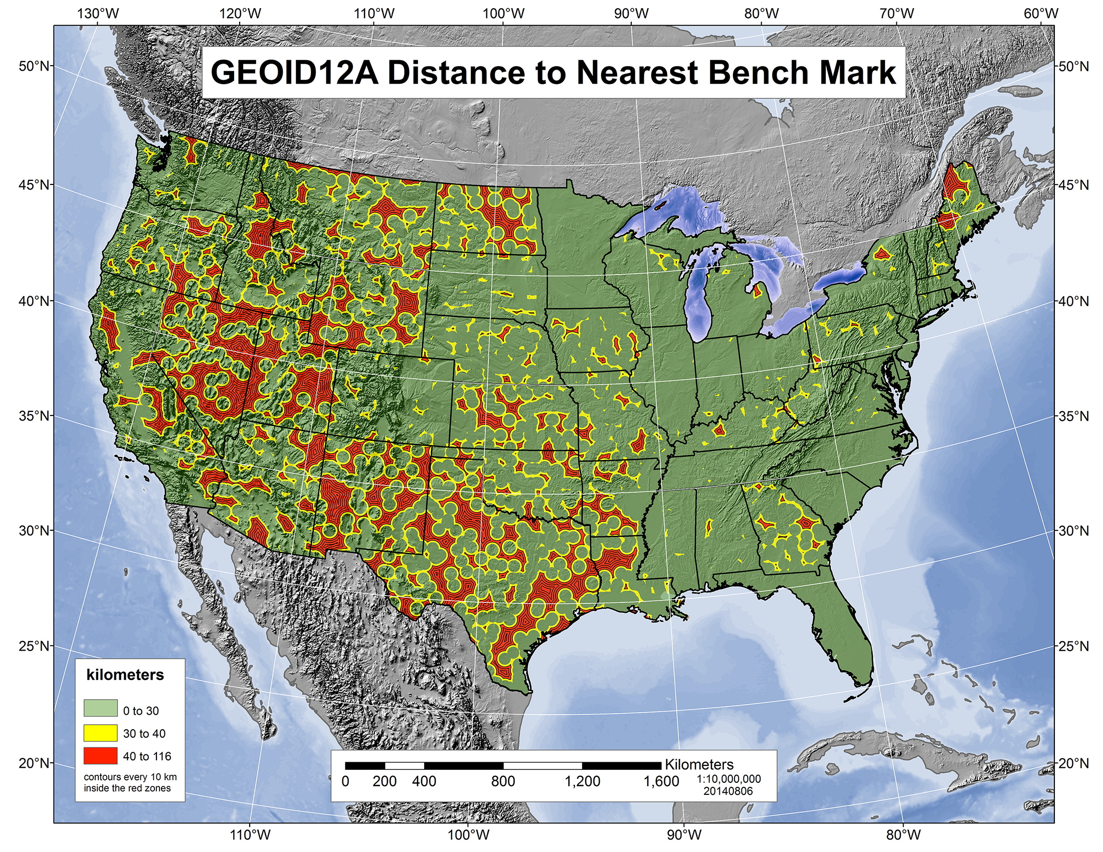
NGS has interesting maps that show big differences in the accuracy across the country.

Retrieving projects associated by PID is done here: http://www.ngs.noaa.gov/cgi-bin/SURV_ID/mark_sources.prl
There was a tool on the NGS site that became an orphan, LineTool, that was invaluable to me when attempting to analyze leveling networks. Evidently my requests for someone to adopt it were unsuccessful.
After finding the project identifiers you can use the retrieve by project identifier page. Unfortunately it will not provide access to the observations or adjustment as LineTool did.
What's pretty cool is that when you look at the Geoid12A estimated accuracy map that Bill linked to, the estimates for that lat/long are generally in the 6 - 8 cm region.
Leveled Bench Marks above 10,000 Feet are relatively rare (except maybe in parts of Colorado).
Here's one situate not too far South of my house, that I will someday do an OPUS Observation on (probably not until I retire though).
PROGRAM = datasheet95, VERSION = 8.7.1
1		National Geodetic Survey,   Retrieval Date = AUGUST 12, 2015
LO0172 ***********************************************************************
LO0172  DESIGNATION -  D 160
LO0172  PID		 -  LO0172
LO0172  STATE/COUNTY-  UT/SUMMIT
LO0172  COUNTRY	 -  US
LO0172  USGS QUAD   -  MIRROR LAKE (1972)
LO0172
LO0172						 *CURRENT SURVEY CONTROL
LO0172  ______________________________________________________________________
LO0172* NAD 83(1986) POSITION- 40 41 14.	 (N) 110 54 18.	 (W)   SCALED
LO0172* NAVD 88 ORTHO HEIGHT -  3267.338 (meters)	10719.59  (feet) ADJUSTED
LO0172  ______________________________________________________________________
LO0172  GEOID HEIGHT	-		-12.90  (meters)					 GEOID12B
LO0172  DYNAMIC HEIGHT  -	   3263.797 (meters)	10707.97  (feet) COMP
LO0172  MODELED GRAVITY -	979,418.8   (mgal)					   NAVD 88
LO0172
LO0172  VERT ORDER	  -  SECOND	CLASS 0
LO0172
LO0172.The horizontal coordinates were scaled from a topographic map and have
LO0172.an estimated accuracy of +/- 6 seconds.
LO0172.
LO0172.The orthometric height was determined by differential leveling and
LO0172.adjusted by the NATIONAL GEODETIC SURVEY
LO0172.in June 1991.
LO0172
LO0172.The dynamic height is computed by dividing the NAVD 88
LO0172.geopotential number by the normal gravity value computed on the
LO0172.Geodetic Reference System of 1980 (GRS 80) ellipsoid at 45
LO0172.degrees latitude (g = 980.6199 gals.).
LO0172
LO0172.The modeled gravity was interpolated from observed gravity values.
LO0172
LO0172;					North		 East	Units  Estimated Accuracy
LO0172;SPC UT N	 - 1,039,470.	  550,300.	  MT  (+/- 180 meters Scaled)
LO0172
LO0172						  SUPERSEDED SURVEY CONTROL
LO0172
LO0172  NGVD 29 (??/??/92) 3265.798  (m)		10714.54   (f) ADJ UNCH	2 0
LO0172
LO0172.Superseded values are not recommended for survey control.
LO0172
LO0172.NGS no longer adjusts projects to the NAD 27 or NGVD 29 datums.
LO0172.See file dsdata.txt to determine how the superseded data were derived.
LO0172
LO0172_U.S. NATIONAL GRID SPATIAL ADDRESS: 12TWL080040(NAD 83)
LO0172
LO0172_MARKER: DB = BENCH MARK DISK
LO0172_SETTING: 66 = SET IN ROCK OUTCROP
LO0172_SP_SET: MASSIVE OUTCROP
LO0172_STAMPING: D 160 1962
LO0172_STABILITY: A = MOST RELIABLE AND EXPECTED TO HOLD
LO0172+STABILITY: POSITION/ELEVATION WELL
LO0172
LO0172  HISTORY	 - Date	 Condition		Report By
LO0172  HISTORY	 - 1962	 MONUMENTED	   CGS
LO0172
LO0172						  STATION DESCRIPTION
LO0172
LO0172'DESCRIBED BY COAST AND GEODETIC SURVEY 1962
LO0172'30.1 MI NE FROM KAMAS.
LO0172'30.1 MILES NORTHEAST ALONG STATE HIGHWAY 150 FROM THE JUNCTION OF U.S.
LO0172'HIGHWAY 189 ALTERNATE AT KAMAS, 34.7 FEET SOUTH OF THE SOUTHWEST POST
LO0172'SUPPORTING BALD MTN, ELEVATION 10,678 FT. SIGN, 53 FEET SOUTHWEST OF
LO0172'THE CENTER LINE OF THE HIGHWAY, 82 FEET WEST OF THE CENTER OF THE
LO0172'JUNCTION OF BALD MOUNTAIN TRAIL ROAD, IN THE TOP OF A MASSIVE OUTCROP,
LO0172'ABOUT 1 FOOT LOWER THAN THE HIGHWAY, AND 1.0 FOOT ABOVE THE GROUND.
Loyal
GeeOddMike, post: 331473, member: 677 wrote: A search for projects associated with this PID results in only the original level project: L1817. This means no additional observations have been made on this point since the 1930s.
Welcome to Utah!
My height of antenna is good, I've done enough of these to do it right. There is another BM in a rock outcrop (better stability) about a mile away but I don't think they will pay for the extra data. The only thing that really matters here as far as elevation is concerned for this project is the slope of the tunnel being rehabilitated (a tunnel for water flow). It's 7000 feet long and from my data appears to have a 0.3 feet per hundred feet drop. Even a foot of error probably wouldn't make much difference as there is only certain size pipes to choose from. I will point out the possibility of some error using the GEOID Model. If they really want to know I guess we can level loop from the bench mark. The BM on top is about 10150 feet the tunnel is about 9700 feet, nice loop, Eh? It's probably a $3000+ level loop!
I will submit my data through OPUS Share.

Loyal, post: 331499, member: 228 wrote: Leveled Bench Marks above 10,000 Feet are relatively rare
Not disputing the rarity, but I'm reminded that there was a First Order level run up to the peak of Mount Whitney (14,500' or so) done, as I recall, in the 1930s. My wife, son and I hiked up there maybe 5 years ago, and I was truly impressed by the fact that a crew with equipment got up there and back and followed high-order procedures to boot.
Dave Karoly, post: 331468, member: 94 wrote: Is the U.S. Bureau of Public Roads sign still there?
Original sign is not there, probably gone due to road improvement.
Here are the Pictures.


base9geodesy, post: 331438, member: 7189 wrote: Considering the limited number of GPS on bench marks in the NGS database that contributed to GEOID12A (or any other previous model for that matter) 8 cm doesn't seem bad at all. I am led to believe that NGS is planning a new geoid model for sometime in 2016. If anyone wants the model to improve in their area then they will need to either submit GPS on 1st- or 2nd-Order NAVD 88 bench marks as a Blue-Book project or using OPUS Share Solutions (much easier). If the number of GPS on BMs obs don't increase then don't expect any improvements until the new vertical datum planned for 2022. If the number of GPS on BMs don't increase in most of the western states than the vertical transformation tool that NGS will create will most likely be much less reliable as well.
Great program last week in Phoenix! I am going to try to mobilize our local professional society members to submit as many local observations as possible in the next 6-9 months to tighten things up around here. Hope everyone else does too!
Your picture of the monument shows it has been damaged with the left side showing significant damage and a crack on the top and bottom of the disk. The disk is not centered in the remaining post.
As there is no way to determine whether it was displaced, as its previous position was by scaling, I would consider myself lucky getting an eight centimeter agreement with the GPS-derived value.
As for extending levels to one other BM, if your results do not agree within expectations what do you prove. The only way to resolve the issue would be extensive leveling. No one is going to pay for that.
All hail the new vertical datum based on GPS-derived ellipsoid heights and a high resolution geoid model.
GeeOddMike, post: 331548, member: 677 wrote: Your picture of the monument shows it has been damaged with the left side showing significant damage and a crack on the top and bottom of the disk. The disk is not centered in the remaining post.
As there is no way to determine whether it was displaced, as its previous position was by scaling, I would consider myself lucky getting an eight centimeter agreement with the GPS-derived value.
As for extending levels to one other BM, if your results do not agree within expectations what do you prove. The only way to resolve the issue would be extensive leveling. No one is going to pay for that.
All hail the new vertical datum based on GPS-derived ellipsoid heights and a high resolution geoid model.
Could have been hit or it could just be weathering. I've seen some a lot worse than this that I know haven't been hit. I went and found PP41 and it was in pristine condition in a grove of Aspen trees (Not GPSable). The next one is N41 which I didn't have the data on at the time to search for. It is in a rock outcrop so probably a good one. I used P41 also as a RTK base point to hunt for some section corners for my project. So I just left it over night and got the OPUS data and was glad it was still there in the morning being right on the road like that. We all like to do this sort of stuff but it's hard to get paid to to it.
GeeOddMike, post: 331548, member: 677 wrote: Your picture of the monument shows it has been damaged with the left side showing significant damage and a crack on the top and bottom of the disk. The disk is not centered in the remaining post
The disk appears to still be embedded in the concrete, so the only concern is whether the concrete post is leaning or broken off near ground level, and it doesn't appear that it is.
Not to re-irritate the issue, I still feel that the monument shows signs of damage which could have impacted its height. There have been eighty years since the work was done.
Unfortunately, NGS policies on accepting level data requires that work done to replace, update or verify the published values require that second-order leveling be performed and all the associated paperwork. Not likely in this or many similar cases.
Getting back to the point of my earliest response, I still think there are issues with the determination of orthometric heights at these high elevations. Prof W. Featherstone of Curtin University in Australia has a very interesting paper on his web page on this issue. It is here: http://espace.library.curtin.edu.au/R?func=dbin-jump-full&local_base=gen01-era02&object_id=158292
I also point out the difficulty of geoid modeling in these high mountainous areas. As you mention there are large geoid slopes. Gravity reductions given lateral mass density variations and the like remain problematic.
Enjoy the paper. I especially recommend looking at his other papers. Looks of good stuff and clearly written as well.