In another thread, John Hamilton, mentioned using a cemetery as a good open place for a base station. That reminded me ...
I'd like to find a surveying way to commemorate a g-g-great uncle who was a county surveyor in the hometown area for decades in the 1800's. Maybe the 2nd one to hold that position after the county was created.
Probably the best I could do personally would be an OPUS Share, since I'm not going to learn bluebooking. There is plenty of open sky at his grave. His stone is too small to be stable, and the big family stone doesn't have any obvious feature to set a GPS over. I'm reluctant to try drilling the stone to put in a metal marker for fear of breaking out a chunk, although I've seen US C&GS disks done that way on statue bases and stone steps.
I suppose I could put a disk on an 8 ft grounding rod driven beside his stone, but have no idea how deep it would really need to go to be stable. I've seen too many USGS points marked in a similar manner that didn't stay in place, maybe because they didn't sleeve them.
Have any of you done something similar?
Bill~
I just got done doing a opus share on a marker here in my hometown. This is the reference from the ngs. https://www.ngs.noaa.gov/PUBS_LIB/Benchmark_4_1_2011.pdf
I know I do not want to drive anything 8 feet down in a cemetery. Also I am not sure a Surveyor from the 1800's would care about having a GPS monument at his grave, since they never used GPS. A rock pile would be more appropriate since that is something he would have made in his Surveys. Maybe just add a plague that has Country Surveyor on it.
Scotland, post: 435784, member: 559 wrote: I just got done doing a opus share on a marker here in my hometown.
Nice. Perfect lettering - did you stamp it or buy it with the stamping done?
BBFQ11
Bill93, post: 435793, member: 87 wrote: Nice. Perfect lettering - did you stamp it or buy it with the stamping done?
BBFQ11
Wow... You found that fast! I actually bought it pre-stamped from Bernstein. Pretty expensive ($100) but well worth it. I also added a magnet that is glued underneath the cap. I dug the hole in poured in the cement for this took like 8 bags of 60 lbs cement.
Scott Ellis, post: 435789, member: 7154 wrote: I know I do not want to drive anything 8 feet down in a cemetery.
Don't you think it would be pretty safe between headstones that are in a nice orderly row?
Scott Ellis, post: 435789, member: 7154 wrote: I am not sure a Surveyor from the 1800's would care about having a GPS monument at his grave, since they never used GPS.
You have a point, but the purpose would be to remind current surveyors and other visitors of his profession, and a rock pile wouldn't look right between the headstones. In that area, I don't think rock mounds were common and suspect most of his work consisted of finding evidence of original pits, mounds, and bearing trees and then burying a marked stone with measured ties to fence posts.
In Texas, the TSPS (Texas Society of Professional Surveyors- different chapters) posts calendar events for deceased surveyors called "Final Point", where they have a ceremony for the Final Resting Place of surveyors; some members, or family may set survey monuments/markers with Lat/Long on them.
Recent Example: http://www.tsps.org/news/346668/Final-Point-Ceremony-for-Harold-Fisher-RPLS-558-and-Glenn-Fisher-RPLS-4146.htm
Bill93, post: 435813, member: 87 wrote: Don't you think it would be pretty safe between headstones that are in a nice orderly row?
I think it would depend on the Cemetery, some probably would be safe, some may not be.
I understand the reason you want to add a monument to his grave, I think a 5/8" x 2 foot rebar with a Cap would be fine. A cemetery is the last place I want to go to find a monument to tie into, I would drive an hour out the way to find another point to use.
I do not believe a family that is burying their loved ones, or visiting their grave, wants to see a Survey Crew working.
Scott Ellis, post: 435789, member: 7154 wrote: Maybe just add a plague that has Country Surveyor on it.
That's being a little harsh isn't it?

Tommy Young, post: 435823, member: 703 wrote: That's being a little harsh isn't it?
I see your point, that is mean for a Surveyor in the 1800's. A plaque would be much nicer, and safer for the alive visitors.
Bryan Newsome, post: 435814, member: 179 wrote: "Final Point", where they have a ceremony for the Final Resting Place of surveyors
What kind of survey monument do they place? Do they do a bluebook submission or OPUS Share on them?
I had one section corner I set once that was a hard climb up a muddy hill and crossing a creek. I stopped and said a few choice words when I walked away from it. Does that count?
Bill93, post: 435830, member: 87 wrote: What kind of survey monument do they place? Do they do a bluebook submission or OPUS Share on them?
I think you end up setting this monument and you can bluebook or opus share it after it is installed. That is what I got from the article http://www.nsps.us.com/resource/resmgr/PR_FrankLenik/Final_Point_Article.docx
Scotland, post: 435841, member: 559 wrote: I think you end up setting this monument and you can bluebook or opus share it after it is installed. That is what I got from the article http://www.nsps.us.com/resource/resmgr/PR_FrankLenik/Final_Point_Article.docx
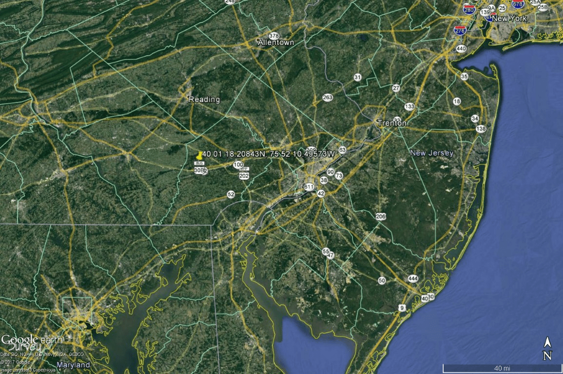
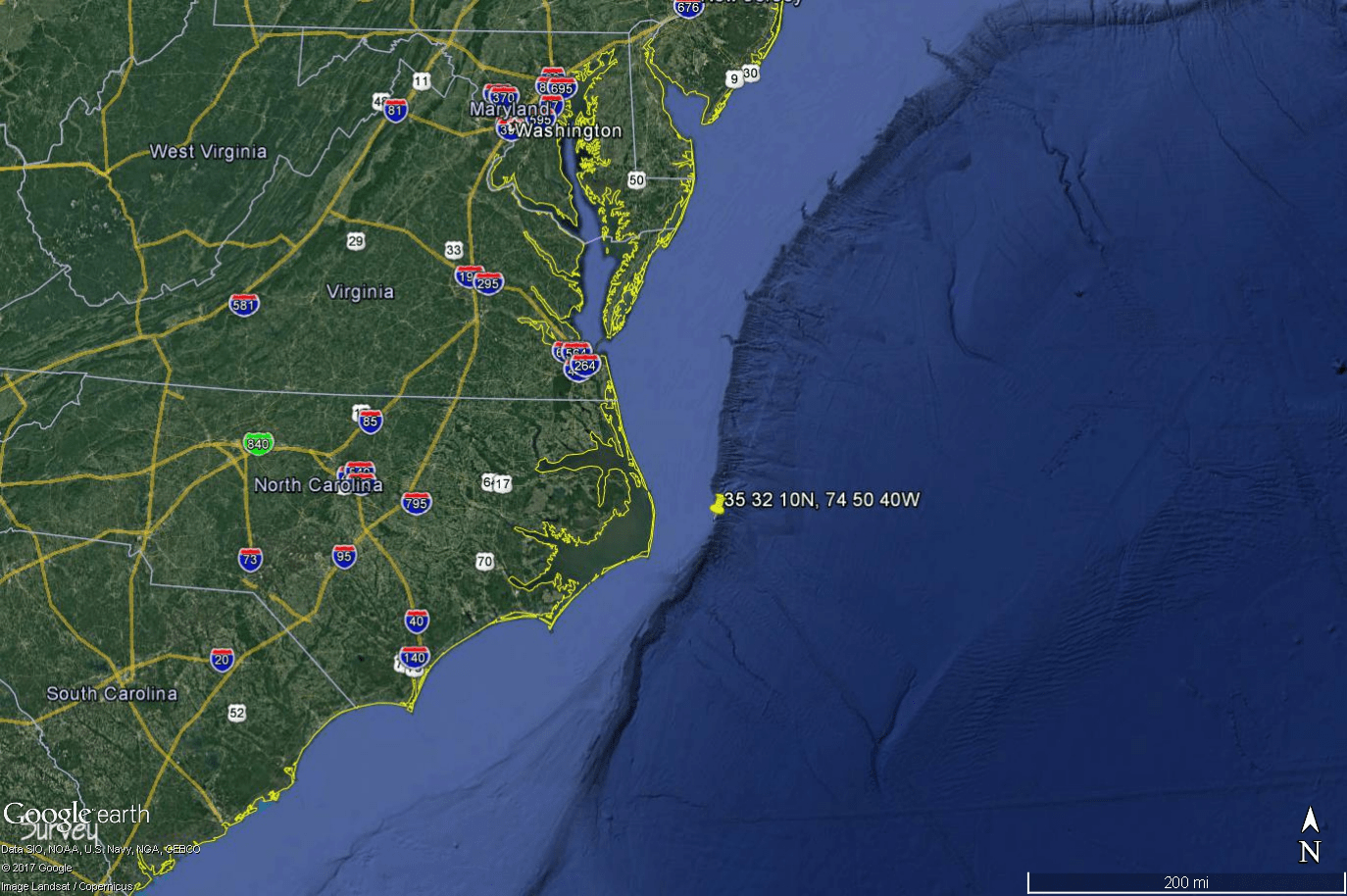
Looking at the docx - nice story about Walter H White. But the OPUS Share file has the location is in Pennsylvania,
but the coordinates on the disk
is out in the Atlantic Ocean by North Carolina.
Wonder if he had a burial at sea?
Have you ever set a commemorative marker?
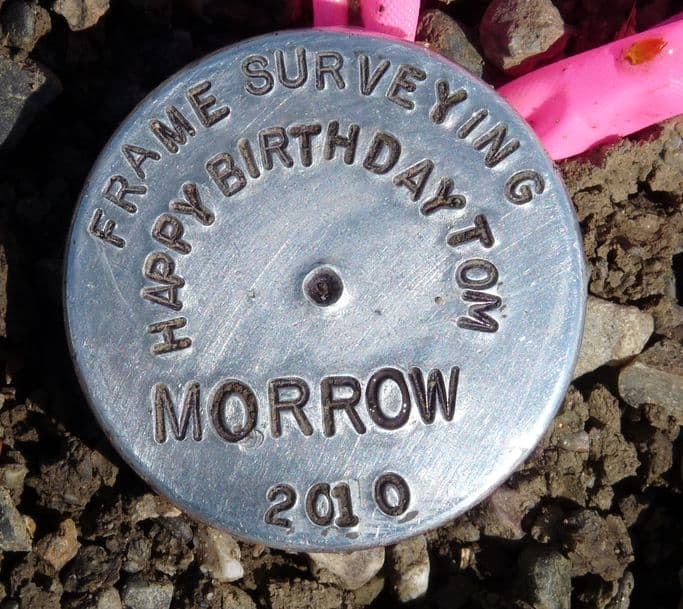
Does this count?
I set this the day before a friend's birthday party. Unfortunately, while the party went well, the project got its funding cut and we never positioned this mark, or any of the other couple dozen stations that were part of the project.
Bill93, post: 435780, member: 87 wrote: In another thread, John Hamilton, mentioned using a cemetery as a good open place for a base station. That reminded me ...
I'd like to find a surveying way to commemorate a g-g-great uncle who was a county surveyor in the hometown area for decades in the 1800's. Maybe the 2nd one to hold that position after the county was created.
Probably the best I could do personally would be an OPUS Share, since I'm not going to learn bluebooking. There is plenty of open sky at his grave. His stone is too small to be stable, and the big family stone doesn't have any obvious feature to set a GPS over. I'm reluctant to try drilling the stone to put in a metal marker for fear of breaking out a chunk, although I've seen US C&GS disks done that way on statue bases and stone steps.
I suppose I could put a disk on an 8 ft grounding rod driven beside his stone, but have no idea how deep it would really need to go to be stable. I've seen too many USGS points marked in a similar manner that didn't stay in place, maybe because they didn't sleeve them.
Have any of you done something similar?
Interesting idea. I'd probably consider disguising the monument as a footstone in a location where it would be a safe bet that it was outside the limits of the excavation for the grave. One relatively well known West Texas surveyor, S.A. Thompson had footstones marked "T" about 6"x 6" at the boundaries of the plot where he and his two wives, the Keesey sisters, were buried in Fort Davis.
Depending on the soil condition, you could buy a 6" x 6" x necessary length granite marker, grout a brass tablet in the top, and then set it in concrete below grade that would be covered with topsoil. I suppose that in Iowa, the main consideration for stability is frost heave, so that plan might not work as well in the frost belt as it would in sunny Texas, depending upon frost depth.


