

Ask A Surveyor
If you are a landowner seeking advice from surveyors, please post your questions and issues here.... View more
Organizer:
- Organized by
-
Trimble workflow
Trimble workflow
This is a rather in-the-weeds question for the ??ask a surveyor? forum. I??m a mechanical engineer doing surveying as a hobby on my own property. I??m using Trimble General Survey software on a Trimble TSC3 collector and a Trimble S6 DR+ robot. I have all the manuals, and I took an introductory surveying class from the late Francis Moffitt at UC Berkeley in 1977. I also have more recent survey textbooks.
I have several property corner monuments that were set by a licensed surveyor as shown in the attached screenshot, so I??ve got the backsights. My objective is to locate some landmarks such as water well bores, power poles, culverts, and develop some topological mapping data.
My basic question is: Given the prior survey data and plat map, what is the recommended workflow?
In particular:
I gather that I need to key in the data for the backsight points. But here??s my first puzzlement: The General Survey software is impressively powerful and comprehensive, yet it doesn??t seem to have a way to input points using bearing distance from another point. In contrast, when keying in a line, it offers the method of inputting the bearing and distance from a point; yet I don??t see a way to make a point from the end of the line. So do I really need to pre-calculate the X-Y coordinates of all of the property corners from the bearing and distance data?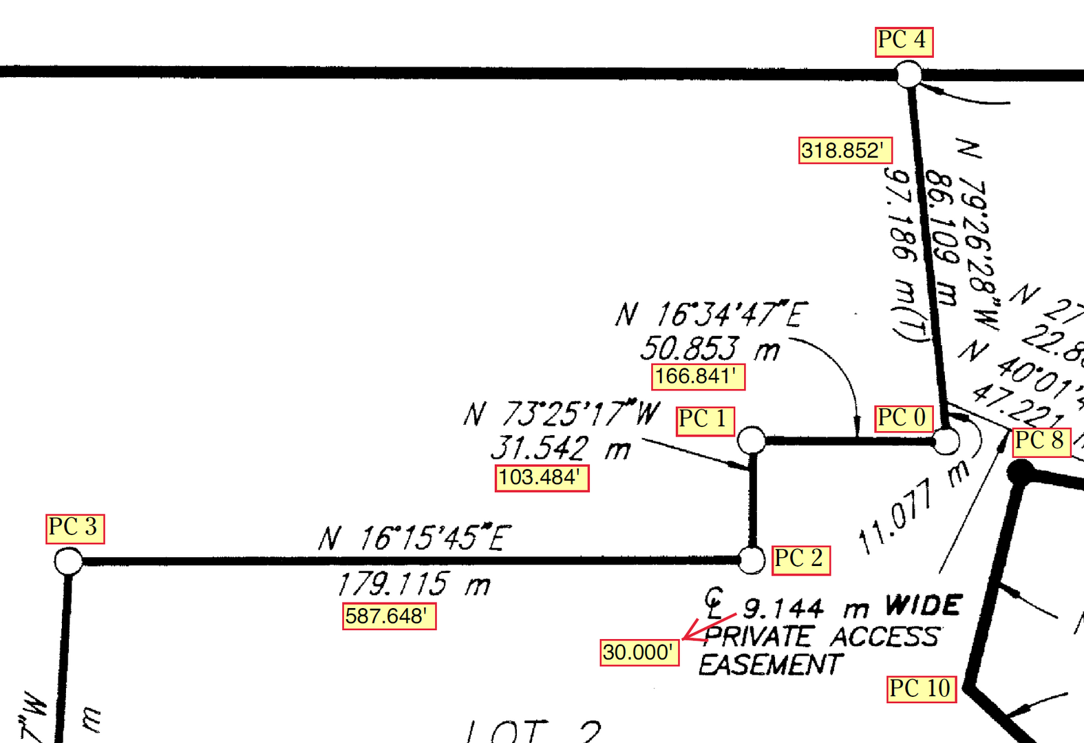


Log in to reply.