

Ask A Surveyor
If you are a landowner seeking advice from surveyors, please post your questions and issues here.... View more
Organizer:
- Organized by
-
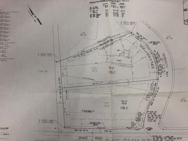
Surveyors Local Coordinate System (lcs) Northing Easting
Surveyors Local Coordinate System (lcs) Northing Easting
How does one convert the lcs grid northing and easting to lat/long or state plane coordinates (spc). From time to time, a survey will show a 10,000 decimal , 1000 decimal, or 5000 decimal point northing and easting. Attached a plan here to show the points.
I work in the GIS mapping field, New Jersey, USA. Without a projected coordinate, I am left with only geo-referencing this map (based on objects can match to between survey and orthoimagery) to where I ”think” it is located. Problem is that “thought” may not be ”exactly” pinpoint to where the point of beginning is or bearing.
Please let me know if there is a formula to get the northing/easting converted to latitude/longitude or state plane.

Log in to reply.