12-6-2018
Utility Easement Survey
SW Sec 23 T23S R24E
Warren, AZ
?ÿ
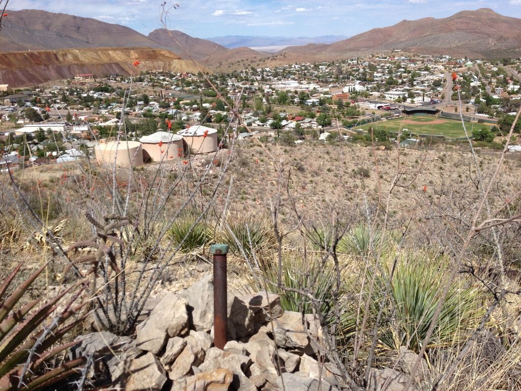
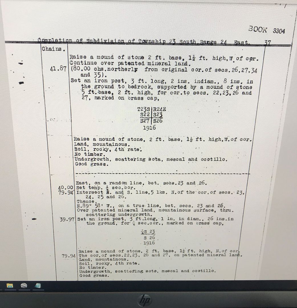
Tying down an original GLO cap from 1916 above Warren, AZ. ?ÿ Warren lies just South of Bisbee, AZ and was home to the wealthier men of the Phelps Dodge mining business.?ÿ The Warren Ball Park seen below was built in 1909 making it nearly 5 years older than Wrigley Field. It also means the GLO Surveyors setting this monument in 1916 had the same view of the Ball Park.?ÿ Good Day to be a Surveyor!!
?ÿ


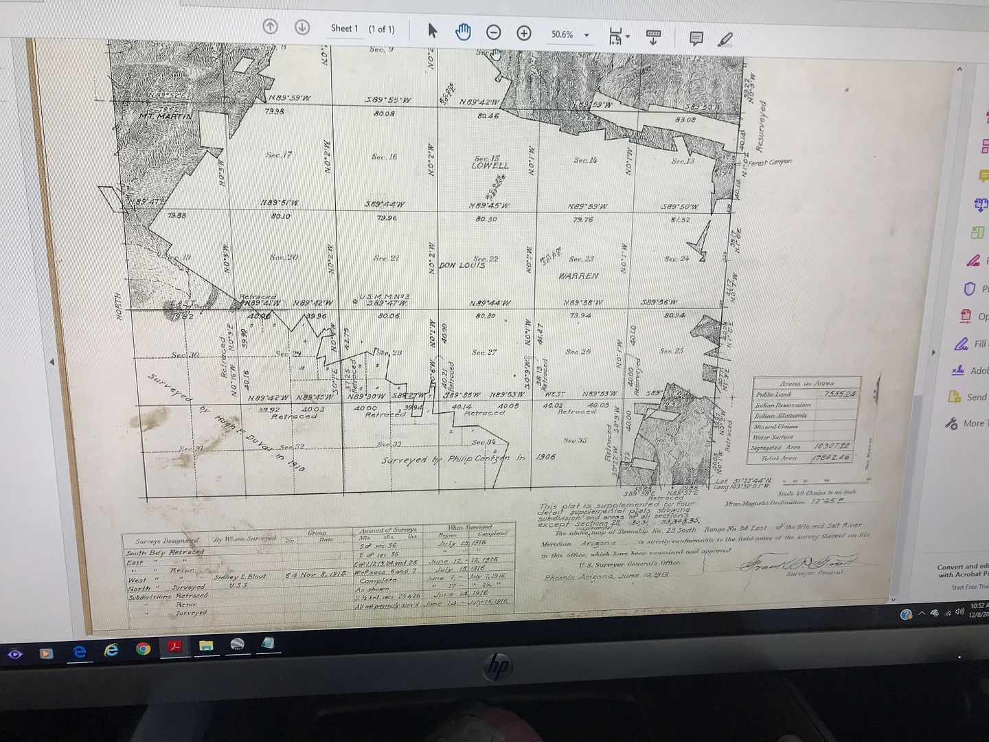
You'd be amazed at the number of mining claim and GLO monuments there are in that portion of the world. All set around the same time, and the recorded distances versus today's measurements is quite remarkable, considering the terrain, the technology at the time, not to mention Bisbee's notorious past. Bisbee is a nightmare to survey, luckily, Warren is the simpler area to survey down there.
After having done worked on a considerable number of boundary surveys in and around Bisbee, I'm half convinced the original town plat of Bisbee (our company has a copy of it) was drawn by someone who spent a little too much time in one of the many opium dens....
I hear you brother.?ÿ I spent 7 years working in Cochise County (Tombstone, Bisbee, Douglas, Hereford, and Palominas).?ÿ I was lucky enough to have a 35 year veteran show me the ropes when I started. ?ÿ?ÿ I'm sure I drove him nuts with all my questions, but I learned so much.?ÿ Researching mining claims, finding the original notes, and locating mineral monuments was always interesting and there really is an Art to it.?ÿ Cochise County has a really good GIS department now.?ÿ It use to be a nightmare to go down to the county buildingcourt house to do research.?ÿ Now its all online and you can do a ton of research from the office.?ÿ
We had a copy of that original plat of Bisbee as well.?ÿ Pretty archaic, but like you said, the distances are spot on and we have found quite a few original monuments.?ÿ Although there is another "original" plat of Bisbee, but history says the whole townsite moved once they realized the cemetery was UPSTREAM and their water supply was getting poisoned. ?ÿ There is so much history in that town and some very unique people as well.?ÿ I really love it, but after a week of working there, you are ready to come home. ??ÿ ?

?ÿ
?ÿ
That 3' iron post must be all of 6 inches in the ground.?ÿ I hope no one around there decides they need a bunch of rocks for something or that pipe is going to fall over.
When I was working in Nevada I had a near impact with one of these bad boys.?ÿ It was stamped 1910. I took a photo, and re-calibrated my visual scans while riding the ATV across the open range with a new sense of trepidation.
If you're going to work around Bisbee, you need to refer to work performed by Ralph Motz and Dick Riddell. The firm I worked for before I retired had obtained all of Dick's survey records that included Motz's and those of some other old timers that had worked in the area.
?ÿ
Actually, if you're going to do any work in Cochise County, you need to refer to these old survey records. Dick had performed a lot of surveys over the years when he was?ÿin operation?ÿin the area.?ÿ?ÿ?ÿ?ÿ
Charles,
Our company ended up with most of Riddell's old work files. Interesting maps in there. We ended up donating the maps to the county so more people could access them.
Does anyone know what's going on with the Cochise County Research site? You can still research with it, but the background doesn't load correctly. The GIS department really suffered when Walter left a few years back, I don't know that they found a good replacement for him.
Cheers
Andrew
I don't know. I got on it a couple of days ago and see that things had changed. I agree, Walter had things pretty well setup when he was there. He also had a good grasp of putting data together and making things work. I also got a message that I needed to upgrade my browser to Google or Firefox. I have them on my computer, but rarely use either one.
I didn't know that all of Dick's old records had been donated to the County. How about Gordon Ray's, Motz's, Stu Cleaves, and all the others that were also obtained by GPS Surveying and Mapping? Were they also donated to the County? Who has charge of them?
?ÿ
Charles,
I actually work for the company that had obtained GPS's old files, they had been obtained by Arizona Land Specialists, which was later bought by Alta, where I work. In our last office move, it was decided to donate all (mostly) of those old maps to the Cochise County Surveyor's Office. Between Arizona Land Specialists and GPS, there was a pretty good base of recorded maps to work with, and with our field crew based out of Bisbee, it made more sense to leave the maps in Cochise County rather than in our Tucson office.
I'm pretty sure we have met or at least talked on the phone together. I also serve on the APLS board and I believe you called in on one of our last telephone conference calls.
Also, Don Loose says Hi!
Cheers, Andrew
I thought from your wording that maybe you worked at ALTA. I knew that Don had acquired those records from Arizona Land Specialists. It was really convienent when I worked for GPS, that all this info was readily available for reference right?ÿin the office. Really helped going into an area and knowing what had been done previously and what to look for and not to have to reinvent the wheel.
Tell Don thanks for the hello and a MERRY CHRISTMAS & HAPPY NEW YEAR to you all.
?ÿ
Hey Charles,
Doing ok? ?ÿBeen awhile/
Do you anything about the resurvey in Ariz. that made it to the Congress for resolution?
A modern day resurvey refused to accept previous monuments and placed several land owners in trespass.
Might be a good topic for discussion?
Keith
Hey Charles,
Doing ok? ?ÿBeen awhile/
Do you anything about the resurvey in Ariz. that made it to the Congress for resolution?
A modern day resurvey refused to accept previous monuments and placed several land owners in trespass.
Might be a good topic for discussion?
Keith
Keith:
Glad to see you're back in the site. Lost track of you when you moved from Cali to Oregon. Never could track down any contact info after your move. I was in that area of Oregon in July 1989 to February 1990 before geting back to Arizona.?ÿLived in an RV park in Woodburn and worked for a firm in Lake Oswego. When the closets in the 5th wheel started getting mildew in the closets, decided to get back to a drier climate.
What Township & Range was this in? I can't recall running across anything in the areas I've worked in down here. There is one Township just south of Sierra Vista that is kinda messed up, but it wasn't a BLM fiasco, but came about by some corner cutting surveys by some private surveyors that worked in the area. They never found a lot of the original corners that were in place and used monuments that were not a section corner to begin with, were only Highway center line P.O.T.'s near where the section line crossed the highway. The BLM recovered quite a few originals in the course of their resurvey.
If you still have my E-Mail address, send me yours, then?ÿI can put it in my address book so I can keep in touch.
Will say Merry Christmas & Happy New Year to you though.
Charles
?ÿ
?ÿ
Charles,
I will search around my records to find that tp. and rg. in AZ.
My email ia Keithwillster@gmail.com.
Merry Christmas and have a Happy New Year.
Keith
What Township & Range was this in? I can't recall running across anything in the areas I've worked in down here. There is one Township just south of Sierra Vista that is kinda messed up, but it wasn't a BLM fiasco, but came about by some corner cutting surveys by some private surveyors that worked in the area. They never found a lot of the original corners that were in place and used monuments that were not a section corner to begin with, were only Highway center line P.O.T.'s near where the section line crossed the highway. The BLM recovered quite a few originals in the course of their resurvey.
?ÿ
?ÿ
Charles,
Are you talking about the mess in Ramsey Canyon? Because the BLM came into a section or two, ignored existing BLM monuments and reset a bunch of monuments along the national forest boundary. One section in particular is pretty ugly, multiple 1/16th and 1/64th corners within a few feet of other.
I did a boundary project in that area in 2013, it was fairly difficult to resolve the boundary courtesy of the BLM. But we sure labeled and noted the heck out of that map.
Andrew,
Maybe that is the township.....I can't seem to find anything in my current files, but it was a BLM resurvey that did not accept existing monuments, and put some land owners in trespass with the FS. ?ÿAnn Kirkpatrick passed a private relief bill which was supposed to fix the problem??
Keith
Was this in Coconino County?
Did Ann Kirkpatrick have a private relief bill to supposedly help the landowners?
What Township & Range was this in? I can't recall running across anything in the areas I've worked in down here. There is one Township just south of Sierra Vista that is kinda messed up, but it wasn't a BLM fiasco, but came about by some corner cutting surveys by some private surveyors that worked in the area. They never found a lot of the original corners that were in place and used monuments that were not a section corner to begin with, were only Highway center line P.O.T.'s near where the section line crossed the highway. The BLM recovered quite a few originals in the course of their resurvey.
?ÿ
?ÿ
Charles,
Are you talking about the mess in Ramsey Canyon? Because the BLM came into a section or two, ignored existing BLM monuments and reset a bunch of monuments along the national forest boundary. One section in particular is pretty ugly, multiple 1/16th and 1/64th corners within a few feet of other.
I did a boundary project in that area in 2013, it was fairly difficult to resolve the boundary courtesy of the BLM. But we sure labeled and noted the heck out of that map.
Might have been the same township or right close to it. The Township I'm referring to was the use of highway center line monuments used for section corners, which were only P.O.T.'s in the highway and then going out and setting other corners from these. A lot of the originals were still in place and resulted in 16'?ñ to 50'?ñ misplacements of the correct section lines and the subdivisions of these sections. There is one area where all the land owners call it a "No Mans Land" , which is a strip that no one claims as their property.
There is a subdivision in the area of Hereford Road called Nicksville, Units 1 thru 4, that when you use the Section Line distance that had the NW corner of?ÿSection 17 and the W?¬ and project it South it puts the SW corner within a foot or so of the BLM railroad spike established in the shoulder of the highway. Everyone erroneously used a highway center line P.O.T. about 40' NWly as the section corner. That SW corner should have been ran in using the Nicksville plat record to re-establish it, since it is apparant that the W?¬ was established during the Nicksville survey using the original SW and NW corners in existance at that time.?ÿ I remember doing a lot of retracement work in Sections 8,?ÿ17 & 18?ÿand have a pretty good handle on some of what happened in there. Too many corner cutting surveys were done by others not doing the proper research and just going out and plunking something in the ground. I think I have some of the maps of these retracement surveys in my files somewhere.?ÿ?ÿ?ÿ
Charles, It seems like we are talking about the 'same-ish' area. Charles, the area you are describing sound like it's only a mile or two away from this particular section. I have no doubt that there were some issues with the FS and private ownership and I'm not overly surprised that there was some needed legislation to deal with the issue.
As an aside, I worked on a project not far down the road from there involving REALLY old mining claims, water rights, the BLM, and the town of Tombstone that ended up in federal court.
Perhaps you will recall the Ramsey Canyon Fire in 2011(?) that ravaged those canyons pretty harshly. The town of Tombstone owns several mining claims and the water rights to those claims, in/near Ramsey Canyon, and had around 23 miles of a naturally-flowing water line that was installed in the late 1800s/early 1900s, and supposedly is the longest water line of that nature in the country (I'm know that I'm forgetting the exact record distance, it might be longer or shorter). Much of that historical water line was damaged in that fire.
After that fire, the town of Tombstone (with a group of Tombstone-resident volunteers) attempted to restore the historical water line that was damaged during the fire. The BLM cited the national forest boundaries and stopped the town's attempts to restore the water line. So, when a localish (albeit a prominent national) PAC caught wind of what was going on with the battle between the town of Tombstone and the BLM, so the PAC helped the town of Tombstone sue the BLM for the rights to maintain that water line, and I'm sure you see where this story is going. I can end it with, after many appeals in federal court, the town of Tombstone no longer has access to that water supply.
Keith, this is all in Cochise County. While I have no doubt there are some GLO problems in Coconino County, as I'm guessing you know, Cochise County is a weird bag of surveying worms, even in the GLO world.
I think the area that I was interested in was T. 20 N., R. 7 East, G&SRM in Coconino County.
The trespass problem that ended up in Congress.
Keith


