In another thread, Holy Cow inquired about the southern boundary of Colorado with Oklahoma and New Mexico. My collection of Side Shots does not go back far enough to post a two-part? column by Bill McComber. Perhaps another Colorado surveyor can scan his article(s) and post them.
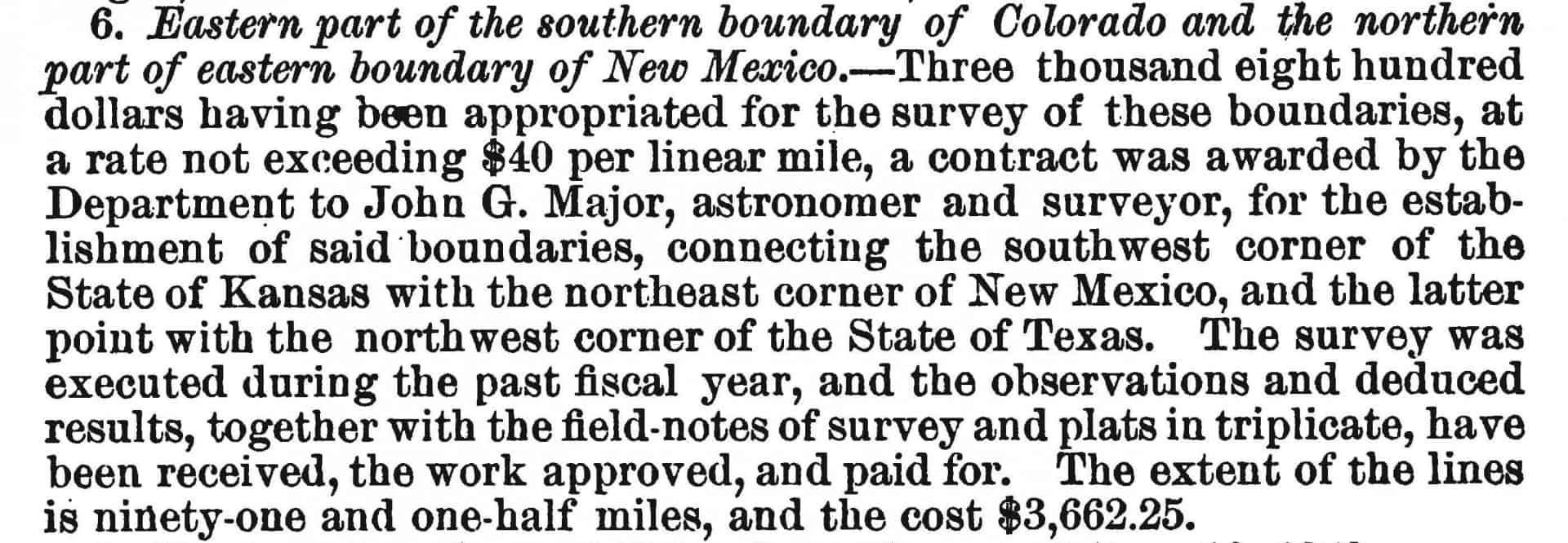
I do have some of the early survey work including John G. Major's survey of the eastern part of the southern boundary of Colorado (from the Kansas line west) and the eastern boundary of New Mexico from Colorado south to the "NW corner of Texas". I did not find a plat, but did find this description of the work in the 1874 Annual Report of the Commissioner of the General Land Office.
The field notes consist of astronomic observations using a sextant and a Wundemann transit. The boundary lines were run with the Wundermann transit with compass. Here is an anonymous link to a 72 MB PDF file containing the astronomical observations and survey field notes. Pages 42 and 43 of the field notes (pages 68 & 69 of the PDF file) describe a diligent search for the NW Corner of the State of Texas.
Having reached the 36å¡30' Parallel according to the chain measurements I commenced a close search for the monument erected in 1859 by the Texas Boundary Commissioners. After a very thorough examination, by all my party together with portion of the Escort, of a belt of country 2 miles wide and 2 1/2 miles east and 1/2 mile west of line, I failed to find either the initial or other monuments of said line. The topography of the country is such as to designate very closely where this monument had been, but the evidence was wanting, except in finding a few scattered rocks which were doubtless a portion of said monument as they had been conveyed to this place from the Rabbit Ear range some 7 miles distant.
I therefore re-established the corner as described in the field notes. We were enabled to trace the old trail from this vicinity to Col. Johnson's or Clark's Astronomical camp some 6 miles N.W on the creek, where there was a stone designating the grave of "Pane Quin, died 1859" on the other side "103 W.L. 36å¡30' L showing that this stone was probably intended to be used in marking the Texas corner.
John G. Major
U.S. Astronomer & Surveyor
I have no idea why the southern boundary line as retraced in 1909 by U.S. Deputy Surveyors Arthur D. Kidder and Jay P. Hester shows so many kinks. Below are plats and field notes of Kidder along with a plat by Carpenter 1902 and a 1991 BLM plat. The Carpenter plat shows the SW Cor. of Kansas approx. 40 chains south of the SE Cor. of Colorado. The 1991 BLM plat shows them to be a common corner?!?
Kidder & Hester 1909 Survey Field Notes
U.S. Dep. Surveyor Thos. B. Medary conducted a survey in the area in 1979, but the plat doesn't show all of the mile posts. I didn't look up the field notes for the Medary survey nor the 1902 Carpenter survey.
Several of the townships were subdivided in the early 1880s (circa 1883) and show the meandering southern boundary of Colorado (paden cash showed a plat in the other thread).
Today, at the southwest corner of Kansas/southeast corner of Colorado is a manhole with a bar under the center of the lid. The lid I saw was made to fit perfectly such that the diagram on the lid showed you where each of the three States were positioned. I recall hearing that someone stole the lid.
This link makes mention of a potential 3/4 mile problem to the north and shows the lid. http://www.kansastravel.org/eightmilecorner.htm
Running south along the common line between New Mexico and Oklahoma takes you to a point on the north line of Texas about 2 mile east of the NW corner thereof. Perhaps Mr. Major needed to extend his search further to the west.
Been there. Both places. Looks about the same.
Mark Mayer, post: 424651, member: 424 wrote: Running south along the common line between New Mexico and Oklahoma takes you to a point on the north line of Texas about 2 mile east of the NW corner thereof. Perhaps Mr. Major needed to extend his search further to the west.
From Mr. Major's notes he seemed to think that Mr. Quin's grave stone was the corner and it was 6 miles to the northwest. Given all the kinks in the southern boundary line of Colorado as found by deputies Kidder and Hester, and the two miles west vs. 6 miles NW positions, he may have been lost rather than momentarily confused.
A follow-up to Mark's post. This is the township subdivision plat for Frac. T. 26 N., R. 37 W., N.M.P.M. that shows the NW Cor. of Texas 2 miles west of the SW Cor. of Oklahoma.
https://glorecords.blm.gov/details/survey/default.aspx?dm_id=91269&sid=45ttws3t.0dv&surveyDetailsTabIndex=1
Anyone know why there is a 5.47 ch. gap shown between OK and TX? 🙂
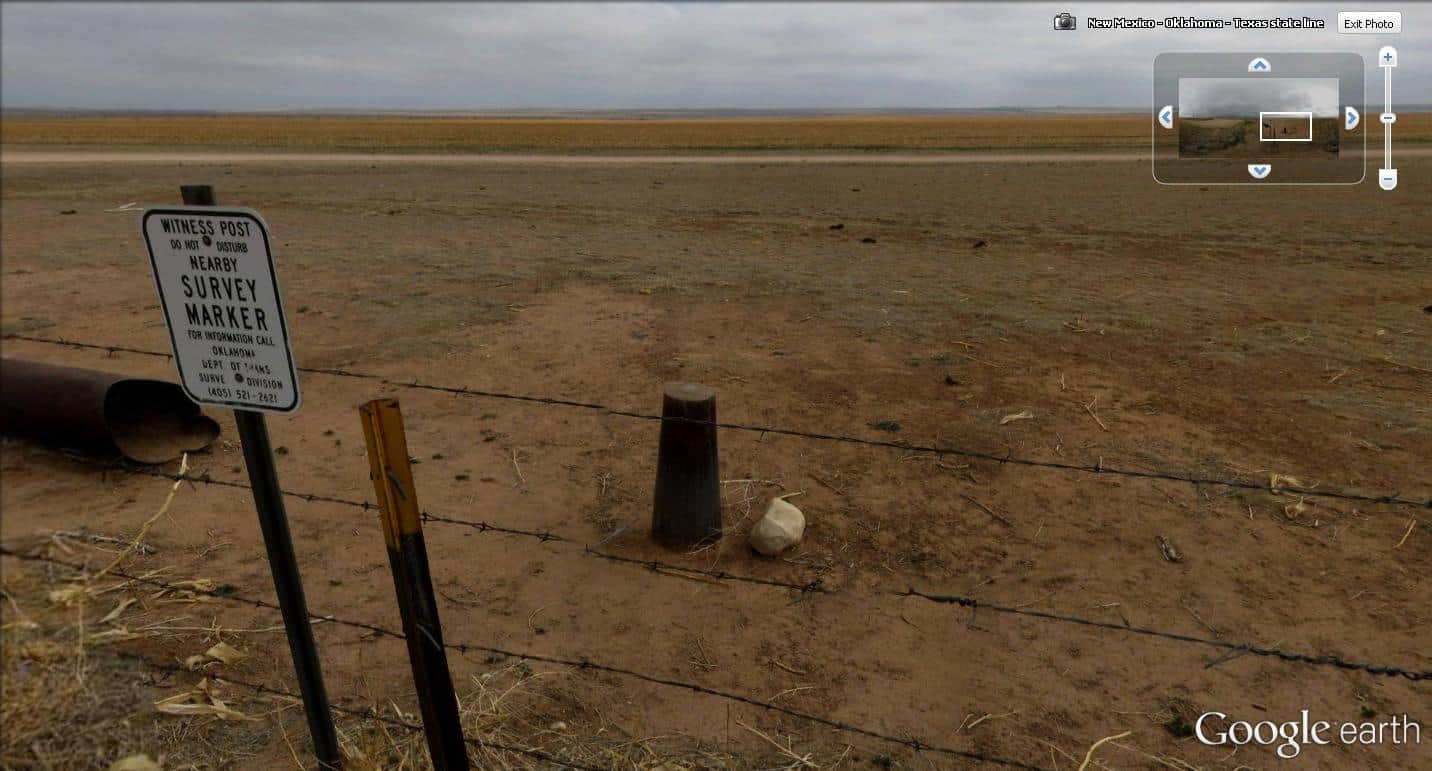
Check this out. If you have never seen flat, you must see this. If you have never been somewhere on land without a tree in sight, check this out. This is a slice out of the 360 panoramic view from Google Earth at the southwest corner of the Oklahoma Panhandle, being about two miles east of the northwest corner of the Texas Panhandle. The view is looking a bit to the east of south. The marker is supposed to be at the true corner.
Holy Cow, post: 424675, member: 50 wrote: Check this out. If you have never seen flat, you must see this. If you have never been somewhere on land without a tree in sight, check this out. This is a slice out of the 360 panoramic view from Google Earth at the southwest corner of the Oklahoma Panhandle, being about two miles east of the northwest corner of the Texas Panhandle. The view is looking a bit to the east of south. The marker is supposed to be at the true corner.
SHHHHHH don't disturb the monument, it's sleeping.


