Dave Karoly, post: 411572, member: 94 wrote: Mrs. Powell is sitting on a box too.
The thing she's sitting on appears to be approximately cylindrical, more like a stump or a bucket of some sort.
Thanks Kent! Very interesting! Jp
Thank you Kent for posting this. I cannot imagine a letter like the one written by Mr. Walsh being penned today. Who for cripes sakes accepts responsibility?
Daniel Ralph, post: 411577, member: 8817 wrote: Thank you Kent for posting this. I cannot imagine a letter like the one written by Mr. Walsh being penned today. Who for cripes sakes accepts responsibility?
One of the additional aspects of Commissioner Walsh's responsibilities was that at the time he wrote there was no mechanism for correcting patents that erroneously issued from the GLO, as would be the case where large parts of surveys or surveys in their entirety conflicted with the prior valid rights of others. So the GLO staff were having to both work as quickly as possible to prepare patents and to make no mistakes when the surveys upon which those patents were to be issued were examined.
One of the letters that E.M. Powell wrote to Commissioner Walsh in 1884 dealt with the question of whether a patent had been wrongly issued on for a certain section of land in Denton County that covered land to which someone other than the patentee had the superior claim. Walsh's reply summarizes how few remedies he had at his disposal:
Kent-
Thank you for your historical research piece.
If today's surveyors/lawyers did not know about how the land was divided (or those before you did not know) how do you reconcile the original division fabric that you have determined by your historical research and the long standing 'occupation' boundaries when you find a recognized difference ?
Or, is there much of that ?:)
Cheers,
Derek
PS-
In a jocular manner.......... we have snow that covers up a lot here !
DEREK G. GRAHAM OLS OLIP, post: 411592, member: 285 wrote: If today's surveyors/lawyers did not know about how the land was divided (or those before you did not know) how do you reconcile the original division fabric that you have determined by your historical research and the long standing 'occupation' boundaries when you find a recognized difference ?
The general rule is that the original surveys are proven by the evidence of where lines and corners were originally marked as described in the record of the original surveys. If there is some compelling reason to think that, say, a particular fence post perpetuates the position in which a corner was originally marked, then that may be evidence of the original survey that would stand if there is no better to contradict it.
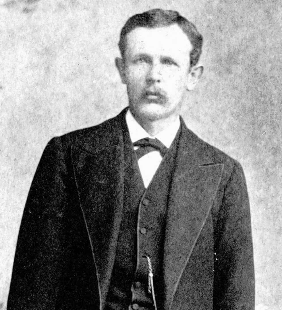
BTW, as a footnote on E.M. Powell, it turns out that he was Earnest Malapert Powell and the text of a State historical marker in Ozona gives a few more details about his life and career, as well as the information that Durrell Powell, the son sitting on the transit box in a photo above probably didn't live for much more than a year after the photo was taken.
"A native of Illinois, E. M. Powell was a surveyor and railroad engineer in Kentucky before moving to Texas in 1874. He worked as a surveyor during the railroad construction boom in Texas in the 1870s, taking parcels of land in payment for his services. By 1878 Powell and a partner, E. L. Gage, opened a real estate and land surveying company in Dallas.
"Powell soon began promoting his land holdings in West Texas and placed newspaper advertisements to encourage settlement in this area. To the first families who purchased homesteads out of his 185,000-acre tract of land in present Crockett County, he offered forty acres of free land as well as reduced prices for additional acreage.
"The city of Ozona was founded on Powell's property. He provided a public well and windmill, as well as lots for public buildings, churches, and a school. As a result of his settlement efforts, the county of Crockett was organized in 1891 with Ozona as the county seat.
"Married to the former Mary Almyra Durrell, Powell was the father of one son, Durrell, who died at age seven. Powell was a major contributor to the Dallas Congregational Church and to other charities."
Ozona, Texas
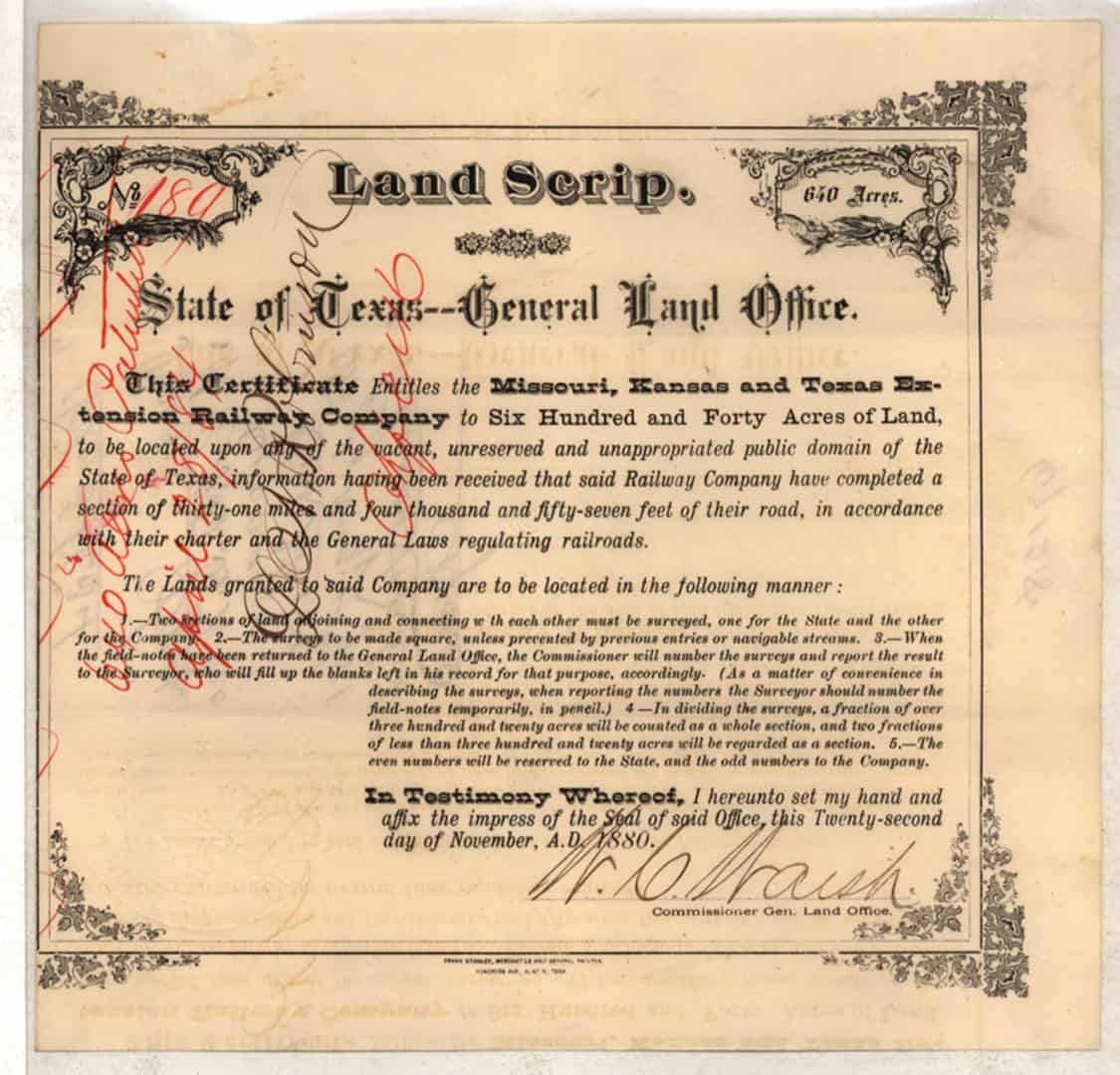
In case there is any doubt about what is meant by "land scrip", here is an example. This is Certificate No. 189 issued to the Missouri, Kansas and Texas Extension Railway Company entitling it to 640 acres of land
"to be located upon any of the vacant, unreserved and unappropriated public domain of the State of Texas" and specifying that to be lawful, the lands located by virtue of the certificate are to be:
"1. Two sections of land adjoining and connecting with each other ... one for the State and the other for the Company.
"2. The surveys to be made square, unless prevented by previous entires or navigable streams
"3. When the field notes have been returned to the General Land Office, the Commissioner will number the surveys and report the result to the Surveyor, who will fill up the blanks left in his record for that purpose, accordingly. (As a matter of convenience in describing the surveys, when reporting the numbers the Surveyor should number the field-notes temporarily, in pencil.)
"4. [...]
"5. The even numbers will be reserved to the State, and the odd numbers to the Company."
This exact piece of paper was what a Land Agent named J. S Daugherty (Jacamiah Seaman Daugherty)
https://tshaonline.org/handbook/online/articles/fda19
presented in 1881 to the County Surveyor of Pecos County, Texas when he applied to have a survey made to define the boundaries of approximately 200 square miles North of the wide spot in US Hwy 90 known as Dryden in present day Terrell County that he intended for the State of Texas to issue patents upon.
The land located by the scrip became soon enough a part of the holdings of Pecos Land & Cattle Company, a group of Eastern capitalists who thought that they could make money in the cattle business in the arid lands of West Texas, but who were eventually proven wrong.
J.S. Daugherty's method of operation as a Land Agent was most likely quite similar to that of Powell & Gage. The statement of facts provided in the record of the 1905 decision of the Court of Civil Appeals in the case of Mansfield et al. v. Wardlow (91 S.W. 859) provides a glimpse of how Mr. Daugherty did business, i.e. how he arranged for other people to provide money by which he purchased land scrip and arranged to locate and survey, obtaining patents in his name, and then selling off the land.
See in particular the statement of facts relating to Daugherty's land dealings on pages 860 - 861.
TTT
I sure miss posts like this from Kent. Wonder how he's doing and what history he has uncovered? Anyone keep in touch with him?
?ÿ
?ÿ
Spend your days researchingthe history of Texas Land grants, Headrights, history of original surveyors and their surveys and reasons of being involved at the General Land Board and gathering information to support your own work will find you filling your cabinets and mind with concentrated reports from information libraries and clerks offices and journeys across Texas.
Kent's work model can hardly leave any stone unturned or the whole process could suffer.
The last time we spoke, I had to turn down an offer from him because it was in an area that I have sworn to nerer find myself in unless there was serious money to bank for myself because it is a desolate wasteland for me as I have plenty of work to do in places I love.
Since much of the GLO has gone online I don't even go to Austin.
Wish I had his address, got something to send that I thought he would appreciate.
I have been a long time lurker and a few years ago recently created an account, and I also miss his posts, they were very informative.
@stlsurveyor, @a-harris, @surv3251
Kent is alive and well and posts some of his unique and interesting survey projects and artwork to his personal Facebook page. He's moved out to Wemberly, TX and still has his practice going strong as far as I can tell.
I sure do miss reading him on this board as well.
Carl


