This survey was very interesting to do.
http://freepdfhosting.com/091ba29d78.pdf
When I first looked at the job I just knew that some of the original pipes would still be in place along Mesa Lila Road. The area was unincorporated territory back when the different subdivisions created. One man did four in the area. His name was Otto Baldus and his tag number was “RE 1682”. The City of Glendale annexed the area sometime after Otto’s work was done.
After a few months time the client called back and said he wanted to get the property surveyed and place fencing in certain areas. The 2 x 2 hubs I set were to keep him in line with the fence
Construction. It’s in a hillside area and the portion of Lot 15 is pretty nasty to work on. The flies that swarm in this area were as obnoxious as the steep grade, manzanita bushes, oak trees and of course, the huge patch of poison oak. Naturally, a critical corner (CM-20) was in the poison oak patch.
The crew that set Otto’s pipes did a great job. Most importantly, they were actually set. The deviation from record to measured was minimal considering the methods and equipment used back in the early 50’s and what was used for a 2011 retracement.
The one thing that had me a bit worried about the job was the City of Glendales centerline control in the area. As I got deeper into the job it seems my worries were unjustified. I found two punched manholes that had no city reference and were not accepted and one punched manhole that was accepted (CM -14) but had no city reference to it.
A total of five original pipes were recovered along the sideline of Mesa Lila Road, these controlled the centerline position of the street and non referenced as well as city referenced points had to match these pipes.
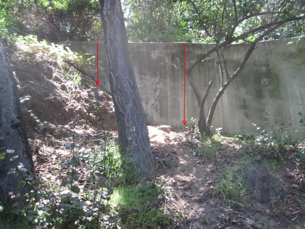
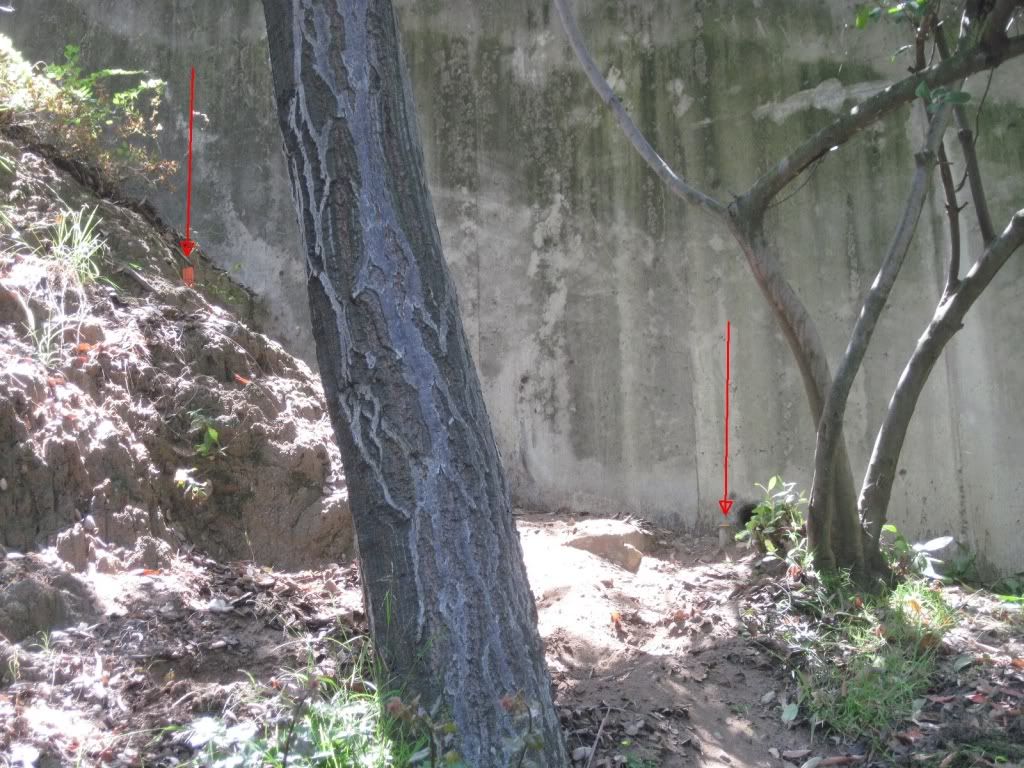
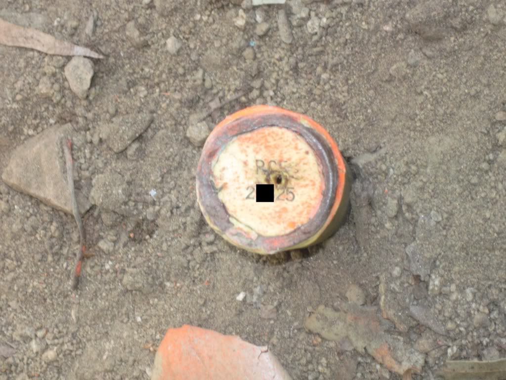
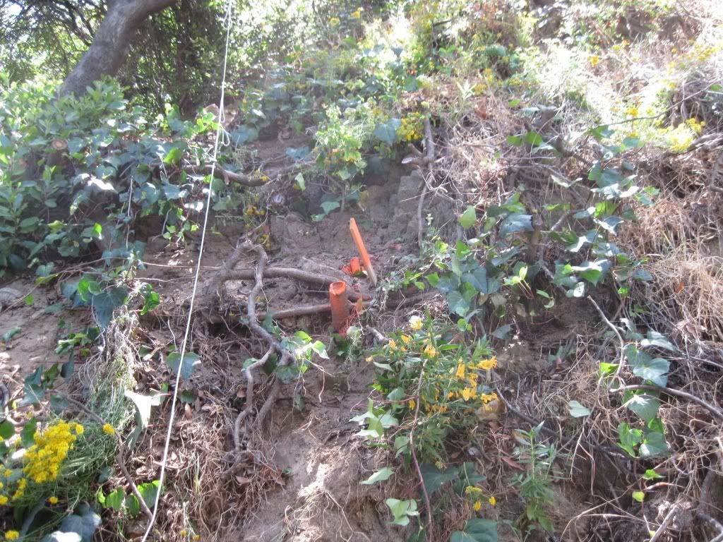
One original pipe we found was on a steep side slope but the slope had failed in that area and the pipe had slid down hill in such a way that it is now close to 90° from vertical. I really needed some type of check, and this pipe did it for me, because 82 feet s’ly of this position I had found a capped 1 inch pipe that missed line by over a foot and distance from a corner by almost 6 feet. When I found the tilted original pipe within 0.8’ I had verified that the capped pipe was a blunder.
The one on the right in the photos is the blunder monument.
MONUMENT WITH NO HISTORY – BLUNDER


TILTED ORIGINAL PIPE
This tilted original is described in Note "A" on the RS
I called the engineer that set this pipe, I have known him since 1984, and he was pretty concerned. He had checked all his records and he told me that not only does he not have any records for where his pipe was found but he also said that he has never even worked in that area. I believe him and I am leaving it up to him to pull his cap or leave it. I will not be showing his pipe on the survey. How it got there, who knows!
Now this is the part that really irritate me.
In 2006 a large Parcel Map was recorded. Portions of this map are common with my lines. The surveyor of record has certified to this statement….
I ALSO STATE THAT THE MONUMENTS OF THE CHARACTER AND LOCATIONS SHOWN HEREON ARE IN PLACE OR WILL BE IN PLACE WITHIN TWELVE MONTHS OF THE FILING DATE OF THIS MAP…
He’s LATE! Like 4 1/2 years late. I came across two positions where his pipe should have been in place. At one of these positions, not only was his pipe not there, but an original tract corner was in place, (CM-21). I also have issues with his establishment of Mesa Lila Road, and basically any other monument he may have set, or will set, that is *NOT WITHIN* his created limits, within the perimeter boundary of his Parcel Map. I would not trust anything he set on the Parcel Map boundary or in the streets leading into that map area.
Look, if I can go out and find seven original monuments with a little sweat and a shovel, then this guy could have done so as well.
Rant over..
Paul-
Is this type of statement common: "OR WILL BE IN PLACE WITHIN TWELVE MONTHS OF THE FILING DATE OF THIS MAP…" ?
Seems a bit off the norm and would not be tolerated in Ontario.
Mind you, we do have mysterious bars for instance planted at boulders that have not moved since the glaciers and another planted exactly where a 'frog' in a set of railway tracks was that also have not moved since you were a wink in your Daddy's eye !
You seem to have a lot of uncertain types of legal survey monuments.
Has there been any standardization thereof available in California ?
Cheers
Derek
>
>
> Cheers
>
> Derek
> Paul-
>
> Is this type of statement common: "OR WILL BE IN PLACE WITHIN TWELVE MONTHS OF THE FILING DATE OF THIS MAP…" ?
Yes it is common. This type of notation is only placed on a Parcel Map or a Tract Map. Those two document types are the only ones, in most cases, that create new lots or parcels.
The standard has changed somewhat since 2006. Below is the county standard that most incorporated cities use....
This map was prepared by me or under my direction and is based upon a true and complete field survey by me or under my direction in (month, year), in conformance with the requirements of the subdivision map act and local ordinance at the request of (name of person authorizing map) on (date). I hereby state that this final map substantially conforms to the conditionally approved tentative map; that all the monuments are of the character and occupy the positions indicated (or that they will be set in those positions within ____ months from the filing date of this map); (and) and that the monuments are (or will be) sufficient to enable the survey to be retraced; [and that tie notes for all centerline monuments (or for all centerline tie monuments (where only ties are required to be set) are (or will be) on file in the office of the Director of Public Works (or on file in the office of the City Engineer) (within ___ months from the filing date shown hereon)].
The time frame varies upon conditions and whatever agency is in charge of approving the final maps.
> You seem to have a lot of uncertain types of legal survey monuments.
Yes..they vary according to jurisdiction.
> Has there been any standardization thereof available in California ?
Nothing the state has come up with. LA County has specific monument types that need to be set, but thier standards only apply to unincorporated county territory. In incorporated cities an ordinance would have had to be passed dictating monument types to be set for subdivisions or to use the county standards.
Paul-
TU
Here's a link to Ontario's take on monumentation:
http://www.e-laws.gov.on.ca/html/regs/english/elaws_regs_910525_e.htm
Generally the standardization of monumentation is good but, the Regulation is under the wrong Act!
It should be under the Surveys Act, not the Surveyors Act that sets out how a professional body is to be run.
Monuumentation Regs. were under the Surveys Act until during the era of a past Surveyor General, the 'Peter principle' robustly came forward taking the monument diagrams out of the Regulation. (Picture is worth a thousand words did not seem overly important).
Also expunged was a "Concrete Monument" not too often planted anymore but still found all over Ontario.
Not being in the Regs. it is no longer a "legal" survey monument !!
But we still show it on our plans.
But, we can have plastic mons. that are destroyable by a 6 month old Golden Retrievers in three hours of chewing as tested by a Graham Golden puppy that could have ingested the magnet.
Just to continue to display bureauhooligan mentality, we have a new Regulation setting out the profession as the only one in Ontario that needs a Regulation to 'change our professional diapers' in
http://www.e-laws.gov.on.ca/html/regs/english/elaws_regs_100216_e.htm
"ONTARIO REGULATION 216/10
PERFORMANCE STANDARDS FOR THE PRACTICE OF PROFESSIONAL LAND SURVEYING"
that has such witticisms of clarity as:
1. In this Regulation,
“cadastral survey” means a survey performed by a licensed member while engaged in the practice of cadastral surveying; (“levé cadastral”)
This definition is particularly sparkling with wit in that there is no definition of "a survey" in law in Ontario.
Going one step further, there is no definition of "a member" either !
Gives one a warm feeling, doesn't it ?
Cheers,
Derek
Derek,
The purpose of having the time frame of 12 months after recording is to allow construction to be finalized before monuments are set.
Ryan-
I can understand this 'delay monumentation' concept but I also see serious angst when what is built isn't within its setbacks etc etc.
Cheers
Derek


