I'm trying to use some inclinometer readings from a geotech study to help assess the amount of movement that might have occurred at control points and boundary monuments that fall in a persistent, slow moving landside/"earth flow" typical of coastal CA and OR. I'm wondering how accurate inclinometer readings are in regards to movement at the surface / top of the casing. The link below suggests they're pretty darn accurate. Has anyone done some carefull monitoring that would back up the specs given?
http://www.slopeindicator.com/support/inclinometers/technote-inclin-accuracy.php
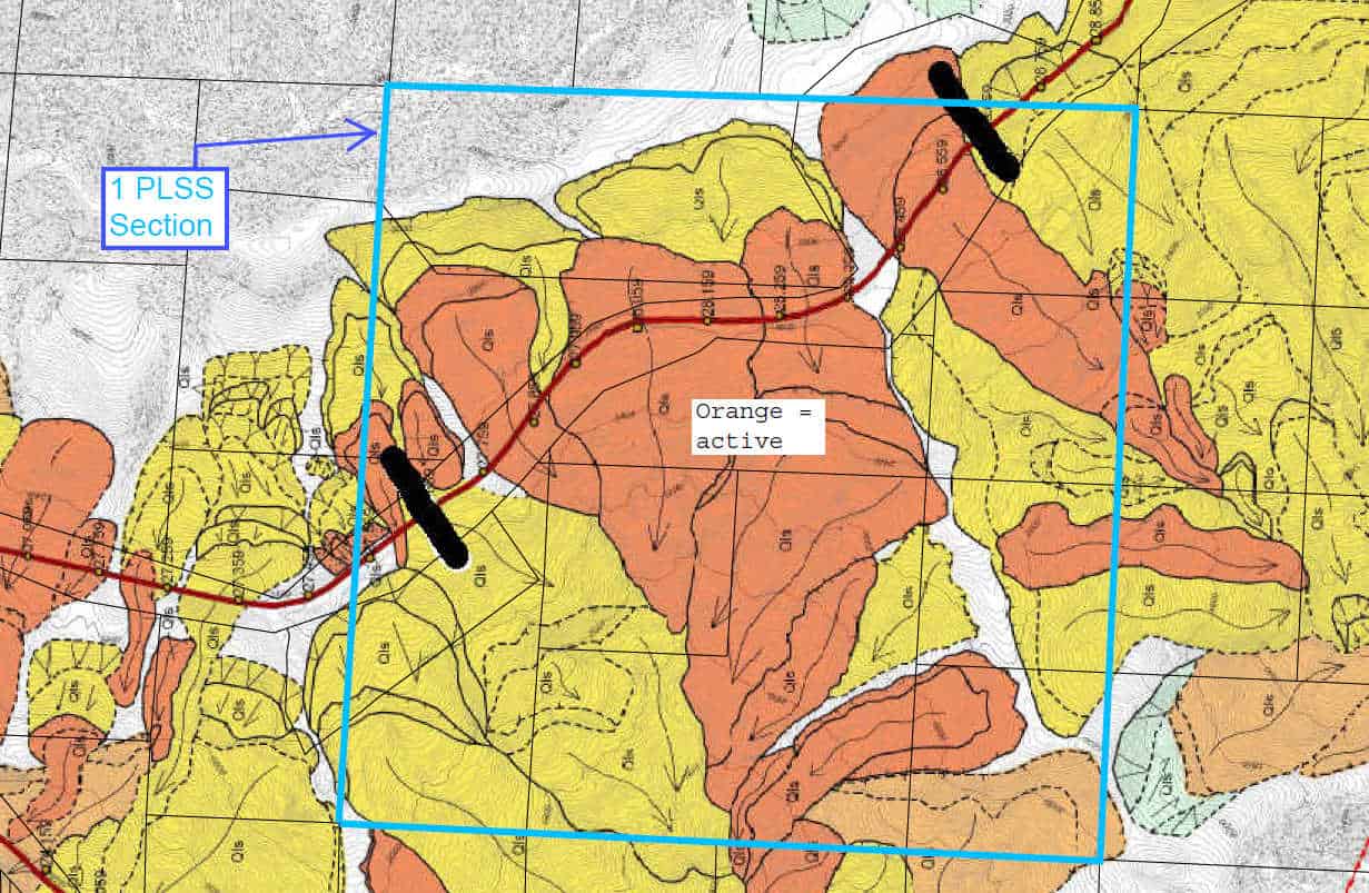
For those not familiar with CA and OR coastal geology, these slides can be thousands of feet across, and many are not obvious to the eye. You have to know what you're looking at. The image below from a State of CA website shows a highway through a slide area, as well as parcel lines. It raises a few questions for boundary surveyors, doesn't it? As well as wide, the slides can be deep. In my case, the slip plane is 20 to 140 feet below the surface. Some of the inclinometers suggest movement exceeding a foot per year. There are county and state roads here that if not maintained for a year would be become impassable.


