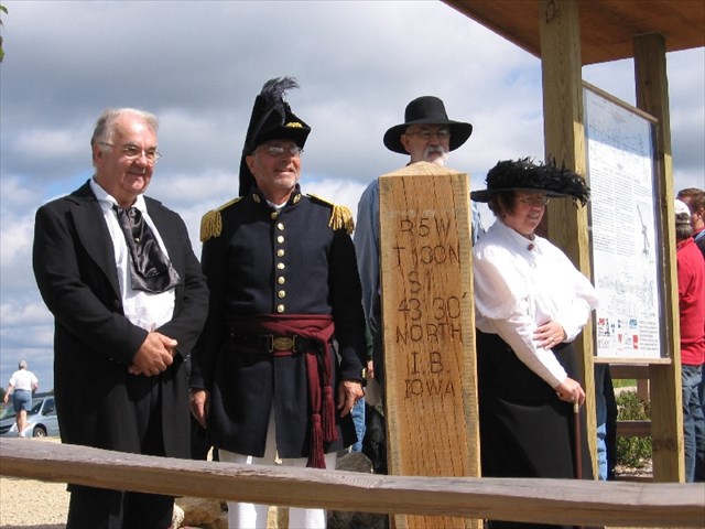
Last Saturday, a group of surveyors from Wisconsin, Iowa and Minnesota set a replica of the 12 inch square, 8 foot long white oak post originally set by Captain Andrew Talcott’s crew in April of 1852. We also erected a kiosk with panels explaining the survey (first two photos below). A formal dedication is scheduled for September 11th.
N 43º 30' 02.3"
W 091º 22' 18.7"


Looks to me like it's off by ....
0.18'. 😉
Actually, good show!! and nice pics!
I have seen a few historical resets but the Oak Post shows real class!
Well Done!
Better put a tack or a Mag Nail in the spot that is the actual corner... Or I will.
😉
Nice looking post. Too bad it's got a split in it already.
gonna be tuff to occupy too...:-P
What sort ?
Looks good so far, but what sort of barbed wire will they be stapling to it to complete the boundary installation? :>
What sort ?
Good work !
No sign showing how far to Austin Texas ?
TNAI
What sort ?
> No sign showing how far to Austin Texas ?
Oh, we wouldn't want that. It will drive down the price for the oak post when it appears on eBay.
Nice work Rich, and all of the volunteers. Did you get BLM and NGS involved? Will there be a survey record filed for the re-monumentation? (I agree it might be a tad hard to occupy). Are you going to tie it into to the CORS and have NGS publish a Geodetic Position?
Good luck with the dedication and ceremony.
Nice work and photos! Capt. Lee also did the initial astronomical work for the 6th PM on November 17, 1854.
The oak post is just a replica to educate the general public and is not actually at the initial point. The Initial Point was theoretically established at the intersection of latitude 43º 30’ 00” and the Range Line between Ranges 4 & 5 West of the 5th P.M.
Here’s a photo looking west from NGS station IASOTA (PID ON0780). The oak post and kiosk are to the left of the car. The actual Initial Point is located in front of the black pickup along the shoulder of the road. It’s more or less on line with the center of the road west of the curve and a fence line running north-south along the Range line.

There was a pickup and trailer parked over it most of the time I was there and we never got around to moving it and digging up the point so I could get a photo. I’ll get one when we go back in September for the dedication.
Incidentally, if anybody’s interested in attending the dedication, let me know and I’ll provide you with specifics when they are available.

Rich, I'd like the information about Sept 11. That looks like it is shaping up to be a busy weekend, but there's a chance I'd go.
billhart (at) cedar-rapids (dot) net
Is Lee's post still around?
Rich
TTT
I'd be interested in the Sept 11 info in case I can make it.
Thanks.
billhart (at) cedar-rapids (dot) net
Event reminder for anyone around - TTT
Thought this ought to go To The Top with the event coming in a few days.
It's looking like a good chance I will make it.
Nice looking.
I hope that they have some really stable reference monuments to use to replace the post when it gets rotten.
SJ
great marker.
check out the history between andrew talcott and peder horrebow. horrebow was the originator of determining lat and lon astronomically. talcott was one of his pupils. horrebow didnt play well with others, so they didnt adopt his technique. it was later that talcott submitted it as the talcott horrebow method. it was then embraced. good reading if you want to dig it up
Stephen
See my [msg=9931]August 05 post[/msg] above.
The oak post is just a replica to educate the general public and is not actually at the initial point or any other point for that matter. Maintaining 4 feet between the post and the rail fence for wheel chair access seemed to be the main criterion for establishing the location of the new oak post.
Initial Point Ceremony (pictures)
Rich is probably on his way to Chattanooga, so I'll post a few pictures that he can supplement later if he likes.
It was a gorgeous day, and the event was well attended. Don Borcherding did an excellent job as Captain Talcott. Rich was also in period dress and brought a Burt Solar Compass which was probably of the same design used by Marsh's advance party on the line.
Some Iowa folks: Bill Hart, Dan Rittel, an Iowa surveyor, Rich Leu.
Rich explaining Burt Solar Compass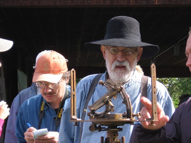
"Captain Talcott" at the post established by Captain Lee to mark the latitude of the state boundary.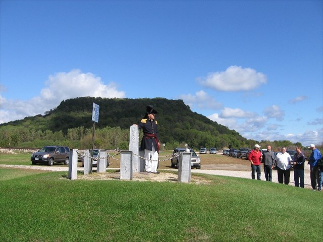
Dignitaries at ceremony for the initial point replica.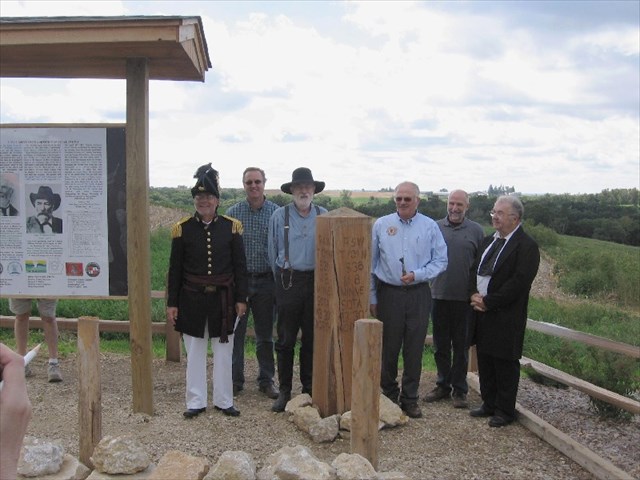
Dignitaries