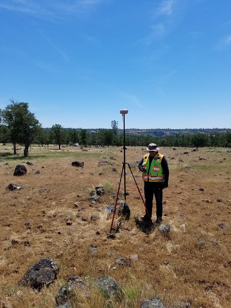
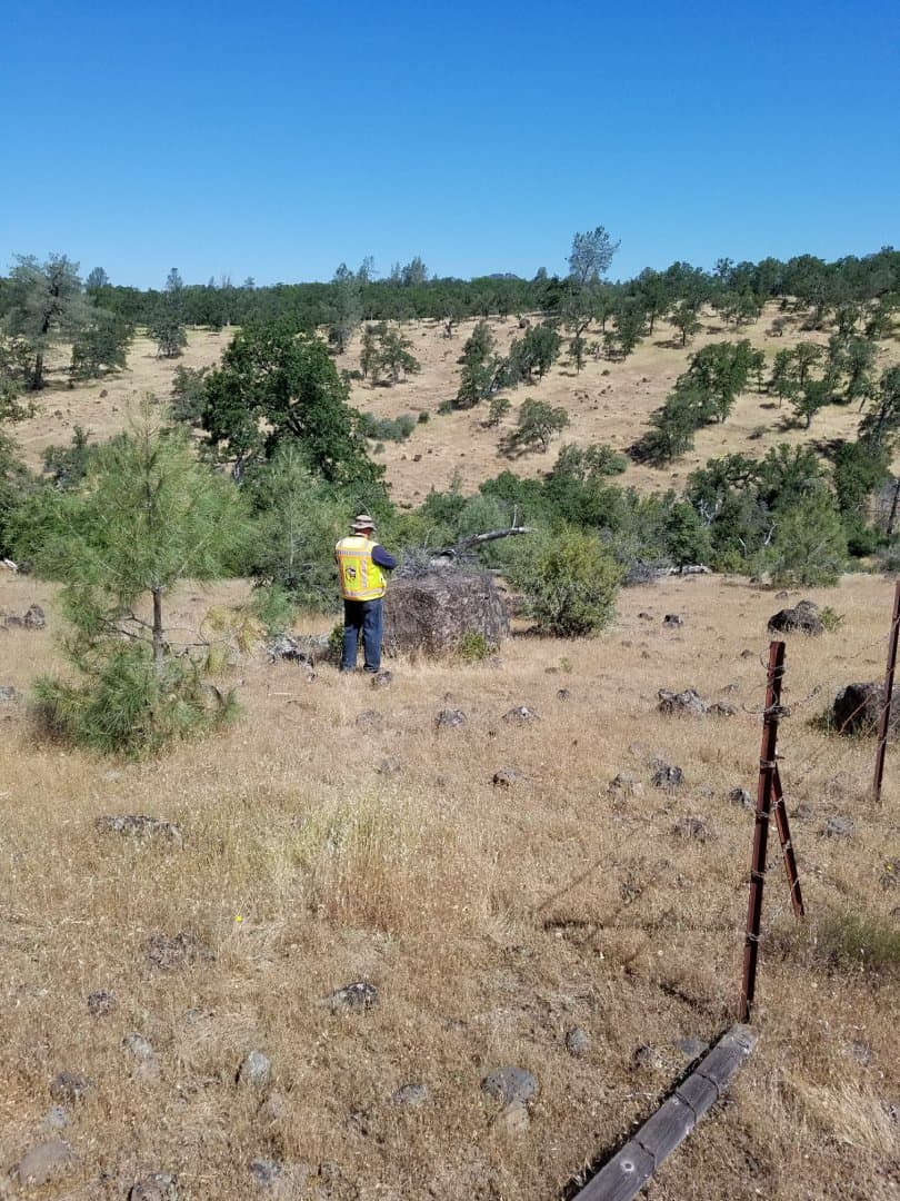
This is looking southerly. I noticed this stone sticking up the first time I walked north along the fence (about 50' east), there are a lot of lava rocks out there. I couldn't see the stone mound in among the weeds. I noticed a stone mound then another then another then about 15 more (probably a lot more running in a straight line north-south. There are old posts laying on the ground at some of the mounds. Dan (in the picture) found the stub of the original bearing tree north 45?ø East (a little past the modern fence line).
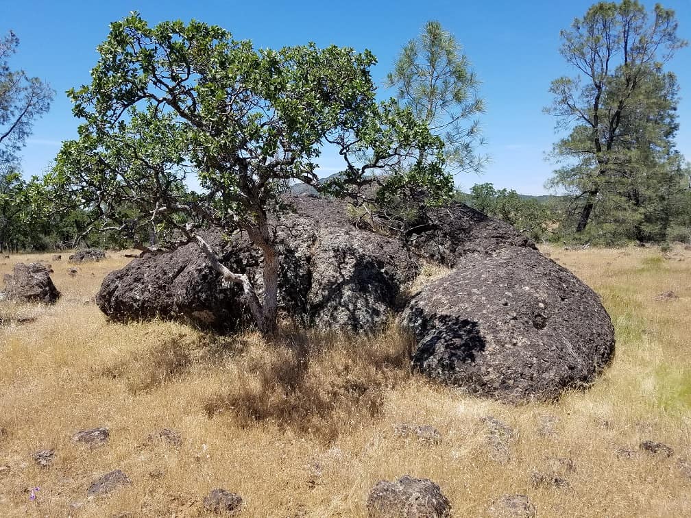
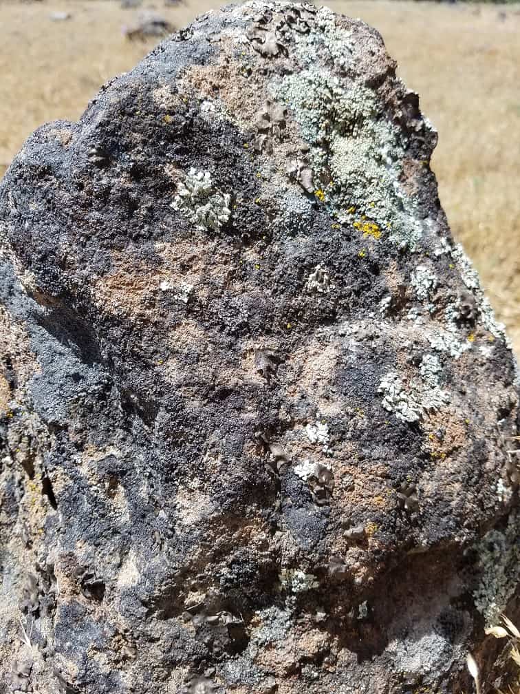
The 1870 Field Notes set the stone at 40.00 chains (running north) and at 50.00 chains called for a large rock on the summit (15'x25'x9' high) 40 links west. I found it (pictured below). Then I walked south 10 chains and at another 10' or so found the stone above with a pretty good 1/4 chiseled on the east face (1 over - over 4).
Believe me, there is a stacked 1/4 on there but it's hard to get a good picture of it. Dan played with the contrast editor on his phone and was able to make it stand out better. The stone matches the dimensions in the notes except it sticks up 15" (notes say it's 25" long). It is firmly set so I can imagine it is 10" in the ground. It has been there 147 years so I'm not going to disturb it.
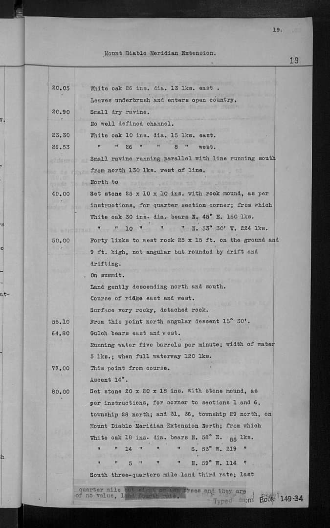
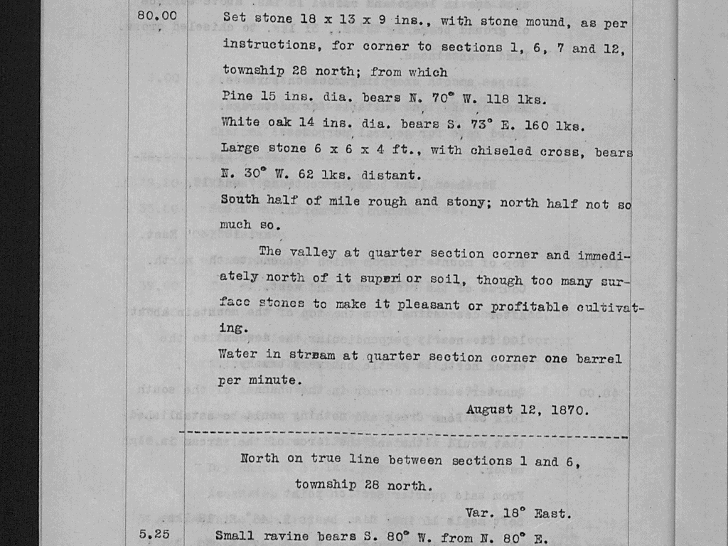
Here is a page from the 1870 field notes. We found the NE bearing tree. There is no sign of the NW bearing tree but there is a 15" oak a little off bearing but at about the correct distance. No evidence of a healed blaze on the oak, it may or may not be the original bearing tree.
Candy for a surveyor!
I love it. Thanks for sharing!
N
A blind man could see that 1/4. Good find.
That's very nice indeed!
I've never seen any typed notes as early as 1870 where I work.
The original notes are handwritten, these are duplicates.
Cool find David!
And an interesting area. T28N, R1W was subdivided in 1875 and T28N, R1E was subdivided two years later. The township plat for T28N, R1W returns 80 chains for the sections along the Mt. Diablo Meridian. The township plat for T28N, R1E returns for the westerly lines of Secs. 30 and 31, 81.33 ch. and 85.40 ch. respectively (along with both sections having lots 1 thru 16).
interesting indeed.
I'm interested in how these marks survive in todays world.
Here in Tasmania I'd suggest we are fast getting past the time when landowners appreciated old marks or could even recognise them and as such don't receive the recognition = protection they once had.
It's only if you really get back into the 'back blocks' where forestry operations have been confined to boundaries and not open slather clear felling and removing any trace, that one can find old original stone piles and reference trees.
Often its an after event, when landowners decide they now need to set a boundary do they call on us and expect us to pluck lines out of thin air.
They are very proud to inform they have cleared the line to make life easier for us!!
If only they'd call before the dozers or excavators. I expect that's par for the course over there too.
Your supply of stone monuments is amazing.
LRDay, post: 429534, member: 571 wrote: That's very nice indeed!
I've never seen any typed notes as early as 1870 where I work.
If I recall correctly, the sets of original field notes were destroyed in the 1906 earthquake and fire. Fortunately there were a set of handwritten copies elsewhere. Another tpewritten set were copied thereafter.
I recall being advised that one has to be wary of transposition errors being as only copies are available.
This one is in an extensive area of lava from Mount Lassen, it's been used for livestock grazing so the stones have survived. It's unpatented public domain on the east (most of Section 6).
Nice stone!!
Was it SOP to mark the east face?
I universally deal with 1/4's on the north and west faces.
I notice the notes don't mention it and wonder if your range line is special somehow since it's Section 6 of R1E, meaning it's the central guide meridian.
MightyMoe, post: 429566, member: 700 wrote: Nice stone!!
Was it SOP to mark the east face?
I universally deal with 1/4's on the north and west faces.
I notice the notes don't mention it and wonder if your range line is special somehow since it's Section 6 of R1E, meaning it's the central guide meridian.
I haven't seen enough stones to see a pattern.
This is the Mount Diablo Meridian.
Dave Karoly, post: 429526, member: 94 wrote: Here is a page from the 1870 field notes. We found the NE bearing tree. There is no sign of the NW bearing tree but there is a 15" oak a little off bearing but at about the correct distance. No evidence of a healed blaze on the oak, it may or may not be the original bearing tree.
What a bone yard!
No scribing I assume.... because you didn't post up any pictures (scribing is as cool as stone monuments in my opinion).
Sounds like a possible bearing tree...no matter - you found the corner.
Cool discovery and survey Dave! Thanks for sharing.
I'm standing at the SW Corner of Section 6 looking northwesterly to the rock called for as a bearing object in the 1870 field notes of the Survey of the Mount Diablo Meridian:
Dan found the chiseled cross called for in the notes, it is a flattened X on the edge of the stone. Given the placement and orientation of the X I can imagine chaining to it being more accurate with a chain than an X on top or on the face. The two legs on the left of the big fissure are there, the bottom one of the right is there, the top one of the right looks like it spalled off at some time in the past:
Field Notes for the corner, I think the pine BT is there and remnants of the oak. My pacing is way off, the distances may have been switched in the notes:
South half of mile rough and stony; north half not so much so.
Love it Dave. Gneiss "+"!
Thanks for the photos and field notes!
Gene Kooper, post: 430314, member: 9850 wrote: Love it Dave. Gneiss "+"!
Thanks for the photos and field notes!
I wouldn't want to be out there when Lassen is spitting out those bombs, they are heavy and loaded with iron. They make the Schoenstedt sing just like a rebar, not jumpy like the typical hot rock, but a smooth transition up and over the rock.
