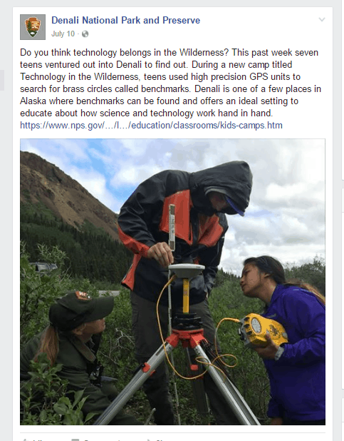
Any surveyors out there know of the history with a 1965 NGS survey of the Denali Park Road in Alaska? A 90 mile East-West Road that currently dead ends in Kantishna. A project started this summer is attempting to recover them (spaced about every mile). We are looking for information on this fantastic survey. Here is a typical data sheet for one of the marks. http://www.ngs.noaa.gov/cgi-bin/ds_mark.prl?PidBox=TT2529
What a beautiful place to work! Do you need volunteers?
I don't know if it is of any help by the work was level project L20408. You can use this project identifier to retrieve datasheets for all the point which were part of the project. See: http://www.ngs.noaa.gov/cgi-bin/ds_proj.prl
You can also request the leveling data for the project from NGS. The data would include the leveling blue book data files. At one time there was a tool, LINETOOL, which would have allowed you to do this on line. The tool is no longer available.
HTH,
DMM
GeeOddMike, post: 387811, member: 677 wrote: At one time there was a tool, LINETOOL, which would have allowed you to do this on line. The tool is no longer available.
And it's dearly missed.


