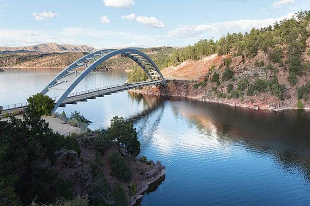
makerofmaps, post: 432488, member: 9079 wrote: Here's a picture of our mobile mapper mounted on a ranger. We are in the process of getting it mounted on one of our helicopters.
Nice, I like it. No LiDAR though, just pics? We just completed 17 miles of highway using the MX-2.
StLSurveyor, post: 432490, member: 7070 wrote: Nice, I like it. No LiDAR though, just pics? We just completed 17 miles of highway using the MX-2.
Or does that have the single head hidden?
StLSurveyor, post: 432507, member: 7070 wrote: The unit on the Ranger is a Trimble Mx-2 the other one is a Regel, I was asking because it didn't look like the Mx-2 has a LiDAR unit and I didn't know they made one without the LiDAR.
Yes you are right. We demoed the trimble I didn't notice but it had a hard time of hitting the overhead guys. We ended up with the Riegl and the ladybug camera.
Where was that picture taken with the bridge in the background? It looks a lot like a custom bridge we had constructed several years ago. Same color and everything.
I'd like to see if I can find some close up pictures of the bridge.
imaudigger, post: 432524, member: 7286 wrote: Where was that picture taken with the bridge in the background? It looks a lot like a custom bridge we had constructed several years ago. Same color and everything.
I'd like to see if I can find some close up pictures of the bridge.
That's in South Pittsburg, TN
makerofmaps, post: 434260, member: 9079 wrote: That's in South Pittsburg, TN
Thanks, it's similar in appearance from a distance only.
Still a neat looking bridge. I'm sure it's featured in many tourist pamphlets.
imaudigger, post: 434266, member: 7286 wrote: Thanks, it's similar in appearance from a distance only.
Still a neat looking bridge. I'm sure it's featured in many tourist pamphlets.
Bad A S S !
StLSurveyor, post: 432490, member: 7070 wrote: Nice, I like it. No LiDAR though, just pics? We just completed 17 miles of highway using the MX-2.
We looked at the MX2. Just curious, how fast can you go and get good density?
spledeus, post: 434342, member: 3579 wrote: We looked at the MX2. Just curious, how fast can you go and get good density?
The most recent project was 17 miles of congested highway. We travelled at 60-65mph. With the dual LiDAR heads we were able to manage about 300-400 shots per square meter. We did drive all lanes and had entrance/exit ramps as well as flyovers. Will all the overlap we could have driven faster. The limiting factor is not the LiDAR , but the processor on the laptop. The faster you drive the faster it has to process. But even at 60mph processor never went over 60%
StLSurveyor, post: 434363, member: 7070 wrote: The most recent project was 17 miles of congested highway. We travelled at 60-65mph. With the dual LiDAR heads we were able to manage about 300-400 shots per square meter. We did drive all lanes and had entrance/exit ramps as well as flyovers. Will all the overlap we could have driven faster. The limiting factor is not the LiDAR , but the processor on the laptop. The faster you drive the faster it has to process. But even at 60mph processor never went over 60%
? Why does the laptop acquire more based on speed? The heads acquire the same 72k per second. The GPS acquires the same data at any speed. The IMU should have the same amount of data. Is The camera a LB5? Still 2 to 4 images per second.
Sent from my SM-G930V using Tapatalk
spledeus, post: 434370, member: 3579 wrote: ? Why does the laptop acquire more based on speed? The heads acquire the same 72k per second. The GPS acquires the same data at any speed. The IMU should have the same amount of data. Is The camera a LB5? Still 2 to 4 images per second.
Sent from my SM-G930V using Tapatalk
I don't know, I assume it has to do with the corrections/ GAMs, etc. 45 mph from experience seems to be optimal.
StLSurveyor, post: 434475, member: 7070 wrote: I don't know, I assume it has to do with the corrections/ GAMs, etc. 45 mph from experience seems to be optimal.
Interesting.
Are you running real time corrections?
Sent from my SM-G930V using Tapatalk


