 We go so many interesting places, see so many fascinating things, that I want to document some of my meanderings. It seems to add dimension to surveying.
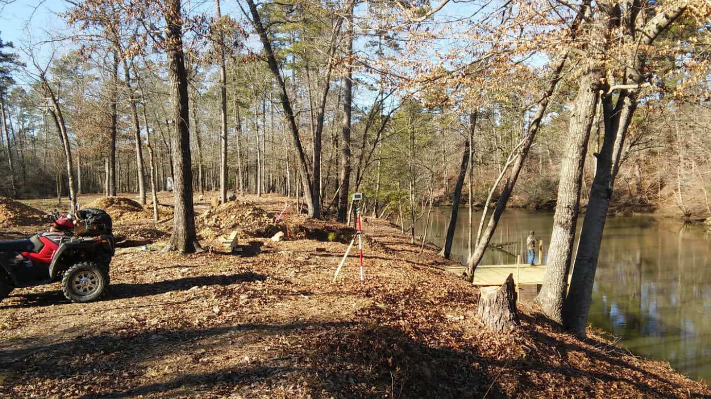
In the above pic, the property line is on the steel fence post, to the left of the GPS. It runs east, to your right, approximately perpendicular to the river.
We are standing on my clients property. The dock was built for my client. On the WRONG property.
We placed steel fence posts, around the perimeter, for my client. Just to solve this problem, and to prevent future problems. The adjoiner does not want the dock... he says. (Unless it's free!) So, the dock is to be moved, or something....
Nate
Nate -
We could send you 8 to 10 inches of 'white out' that would maybe solve the problem ! 🙂
Cheers,
Derek
PS-
Winter length surveying kilt is needed at 20F with 25MPH wind today
Looks like you are on the dock fishing instead of workin! Catch anything?
Did not fish.... but I did secure permission to come and do a family outing there.... we fish then!
Nate The Surveyor, post: 355500, member: 291 wrote: We go so many interesting places, see so many fascinating things, that I want to document some of my meanderings. It seems to add dimension to surveying.
Nate,
You need to check into the Theodolite Pro app. It will 'stamp' Lat/Long and information about position, altitude, bearing, and horizontal/vertical inclination onto the photo. You can even add custom notes such as job number, weather, fieldbook page.
DDSM
 one thing I regret about my surveying career, is I did not take a camera, and take a few pics every day. That would make a book now. It would jog my memory, and be a lot of fun to look at.
With digital cams now, it's a no brainer. Document your journey.
Nate The Surveyor, post: 355683, member: 291 wrote:
one thing I regret about my surveying career, is I did not take a camera, and take a few pics every day. That would make a book now. It would jog my memory, and be a lot of fun to look at.
With digital cams now, it's a no brainer. Document your journey.
Sync your phone to auto download your pics. I hadn't done that. Phone overheated and fried datacard. All photos for over a year LOST!


