
Activity Feed › Discussion Forums › Photogrammetry, LiDAR & UAS › Faster accurate terrestrial scanning with survey methodology.
Faster accurate terrestrial scanning with survey methodology.
JSP replied 7 months, 4 weeks ago 9 Members · 45 Replies

Some points at distance, falling onto the surface of wall sheeting, I’ve magnified the points to 5 pixels, as they’re sparse.
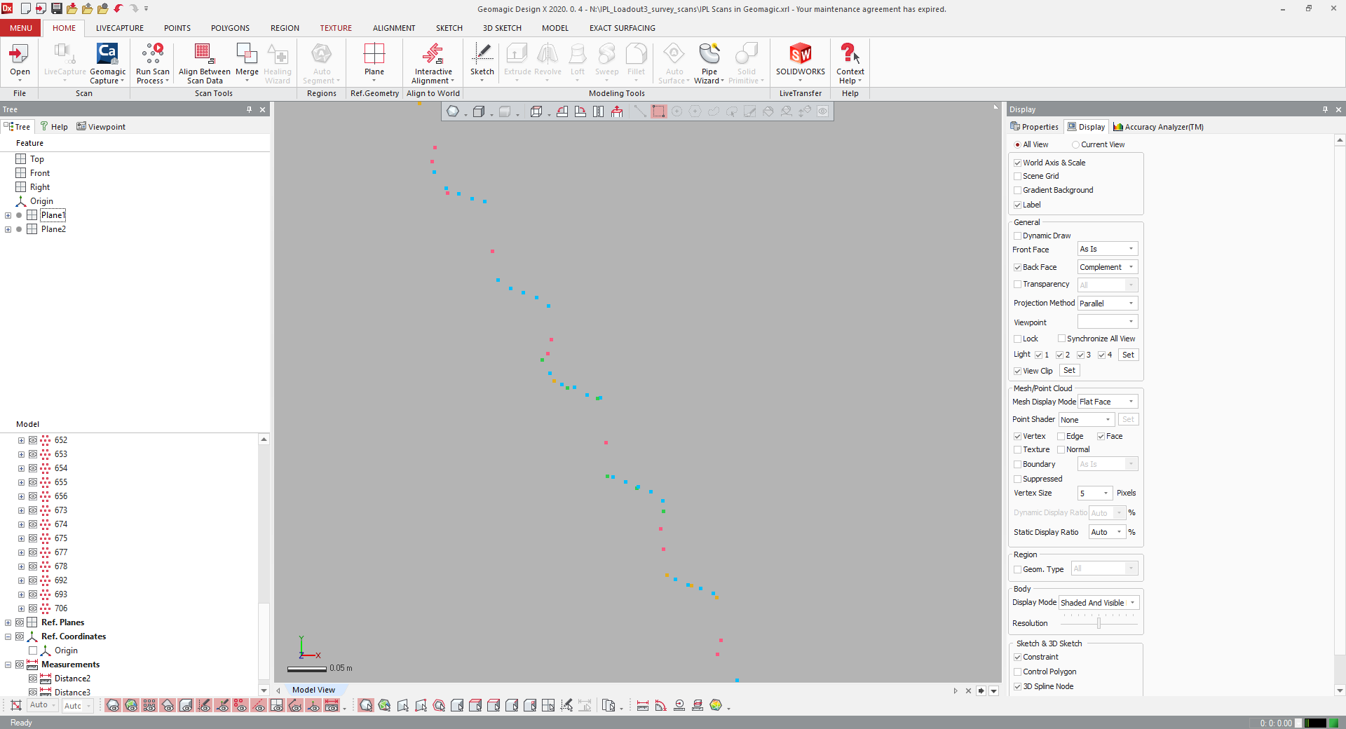
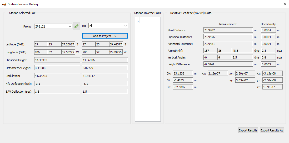
Uncertainty between scan positions.
So just trying to increase speed without loss of accuracy, by changing from a traverse workflow, where we’re leapfrogging the scanner with prisms on survey tripods, to a resection workflow, where we move the tripod without removing the scanner, scan prisms (or sphere targets if using a different scanner) and track the scanner location with a total station. The scanner can do 12mm @ 10m in 1:45 (1 minute and 45 seconds), a prism target scan takes about 1 minute per target, so we’ll be able to reposition relatively quickly, as we won’t need to remove the scanner from the tribrach.
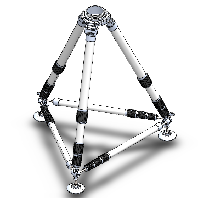
The tripod manufacturer has expressed concerns the scanner market is too small, so now also looking to allow the tripod to be used for metrology and total stations, with some additional stiffening braces, the tripod is carbon fibre:
3.5″ thread, all joints are clamped to remove play, for a laser tracker:
Configured with braces for robotic total station on concrete or asphalt:
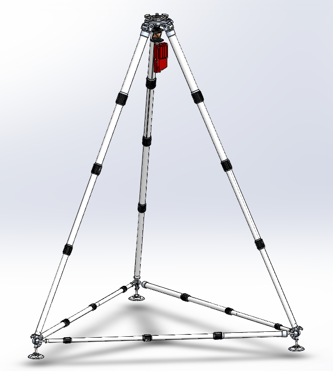
Laser scanner configuration:
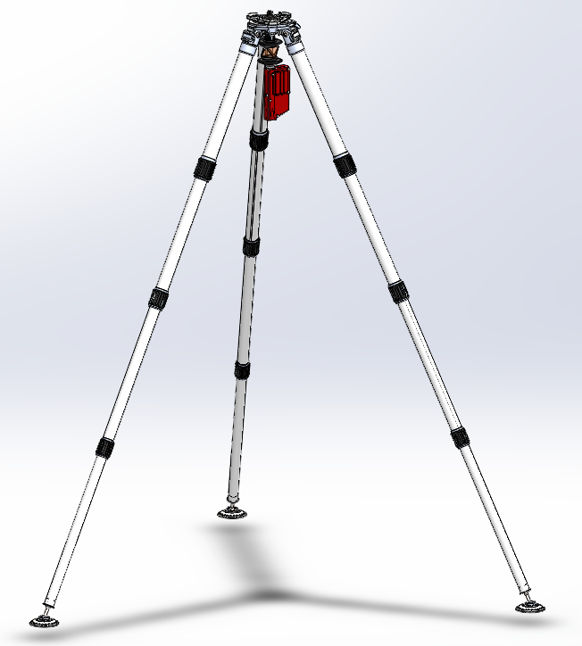
It will also be possible to fit castors with foot brakes and braces for moving the scanner over smooth surfaces.
The height tool (laser plummet and 2m tape) could be replaced with a pole to use it similarly to how @leegreen uses his GPS tripod, for a constant instrument height, while measuring the position with a total station, if levelling is performed. The pole height doesn’t need to be recorded if not levelling, but I think I would measure it anyway.
Note:
- The prism and height tool can be removed to allow the instrument plummet to view a ground point.
- This isn’t the final design, the manufacturer has suggested more revisions.
While I can have the prototypes manufactured for myself, I’ll probably need to consider crowd funding for the manufacturer to make a production run. Or maybe I’ve just been in the sun too long. 😉
Cheers,
Peter.
Some points at distance, falling onto the surface of wall sheeting, I’ve magnified the points to 5 pixels, as they’re sparse.
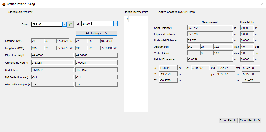
Uncertainty between scan positions.
Uncertainty between green and red point scan positions, the previous uncertainty was between the red and blue point scan positions.
I noticed a new trend where many non-surveyors are performing scans. All were performed without asking for a single control point. Then when their scans don’t align they come to the surveyor.
I have noticed this trend too, I’ve been guilty of engaging such people to perform scans in the past (either through another engineering company, or scanning specialists), although I managed to find a surveyor for measuring target positions for control points, I got burnt quite badly by the scanner tech’s. Not only is their work prone to registration errors, but they tend to over scan in high resolution colour, which presents well, but causes performance problems.
I lease the Topcon scanner from a surveyor and have purchased insurance to cover it in case of damage or theft, I had originally engaged him to do the scanning, but he was too busy and I have no other alternatives. You can no longer purchase Topcon scanners in Australia, as far as I’m aware this is the only one in my state, so it’s very well looked after.
The scanner tech’s we’re talking about, either they or the company they work for has purchased a scanner, received training from the scanner OEM and go out into the field and start using it, but don’t understand error probability, tolerance stack-up, accuracy and precision. When you first engage them, they’re confident and sound like they know what they’re talking about, and when you receive samples of work, such as point clouds, they’ll be from successes, not failures, failure will strike randomly, due to the nature of error probabilities.
I’m not a surveyor, I’m a field mechanical engineer, my experience with measurement is from metrology. My daughter will be finished her surveying degree this year, it’s been a good learning curve for her, she can take it over when ready.
There are three reasons why we need point clouds, one is for our customers to supply to other contractors for designing plant modifications and upgrades, to second is for them to use as a virtual 3D environment of their plant, the third is for structural engineers (whom we engage) to assess and manage structural strength, to prioritise remediation of issues, such as corrosion, or existing structures with upgraded plant.
Some more measurements with the Topcon and our current traverse methodology, most of our uncertainties between positions are sub mm, I have to say, I’m more than happy with the performance of SALSA for least squares analysis and the equipment, we use 62mm nodal prisms and precise carriers from Sokkia. All level bubbles and plummets are adjusted, tripods legs tightened and tops checked for flatness, prior to arrival on site.

I have also done land surveying services using the laser scanning method, traverse surveys using a total station and registration with software from Leica.
And the results are satisfactory as you said at the beginning of the sentence, I use the same method for this…
while using drone Lidar, airing according to the measured area, and Installing premarks for full accuracy……..Thanks Petrus (Jasa Pengukuran Tanah / https://jasasurveypemetaan.com)
jasasurveypemetaan.com
Jasa Pengukuran Tanah - Jasa Survey Pemetaan | Konsultan Pengukuran
Hubungi kami: 082249050011, Konsultan Jasa Pengukuran Tanah, Untuk mendapatkan Petas Situasi Memanjang - Melintang, Peta Kontur Aktual


Log in to reply.