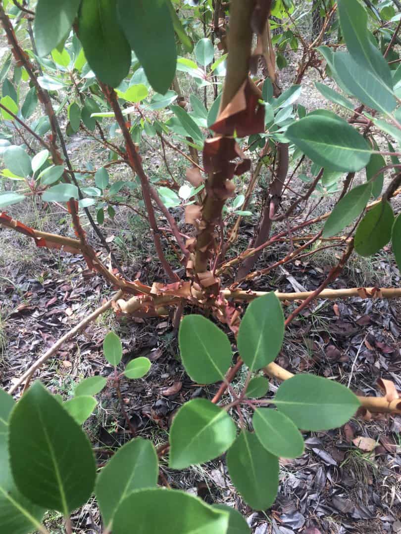
Before we got sidetracked by a highly important discussion of mining claims in the Rocky Mountains, I mentioned that yesterday I'd found what is in effect a ghost of a surveyor's opinion from early in the 20th century.
In light of what the record disclosed, the old Rock Mound that I'd found appeared to be something that either had been set or found in place in 1906 by the Travis County Surveyor H.G. Lee and thought by him to mark a corner of a senior land grant surveyed in 1876 on the East line of a much older grant originally surveyed in 1839. It wasn't perfectly clear from his record whether Mr. Lee had set or found the mound, but I initially leaned toward his having set it because the rather small size of the mound seemed unlike the sort of more substantial mounds that I've found over the years that the 1876 surveyor, Travis County Surveyor John E. Campbell, typically made.
The record is sparse enough that the means of identifying the likely who, what, when, and where of otherwise unidentified markers is partly in reconstructing their pattern, including systematic chaining errors and systematic errors in the directions of lines. That requires working forward and backward from some suspected corner to see what, if anything can be found that resembles the footsteps of a survey made by a particular surveyor at a specific date using a surveying compass adjusted for a stated variation or declination.
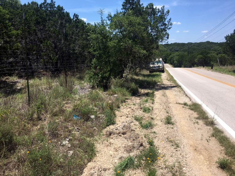
In theory, if yesterday's rock mound were a corner made by the 1876 surveyor, there should have been another one nominally 1101 varas (about 3058 ft.) uphill from there. That position fell on the South side of a public road, approximately along the line of the remains of an old Post and Wire fence (mostly removed)
The last record of recovery of a survey marker at this corner was a rock mound reported in place in 1948, before the road was built. Here is the photo of the vicinity of the search. The scattered remnants of the older cedar post and wire fence were approximately 1.2 ft. North of the fence presently in place.
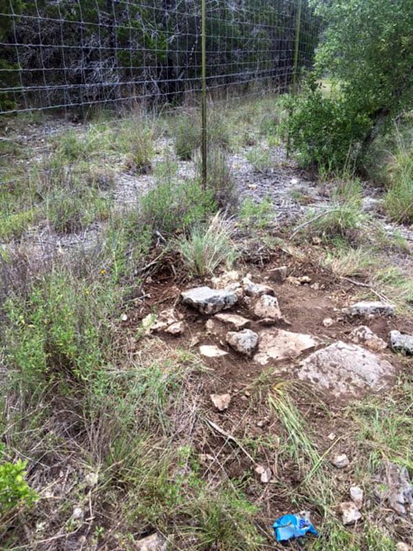
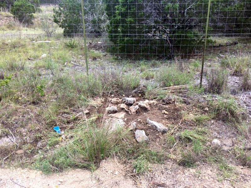
There was a hump in the ground surface with some pieces of limestone visible at the surface, both of which would be consistent with an old rock mound that time had partially buried alongside a road.
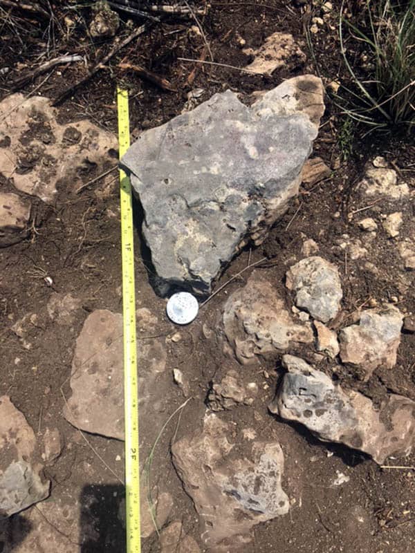
Some work with a shovel and whisk broom revealed that the buried stones made a cluster about 2.7 ft. in diameter. The base of the mound had evidently survived road and fence construction, but not in perfect shape.
I went ahead and set a rod and cap in the center of the cluster, and will get an accurate location on it tomorrow in the course of other work.
It may turn out to be something other than what the 1948 surveyor reported in place, but if it is consistent with the expected pattern of one of the 19th century surveys, then the cap gets stamped "FD OLD RM" and there are other places to search to continue filling in the pattern of the old work.
So, the situation is that there are at least two locations for where a line of a senior grant from the Republic of Texas might have been run in 1839 as evidenced by two rock mounds about 164 varas (456 ft.) apart. Both have been described as falling on the line of the senior grant, but depending upon which might be more correct, the results place the line surveyed in 1838 in different locations about 164 varas distant.
Part of the work of the morning was examining the strips of land along theoretical alignments of the two alternate theories of location of the lines for about 600 ft. of the uphill 3050 ft. that the line reportedly runs. One strip along one trial line had an abundandance of evidence of old clearing. The line ran mostly through cedar (juniper) forest and at some time in the distant past an axe had removed some of the limbs to clear the line.
The interesting thing about these old cut cedars is that the axe killed the cut branches and they remain frozen in time, more or less the same diameter as they were when cut. The still-living branches have grown during the interim and are now much larger than the dead cut stubs adjacent to them. This provides a means of estimating when the line was cleared because it would approximately be the time required for a cedar limb to grow about 3" - 4" in diameter
Glad to see you get back on track, Kent. Thanks for posting some details of your project.
Gene Kooper, post: 435470, member: 9850 wrote: Glad to see you get back on track, Kent. Thanks for posting some details of your project.
That would be yet another off-topic post from you, wouldn't it? It's a strange talent of dubious value.
Kent McMillan, post: 435472, member: 3 wrote: That would be yet another off-topic post from you, wouldn't it? It's a strange talent of dubious value.
But not as predicable as your off-topic diversions, Kent. I asked a couple of simple, on topic questions in the other thread and you decided to derail your thread with another rant about PLSSia, me and mineral surveys. I certainly wasn't the first in that thread to bring up my work.
I merely responded to this thread by saying thanks for posting some details you omitted in the other thread. Or is it that you are too modest to accept a thank you from me? Hopefully, after a few more stylized insults pointed in my direction, you'll get back on topic.
Best Regards,
Gene Kooper, PLS
Gene Kooper, post: 435478, member: 9850 wrote: But not as predicable as your off-topic diversions, Kent. I asked a couple of simple, on topic questions in the other thread and you decided to derail your thread with another rant about PLSSia, me and mineral surveys. I certainly wasn't the first in that thread to bring up my work.
I merely responded to this thread by saying thanks for posting some details you omitted in the other thread. Or is it that you are too modest to accept a thank you from me? Hopefully, after a few more stylized insults pointed in my direction, you'll get back on topic.
Completely off the topic of this thread, sorry.
Kent McMillan, post: 435463, member: 3 wrote: So, the situation is that there are at least two locations for where a line of a senior grant from the Republic of Texas might have been run in 1839 as evidenced by two rock mounds about 164 varas (456 ft.) apart. Both have been described as falling on the line of the senior grant, but depending upon which might be more correct, the results place the line surveyed in 1838 in different locations about 164 varas distant.
Part of the work of the morning was examining the strips of land along theoretical alignments of the two alternate theories of location of the lines for about 600 ft. of the uphill 3050 ft. that the line reportedly runs. One strip along one trial line had an abundandance of evidence of old clearing. The line ran mostly through cedar (juniper) forest and at some time in the distant past an axe had removed some of the limbs to clear the line.
The interesting thing about these old cut cedars is that the axe killed the cut branches and they remain frozen in time, more or less the same diameter as they were when cut. The still-living branches have grown during the interim and are now much larger than the dead cut stubs adjacent to them. This provides a means of estimating when the line was cleared because it would approximately be the time required for a cedar limb to grow about 3" - 4" in diameter
Great illustration Kent, thank you for sharing your insightful observations. Can you recommend a reference for tree growth?
rlshound, post: 435602, member: 6800 wrote: Great illustration Kent, thank you for sharing your insightful observations. Can you recommend a reference for tree growth?
In Central Texas, It varies so much depending upon the species, soil condition, and setting. The rule of thumb I use for cedars and live oaks growing in caliche soils in well-drained uplands in Central Texas is a range of 1 inch per 14 years to 20 years, with 16 years being the expected value. One non-destructive method is to keep a log of bearing trees that you recover for which a diameter was given on the date of some prior survey and use the change in diameter to compute a growth rate. Otherwise, counting growth rings is the main option that's left.
In the example of the old cut line that I found, 16 yrs/inch x 3 inches = 48 years and 16 yrs/inch x 4 inches = 64 yrs. Based upon the records of prior surveys, I think that line was probably cut out about 69 years ago.
Kent what part of Travis County are you working in? Sounds West of US183 to me
Ah! La madrona... she can shut down a project in western Travis County. In Northern California it can be some of the best firewood around. Live oak is not bad either. It's slim pickens on the good wood in Travis, I never really considered the junipers to be trees. Never thought they were native either until you said that the other day and I looked it up
David Kendall, post: 435704, member: 12659 wrote: Ah! La madrona... she can shut down a project in western Travis County. In Northern California it can be some of the best firewood around. Live oak is not bad either. It's slim pickens on the good wood in Travis, I never really considered the junipers to be trees. Never thought they were native either until you said that the other day and I looked it up
I've yet to see a madrone used as a bearing tree, but there are plenty of calls for the junipers in field notes produced by 19th-century surveyors when nothing better was available. One of the land grants I'm dealing with, one that was originally surveyed in 1839, called for cedar bearing trees at one corner that were both more than 100 varas (278 ft.) distant. In that particular location, I'd say that what is now dense cedar forest was probably mostly grassland interspersed with scattered cedars in 1839, possibly the result of the Texas Indians having periodically set fires to burn off the brush before the EuroTexans arrived.
Most of the cedar forest one sees in Wester Travis County is second or third-growth forest. When you get into the original old-growth forest, the cedars make quite respectable trees. It would have been much, much easier to survey through that with compass and chain than the bushy mass that is now more common.
Kent McMillan, post: 435706, member: 3 wrote: I've yet to see a madrone used as a bearing tree, but there are plenty of calls for the junipers in field notes produced by 19th-century surveyors when nothing better was available.
We called this 18" madrone a found accessory to the quarter corner on the map, not an original government corner but good enough. This one healed nicely. Many rot out and fall over once they are blazed.
Generally a poor choice for a BT
David Kendall, post: 435709, member: 12659 wrote:
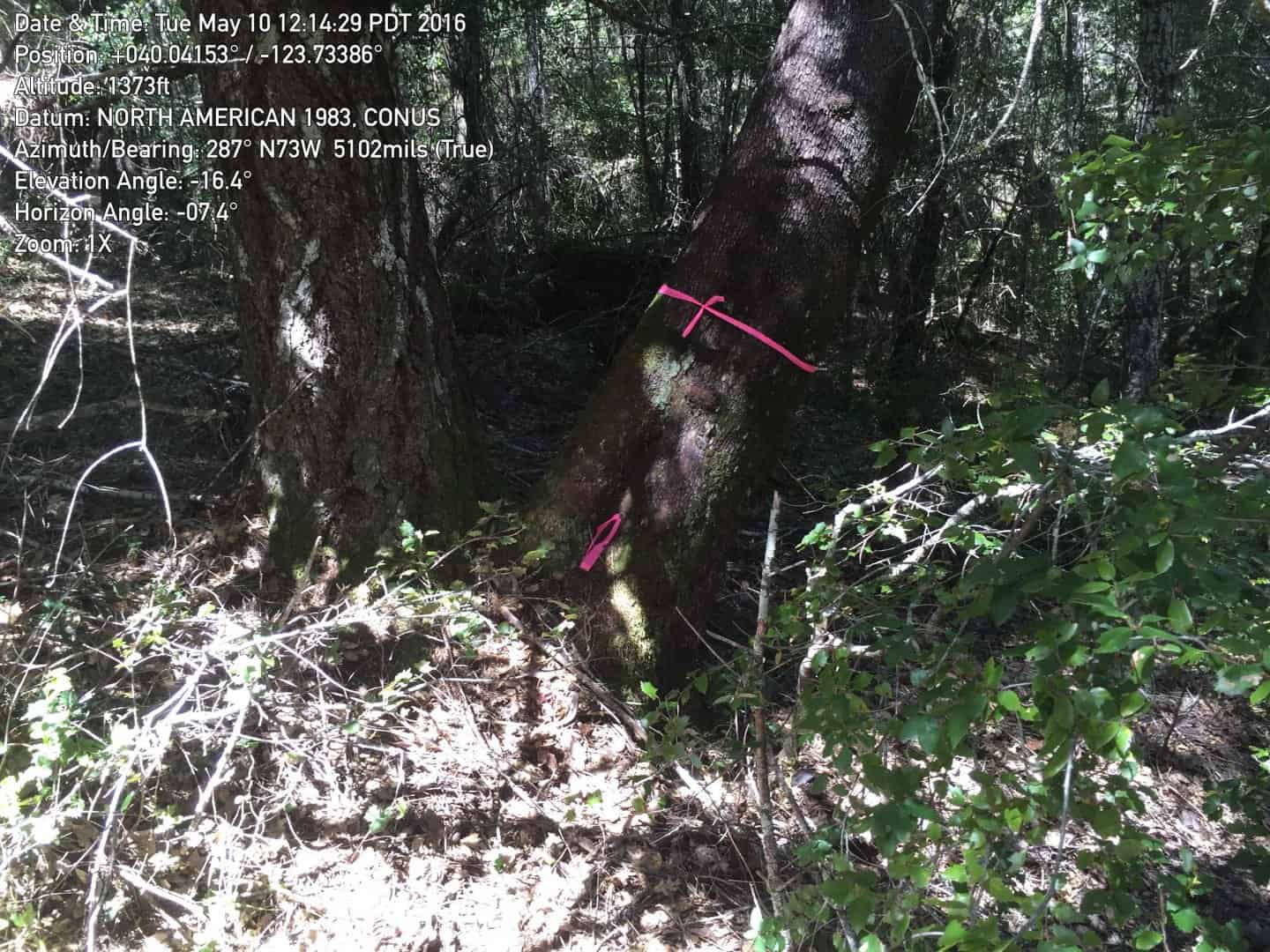
We called this 18" madrone a found accessory to the quarter corner on the map, not an original government corner but good enough.
The Texas madrone is Arbutus xalapensis and a 12 in. dbh specimen would be very unusual. I gather that the California madrone is probably a different species, Arbutus menziesii, that may grow to a larger size.
Kent McMillan, post: 435627, member: 3 wrote: In Central Texas, It varies so much depending upon the species, soil condition, and setting. The rule of thumb I use for cedars and live oaks growing in caliche soils in well-drained uplands in Central Texas is a range of 1 inch per 14 years to 20 years, with 16 years being the expected value. One non-destructive method is to keep a log of bearing trees that you recover for which a diameter was given on the date of some prior survey and use the change in diameter to compute a growth rate. Otherwise, counting growth rings is the main option that's left.
In the example of the old cut line that I found, 16 yrs/inch x 3 inches = 48 years and 16 yrs/inch x 4 inches = 64 yrs. Based upon the records of prior surveys, I think that line was probably cut out about 69 years ago.
Morning Kent, thanks again for taking the time to share your insights and methods, its not everyday you find someone who is willing to go the distance. I emailed the Arizona Cooperative Extension with the University of Arizona yesterday trying to find similar information on native trees. I'll keep you posted as to what returns, Respectfully, Paul
Kent,
Those cuts do not look like axe cuts to me. They are too smooth. more like chainsaw cuts.
But I have poor vision.
Jack
Jack Chiles, post: 436189, member: 24 wrote: Those cuts do not look like axe cuts to me. They are too smooth. more like chainsaw cuts.
They were definitely cut with an axe. At one time in Central Texas, there were guys working on survey parties in the cedar brake who were very proficient with cedar axes and this is some of their handiwork. One clue is the angle of the cuts. The other is the surface of the cut which is free of the sort of striations typical of a chain saw. A very sharp cedar axe in skilled hands will make cuts like that.
