A few years ago, I made one of the more difficult surveys that I've worked on to date. It involved retracing all or parts of more than ten original land grants that had been surveyed between 1835 and 1888 in the Texas Hill Country. One feature of surveying in that area is that all of the original surveys were made with surveying compasses, virtually all of which were adjusted for variations that differed from the correct values for the time. As a result, lines run by the different surveyors were systematically in error by fairly uniform amounts, differing for each survey.
For example in 1847, a large system of surveys was run by a surveyor who reported that he had used a variation of 10å¡00'East in adjusting his compass. That is, he considered magnetic North to have a true azimuth of 10å¡00' and set that declination angle off on the declination arc of his compass.
The National Geophysical Data Center has developed a model of historic magnetic declination for the US that estimates that the actual variation or declination angle was 9å¡31' in 1847 in the vicinity of four of the surveys run then. Using that modeled value of declination, it is possible to estimate the grid azimuth of the "North" direction used by the 1847 surveyor in running his lines.
That calculation is as follows:
+ 9å¡31' True Az of Mag North in 1847
-10å¡00' Survey Variation
-------
- 0å¡29' True Az Survey North
- 0å¡31' Convergence
-------
- 1å¡00' Grid Az Survey North (Predicted)
So, how did prediction compare to the directions of lines as found on the ground? Well for five lines that could be located from original evidence of the 1847 survey and ranging in length from about 4400 ft. to about 6400 ft., the actual bearings of the lines as marked on the ground showed that they had been run in relation to a "North" with the following grid azimuths:
- 1å¡18'14"
- 1å¡06'36"
- 1å¡03'37"
- 1å¡04'00"
- 1å¡07'41"
----------
- 1å¡08' Average
So, the Grid Azimuth of the "North" direction used by the 1847 survey was on average 0å¡08' different than predicted by the US Historical Declination model.
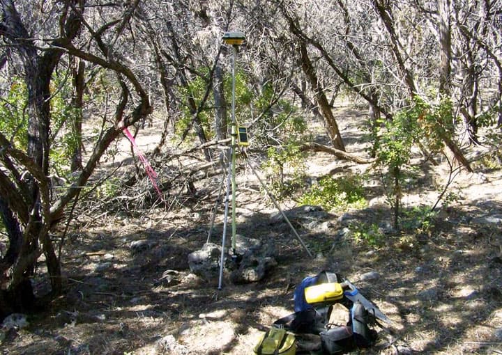
One of the most difficult parts of the whole project was locating a survey that had been made in 1873. The difficulty was largely the result of the grant falling entirely within the interior of a larger tract, none of its lines having been perpetuated by later surveys or by occupation, and the 1873 surveyor having been mistaken as to the locations of lines and corners of other surveys that he called for in the field notes he filed for record. The 1873 surveyor had left very few few clues as to exactly where he had run lines and marked corners, so the process of reconstructing the boundaries as run in 1873 was not quick or easy.
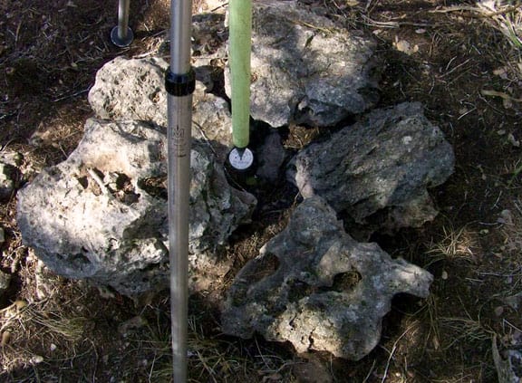
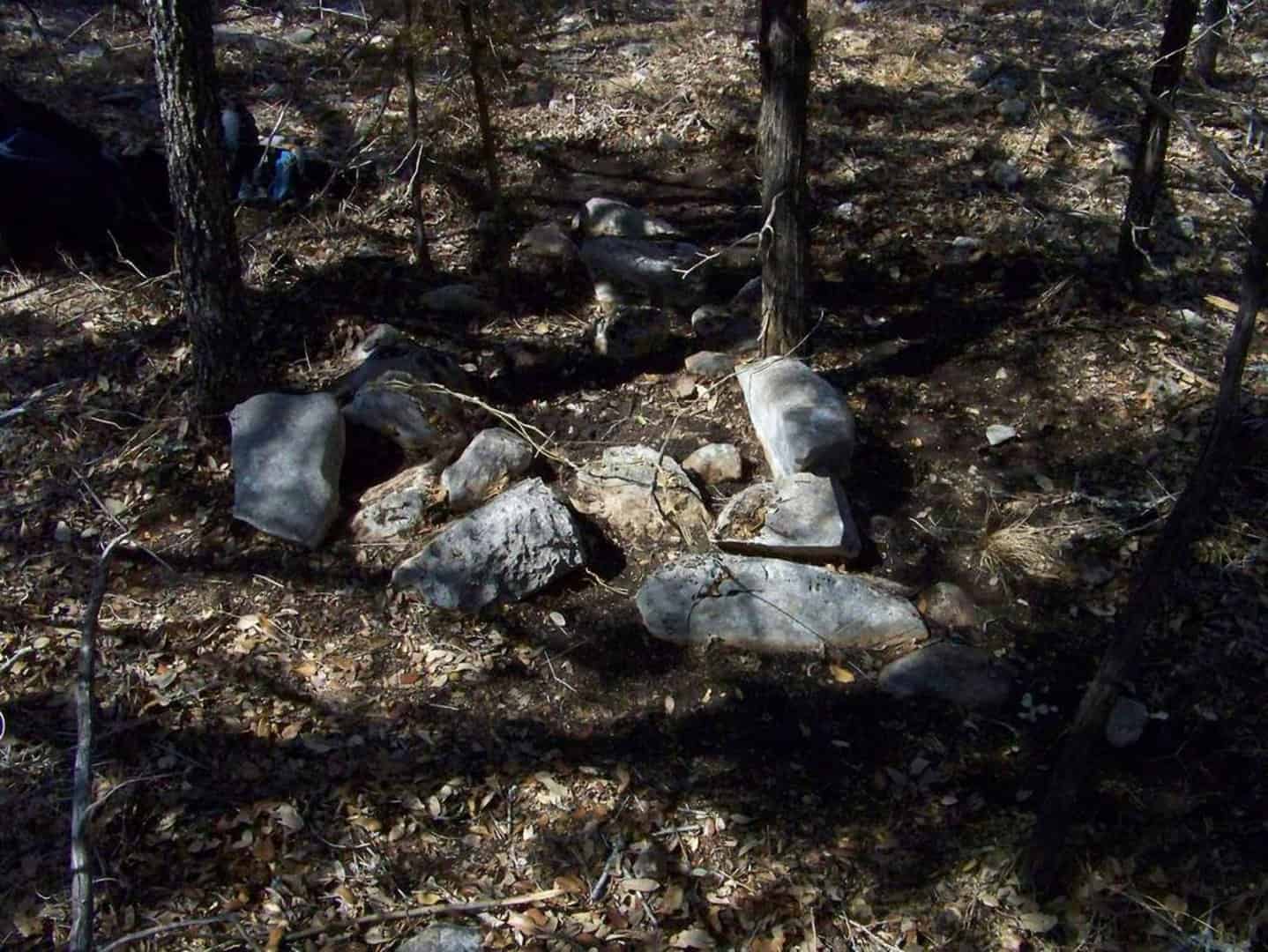
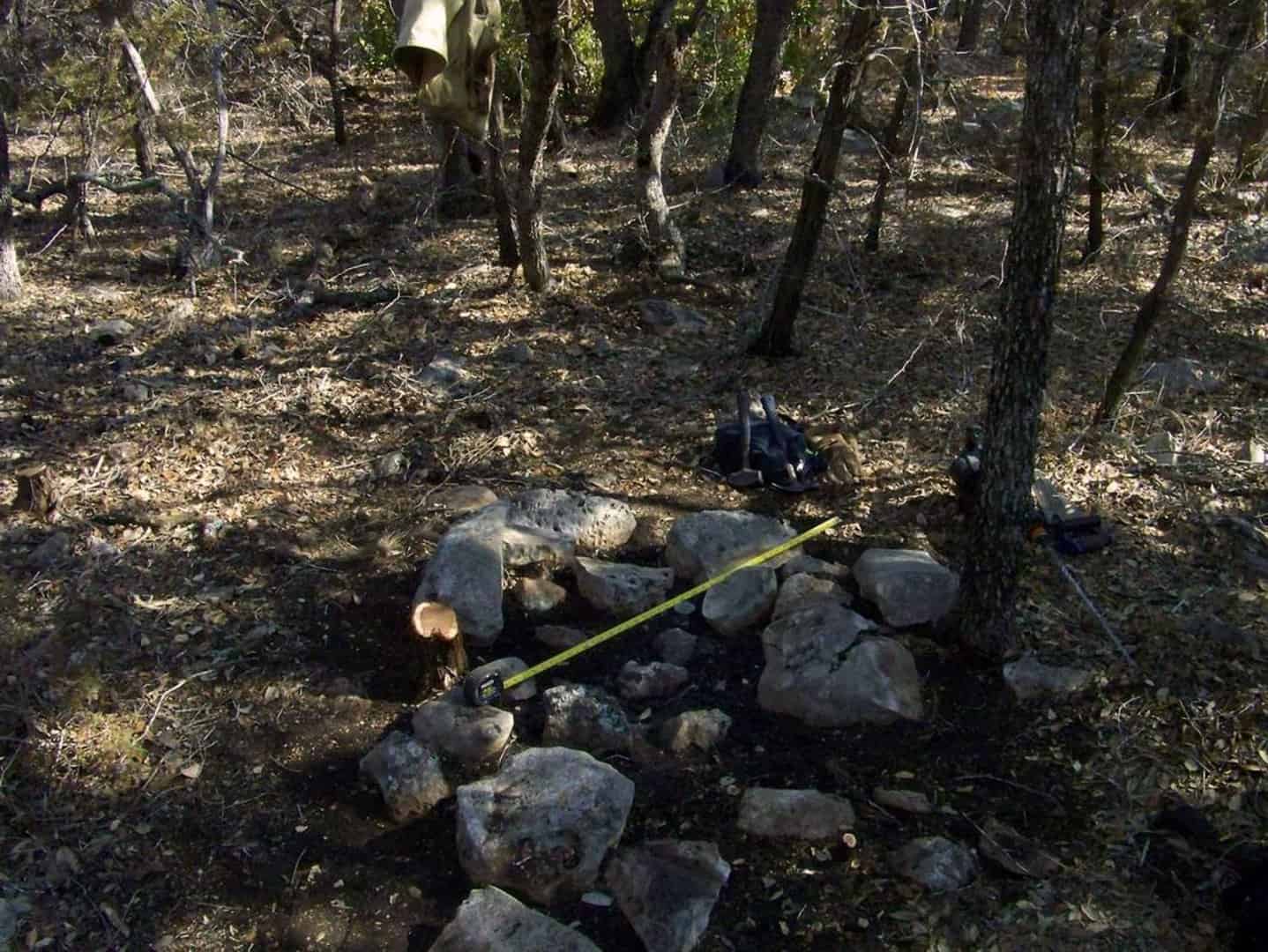
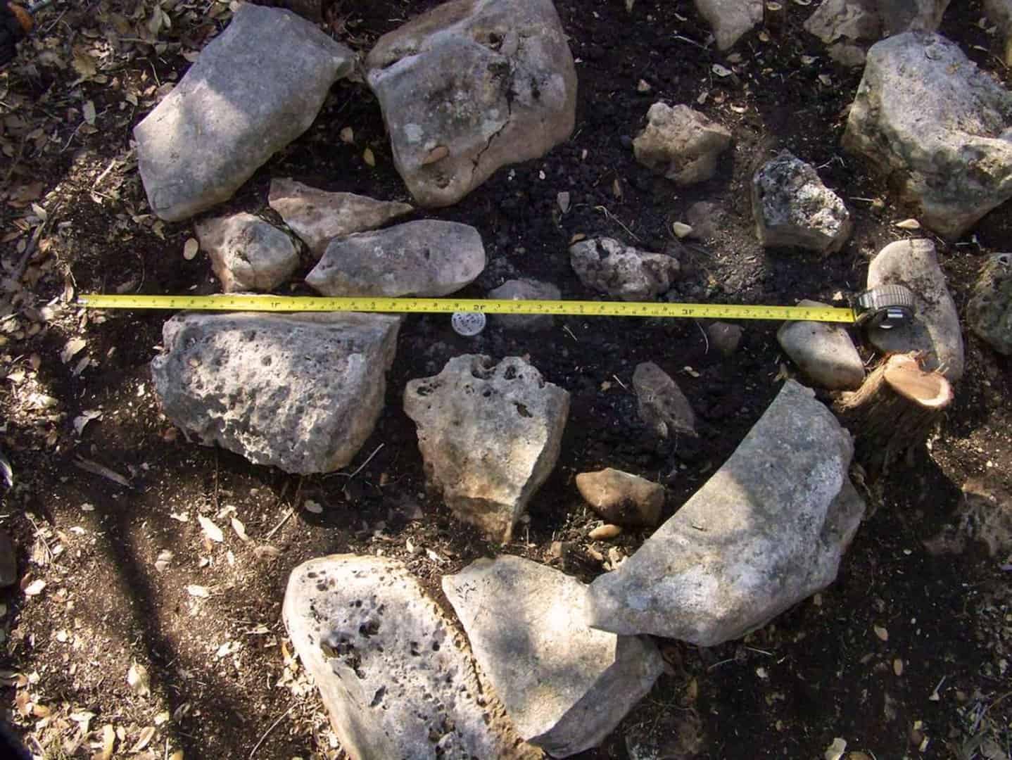
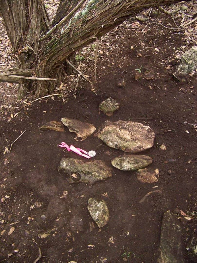
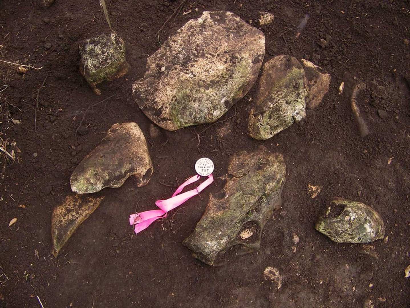
When all was finished, though, I was able to reconstruct the 1873 surveyor's work from such sparse evidence as was left. There were the remains of two rock mounds in place, neither of which was an easy find. One appears in the photos below:
The bearing trees had fallen to wood cutters more than a century earlier, but the stump of what I judged to be one remained in place with old regrowth from it. I found a total of three small rock mounds along the lines of survey, none of which were mentioned in his field notes, but one of which was mentioned in a deed drafted in 1873, plainly using the results of the surveyor's work.
The actual directions of the lines that I concluded were those run by the 1873 surveyor were part of the pattern of evidence. His work had been run at a variation of 10å¡00'East, a value that was used for decades in the area while never actually being correct.
Survey in 1873:
+ 9å¡15' True Az Mag North
-10å¡00' Survey Variation
-------
- 0å¡45' True Az Survey North
- 0å¡31' Convergence
-------
- 1å¡16' Grid Az Survey North (Predicted)
Of the lines of the 1873 survey, the marks of three of the lines showed that they had been run in relation to "North" directions having the following Grid Azimuths:
- 1å¡28'24" about 3800 ft.
- 1å¡16'42" about 2300 ft.
- 1å¡27'38" about 1400 ft.
- 1å¡25' Grid Az Survey North (weighted average)
So, the Grid Azimuth of the "North" direction used by the 1873 surveyor was on average 0å¡09' different than predicted by the US Historical Declination model, which is similar to the result found when the actual bearings of lines run in 1847 in the same vicinity were compared to those predicted by the USHD model.
It so happened that I had also retraced a survey made in 1871 about three miles away from the 1873 work. The 1871 survey was almost certainly the work of the same surveyor since he was County Surveyor at both times. The 1871 survey was made for private owners in the course of subdividing a part of an original land grant surveyed in 1838, but does give another data point from the 1870s that compares the USHD models to actual survey made at a known time.
Using the USHD models, one would predict that the lines run in 1871 at a variation of 10å¡00'East would have bearings on the ground that were consistent with a "North" direction having a Grid Azimuth of -1å¡14'.
Survey in 1871:
+ 9å¡18' True Az Mag North
-10å¡00' Survey Variation
-------
- 0å¡42' True Az Survey North
- 0å¡32' Convergence
-------
- 1å¡14' Grid Az Survey North (Predicted)
One line from that 1871 survey that could still be definitely located from original evidence ran for about 2000 ft. between two corners proven by the original bearing trees. It had a bearing that indicated that the Grid Azimuth of the "North" direction used in 1871 was -1å¡27'46", a difference of about 0å¡14' from the value predicted by the USHD model. That result is essentially consistent with the work done in 1873 by the same surveyor and also suggests that a small systematic bias likely exists in the USHD model in that locality for the time periods involved.
Here is what one of the three line mounds looked like. The style of the mounds suggested that they were built to support a cedar stake or "lath". All three were built of larger rocks, in an obviously artificial arrangement. Two were relatively short distances (<100 varas) from the corner, moving around the boundary of the survey in the counter clockwise direction of the original traverse. They were the sort of thing that someone retracing the survey with a compass would use to make a preliminary correction to the variation set in their compass, i.e. adjust variation to run line though visible cedar stake in line mound and continue along line to make final correction from miss at next corner.
Thanks Kent, great stuff as usual! It makes me want to be a real surveyor when I grow up.:-D
Please don't survey anything next to my work, I couldn't stand the embarrassment.
In all seriousness your fine work proves that we don't need all of the newest toys to produce an outstanding land survey. Scanners, UAVs , RTK, RTNs, are all great and useful tools, I want them all, but they are not what make a great survey or surveyor. I have learned a great deal from your posts over the years and I am always inspired to try a little harder on my next project.
Stay well - T.W.
Tom Wilson, post: 366587, member: 247 wrote: In all seriousness your fine work proves that we don't need all of the newest toys to produce an outstanding land survey. Scanners, UAVs , RTK, RTNs, are all great and useful tools, I want them all, but they are not what make a great survey or surveyor.
In the case of retracing 19th-century (and many early 20th-century surveys), the errors in the original work are large enough that it's more of a distraction to be able to navigate to some exact coordinate. Being able to find the spot within 6 ft. is perfectly fine when corner turns out to be thirty feet from the theoretical position and having equipment that fits in a shirt or vest pocket is better yet.
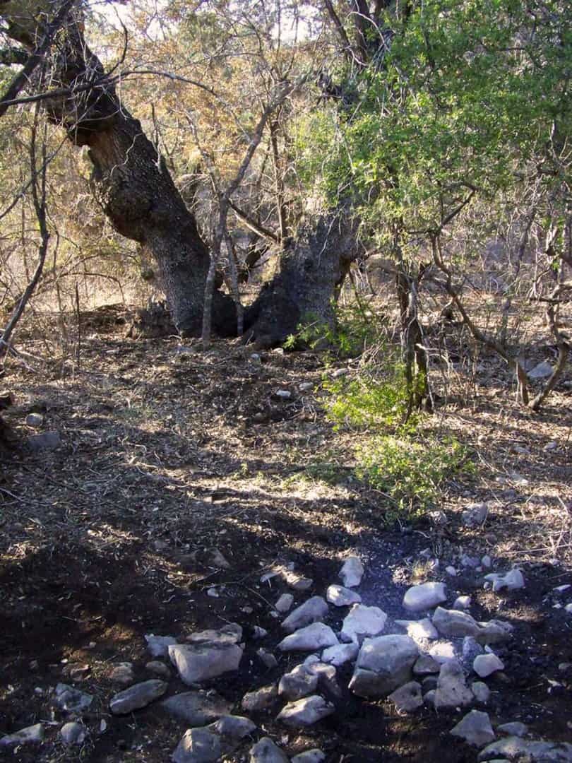
Not all of the rock mounds were in excellent shape, however. This scatter of stones (whitened by the limestone dust thrown up by my rock drill) is what remained of a mound built in 1854 to mark one original land grant corner:
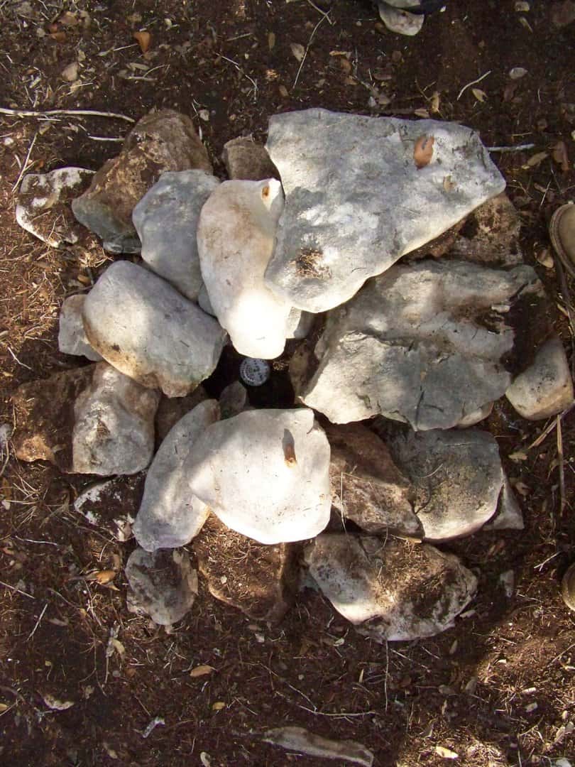
While ordinarily I think it's bad practice to rebuild old rock mounds (sometimes the state of the scattered mound provides good clues as to its age), in this case the corner could be reestablished very well from the twin Live Oak bearing trees seen in the background above, both bearing the scar of their original marks on their bark. So there wasn't any question as to the location and identity of the corner and I set a new rod and cap to mark it and left it looking like this:
Wow!
Apart from allowing for the variation that the early surveyors used, at least two significant problems remain in just getting close to where corners were made. The first is the chaining factor to be applied to the distances they reported measuring. In the case of the 1847 surveyor's work, the chaining was in error by fairly consistent factors. For example, compare the record lengths (in Texas varas, 36 vrs. = 100 ft.) of these lines to the actual lengths as found on the ground from original evidence of the 1847 survey:
Rec. Actual
1582 1590.49 vrs.
1582 1589.27 vrs.
2283 2298.18 vrs.
4566 4594.57 vrs.
1582 1608.51 vrs.
1582 1581.03 vrs.
2283 2294.73 vrs.
The other important problem is trying to figure out which lines were actually run and which appear to have been either protracted or left as open sides of an unclosed figure.
Don't hurt yourself patting your back like that.
Well, there are licensees who very seldom deal with retracing 19th-century surveys and have very little idea what is involved. I'm sharing a glimpse of that which doesn't require climbing fences and crawling through the cedar brake to get there. You're welcome.
BTW in mentioning chaining factors, it's worth pointing out that not all of the original 19th-century surveys had markedly inaccurate chaining. As an example, here is another corner by the same surveyor whose mound with twin Live Oak bearing trees appears above, made on this date in 1854. He reported a distance of 660 varas between the two mounds. Here is what remained of that other one as I found it:
Yes, that's about a 4 ft. diameter scatter of rocks, so I set a rod and cap monument to mark the corner. I suppose if you want to get all technical about this, when you fly your drone in to locate this one, be sure to locate the punchmark on the aluminum cap.
This oblique view shows the relation of the corner as marked to the scatter rocks from the mound. Basically, I just examined the arrangement of the rocks to identify what I thought were most likely rocks remaining pretty much as originally placed from which the center of the original cluster could be deduced. Where there are no identifiable remains of a bearing tree, it's about the best one can do. Oh, the Rod and Cap is a distance of 660.41 varas from the corner that the 1854 surveyor reported as 660 varas distant.
Kent McMillan, post: 366887, member: 3 wrote: You're welcome.
For what? I've thanked you for nothing but simply noted your need to explain, for no particular reason, just how good you are.
Kris Morgan, post: 366910, member: 29 wrote: For what? I've thanked you for nothing but simply noted your need to explain, for no particular reason, just how good you are.
I'll post some photos of fence posts later if that will be more familiar. This is a different sort of problem.
Kent McMillan, post: 366917, member: 3 wrote: This is a different sort of problem.
Yes I agree. Your particular flavor of narcissism and sociopathic tendencies are a different sort of problem than most are used to dealing with. That being said, admitting you have a problem is the first step to recover. Bravo.
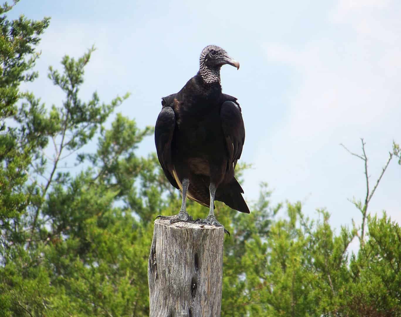
I think you must have some other thread in mind. This one is about some aspects of retracing 19th-century compass surveys in Central Texas. If the subject bothers you, you might consider some deeply philosophical question such as whether the object below would be described as a fence post with a bird SETTING on it or FOUND on it:
Oh, for the record, the positions of the corners made by the 1854 surveyor are actually about 430 ft. distant from where they appear in the Texas GLO GIS. The GIS is useful in a very general way, but isn't all that sporty for spatial accuracy across much of Texas. I'm not saying that a drone couldn't have found these corners, though, given enough time (and maybe a crew to clear a flight path for it though the cedar brake).
Part of the art of retracing the original 19th century Central Texas land grants run with compass and chain is both recognizing what the old marks look like and figuring out what was actually done to locate the particular piece of the jigsaw puzzle pattern of land grants in which it falls. This is what in 1852 was described as a "stone mound" that was S45å¡W, 1900 vrs. from a "corner made for the Northwest corner of [a certain survey that had been originally made in 1838]". There were no calls for bearing trees given by the 1852 surveyor. The "corner made" bit is essentially a statement that the surveyor did not find a mark in place, but decided to make one according to his theory of where it was or ought to be.
Typically, rock mounds that get buried under tree litter are a problem. A probe, a trowel, and a whisk broom are the tools of choice to see what really lies under the century of mulch.
So, how did the 1852 surveyor decide where to make "a corner" of that 1838 survey? The nearest corner of that survey was nominally 1.43 miles away through cedar forest interspersed with sparse live oaks. The most probable explanation turns out to be that the 1852 surveyor actually began at the Southwest corner of the 1838 grant and chained off the record distance, generally following the line of the senior survey as marked in timber at wide intervals. I found that Southwest corner remained marked today and no reason to think it had not also been in 1852 given the history of later surveys.
Even more likely, the 1852 surveyor arrived to lay out a survey that was tied to the Northwest corner of the senior survey and ran for 1900 varas along the common line. Given that the record length of that side of the senior survey as run in 1838 was 2717 varas, that would mean that if the 1852 surveyor began not at the Northwest corner, but the Southwest corner of the 1838 grant, he would have chained off 817 varas to reach a point that he would expect would be 1900 varas from the Northwest corner.
So, how did the 1852 surveyor do in laying out his theory based upon the record of prior surveys?
[xtable=skin1]
{tbody}
{tr}
{td}1852{/td}
{td} 1838{/td}
{td} Chaining Factor{/td}
{/tr}
{tr}
{td} 813.99 vrs{/td}
{td} 2717-1900=817 vrs{/td}
{td}1.00369{/td}
{/tr}
{tr}
{td}1890.39 vrs{/td}
{td}1900 vrs{/td}
{td}1.00508{/td}
{/tr}
{/tbody}
[/xtable]
In other words, not too bad. More importantly, the chaining errors were fairly consistent.
The obvious question is: "If the 1852 survey really commenced at another corner and chained distance from it along a line marked at intervals in the few hardwood trees to locate what he considered to be the Northwest corner of the 1838 land grant, why didn't he write the field notes in that way?" It's a good question. The most likely explanation is that the application for the survey (the writing that requested him to locate a certain land certificate in the position that he did) tied the position of the survey to the Northwest corner of the senior grant and the field notes as filed followed the language of the application by beginning at that same corner as described in the application.
That particular survey was in Travis Land District and many of the land district records exist in the archives of Travis County. So, it may be possible to examine the original application under which the 1852 survey was made.
