AI Assistant
Notifications
Clear all

Oahu Survey Markers

4 Posts
4 Users
0 Reactions
311 Views
j-penry
(@j-penry)
Posts: 1396
Member
Topic starter
Translate
English
Spanish
French
German
Italian
Portuguese
Russian
Chinese
Japanese
Korean
Arabic
Hindi
Dutch
Polish
Turkish
Vietnamese
Thai
Swedish
Danish
Finnish
Norwegian
Czech
Hungarian
Romanian
Greek
Hebrew
Indonesian
Malay
Ukrainian
Bulgarian
Croatian
Slovak
Slovenian
Serbian
Lithuanian
Latvian
Estonian
 

I'm headed to the island of Oahu, Hawaii in a few months. Are there any really old survey markers there? I have seen some C&GS stations in the NGS database from the 1920's, but I want to find something really old. I think the island of Hawaii has the early USGS markers. How are are the islands surveyed for property boundaries?


Posted : August 3, 2012 6:47 pm
dave-karoly
(@dave-karoly)
Posts: 11990
Member
Translate
English
Spanish
French
German
Italian
Portuguese
Russian
Chinese
Japanese
Korean
Arabic
Hindi
Dutch
Polish
Turkish
Vietnamese
Thai
Swedish
Danish
Finnish
Norwegian
Czech
Hungarian
Romanian
Greek
Hebrew
Indonesian
Malay
Ukrainian
Bulgarian
Croatian
Slovak
Slovenian
Serbian
Lithuanian
Latvian
Estonian
 

This is at the top of Diamond Head:
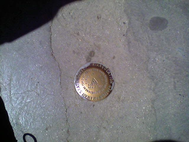

 
Posted : August 3, 2012 7:05 pm
Rich Surveyor
(@rich-surveyor)
Posts: 13
Member
Translate
English
Spanish
French
German
Italian
Portuguese
Russian
Chinese
Japanese
Korean
Arabic
Hindi
Dutch
Polish
Turkish
Vietnamese
Thai
Swedish
Danish
Finnish
Norwegian
Czech
Hungarian
Romanian
Greek
Hebrew
Indonesian
Malay
Ukrainian
Bulgarian
Croatian
Slovak
Slovenian
Serbian
Lithuanian
Latvian
Estonian
 

Hello
The ancient land system in Hawaii was similar the feudal system of Europe during the Middle Ages. Those ancient subdivisions of land remain today. Land was first placed into private ownership in 1848 by a document called the Mahele (division) Book. In 1871 the initial steps were made to create an accurate triangulation survey of the islands. If I remember correctly, the survey was completed in the1930’s. To this day all subdivision maps and lot descriptions reference the north (or south) and east (or west) distances to these trig stations. Many of them are now NGS monuments so you can find them in the data base. The oldest I have been to trace their history to the late 1800’s, but have been remonumented at least three times.
Hope you enjoy your stay
Aloha Rich


Posted : August 4, 2012 12:43 am
Keith
(@keith)
Posts: 2049
Member
Translate
English
Spanish
French
German
Italian
Portuguese
Russian
Chinese
Japanese
Korean
Arabic
Hindi
Dutch
Polish
Turkish
Vietnamese
Thai
Swedish
Danish
Finnish
Norwegian
Czech
Hungarian
Romanian
Greek
Hebrew
Indonesian
Malay
Ukrainian
Bulgarian
Croatian
Slovak
Slovenian
Serbian
Lithuanian
Latvian
Estonian
 

We are going there in February on a cruise, out of San Diego.

Keith


Posted : August 4, 2012 10:10 am