I am studying to take the Kansas State Specific exam and have a question on a question that I am drawing a blank on. Given the coordinates of the NE, NW, SE, and SW section corners, how is the centerline bearing calculated? Is it an average of the bearings between the SE and NE and the SW and NW corners? Thanks in advance
R Conrad, post: 395060, member: 12192 wrote: I am studying to take the Kansas State Specific exam and have a question on a question that I am drawing a blank on. Given the coordinates of the NE, NW, SE, and SW section corners, how is the centerline bearing calculated? Is it an average of the bearings between the SE and NE and the SW and NW corners? Thanks in advance
Based on the parameters you provided (and, accordingly) that they are not addressing the Quarter-Corners. I would think the only way to do it would be to determine the N-1/4 and the S -1/4 and inverse between (which would probably be the same answer you get with bearings.
I'm not positive I know the question that clearly though, and don't take my word as gospel
The problem with such questions is that they have no relevance in the real world.
R Conrad, post: 395060, member: 12192 wrote: I am studying to take the Kansas State Specific exam and have a question on a question that I am drawing a blank on. Given the coordinates of the NE, NW, SE, and SW section corners, how is the centerline bearing calculated? Is it an average of the bearings between the SE and NE and the SW and NW corners? Thanks in advance
Yeah, without establishing the quarter corners first, maybe you go back to the rule they should be parallel with the easterly line? Maybe Kansas has a specific rule for the situation. But the answer should be as Tom mentioned.
The instructions differed over time. Pre-Civil War and after. Many early north-south center lines were established parallel to the east line.
For test purposes, it depends on which Section and when. In the real world it depends on where you find the 1/4 Coners..
Tom Adams, post: 395065, member: 7285 wrote: Based on the parameters you provided (and, accordingly) that they are not addressing the Quarter-Corners. I would think the only way to do it would be to determine the N-1/4 and the S -1/4 and inverse between (which would probably be the same answer you get with bearings.
I'm not positive I know the question that clearly though, and don't take my word as gospel
The N and S 1/4s are definitely unknown. If I remember the question correctly it was Section 6. Thanks for the help.
R Conrad, post: 395182, member: 12192 wrote: The N and S 1/4s are definitely unknown. If I remember the question correctly it was Section 6. Thanks for the help.
Section 6.....different scenario. It would be a proportional difference. Same solution probably, but makes sure and proportion in the corners. The bearing should be parallel to the East line. You are proportioning in 40 chains on the east, and the measure remainder on the west, since all of the error goes to the north and east tiers on Section 6.
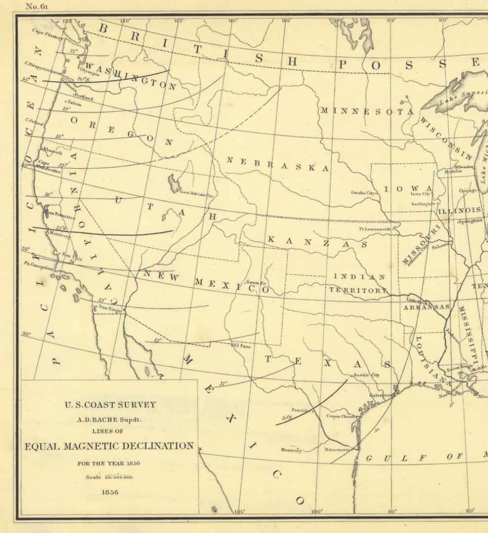
Part of the problem with Kansas surveying may well be that there has been a long-standing confusion about things as fundamental as how to spell the state name as well as whether compasses would work there, as the absence of isogonic lines in the magnetic declination chart reflects (the same would apply to Colorado, of course):
Named for the Kanza Indians.
Holy Cow, post: 395204, member: 50 wrote: Named for the Kanza Indians.
Our resident ruminant speaks the truth. But for some reason we yellow-eyes refer to their tribe as the Kaw. In their native tongue they are called 'people of the prairie' (or wind). And for an exciting "ace-in-the-hole" trivia question (in case you're actually ever in Kansas and get stuck in a trivia game) is how Topeka, KS got its name.
From the native Kaw phrase "TÌ? PpÌ? KèÛÌ©"....meaning "a good place to grow potatoes". Which means they were just as impressed with the area as everybody else....;)
R Conrad, post: 395182, member: 12192 wrote: The N and S 1/4s are definitely unknown. If I remember the question correctly it was Section 6. Thanks for the help.
Ahh, the old trick question (otherwise known as: how deep is your knowledge?). If I recall, it is parallel with the east line in that section (but might be due north); as opposed to normal practice of connecting 1/4's (notwithstanding varying practice as the holy cow mentioned). The westerly line should have no bearing on the solution (pun intended). My suggestion, review general practices for northerly and westerly sections in the PLSS.
There are a lot of oddities when it comes to surveying in Kansas. They have something they call "permanent surveys." Essentially they had the idea that most of the GLO surveys were fraudulent and landowners could petition to have in some cases entire townships re-surveyed. All of the landowners would have to sign a document allowing the county surveyor to proceed with the survey. Sometimes these were done using similar methods of the GLO but sometimes the county surveyors were much more creative and the results were quite odd. In order to retrace those surveys you have to find the county surveyors plat and notes to determine the method the county surveyor used so that you can determine the best method to reestablish any lost corner positions.
No doubt! My point is to make sure you get the right records. You shouldn't use GLO records or methods to reestablish lost corners in a township that has a "permanent survey." I worked in one township that the county surveyor began his survey at the SW corner of Section 36 and measured all the way to the NW corner of Section 1 and then divided the total by 6 to establish the Section corners. He then went to the SW of 35 and began the process again until he had resurveyed the entire township. He apparently accepted the township exterior. You would not want to reestablish any of the interior Section corners by Double Proportion but by Single Proportion using the nearest accepted monuments north and south of the lost section corner.
[USER=12192]@R Conrad[/USER] Did you take the test yesterday?


