
Activity Feed › Discussion Forums › GNSS & Geodesy › What is a “ground” measurement?

Sooner or later surveyors will have to gain the understanding of the 3d and 4d concepts
I once heard a licensed surveyor at a 3d training session say, “We’re land surveyors, we don’t give a _blank_ about elevations.” Continuing education is a requirement for a reason. Honestly, a person can learn quite a bit hanging around this forum. Some of it’s even useful.
I had this old-time surveyor tell my partner that he didn’t care about those 1/4 corners; “They don’t mean anything”.
He eventually passed and I was chatting with a young local surveyor from the old-timers area; “You remember old Joe, he didn’t believe in 1/4 corners”.

Excellent discussion and description of the problem. The attached text, pages 5-9, discusses it well with examples. State of the art in 1915; not sure what the old-timers referenced above studied.

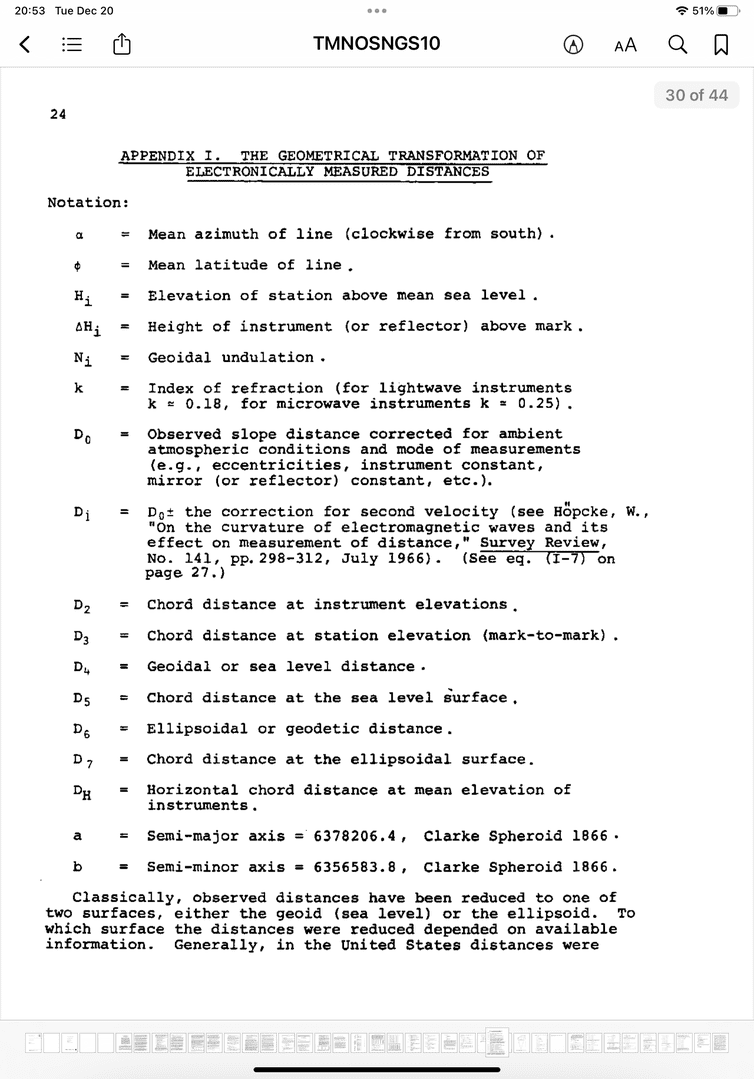
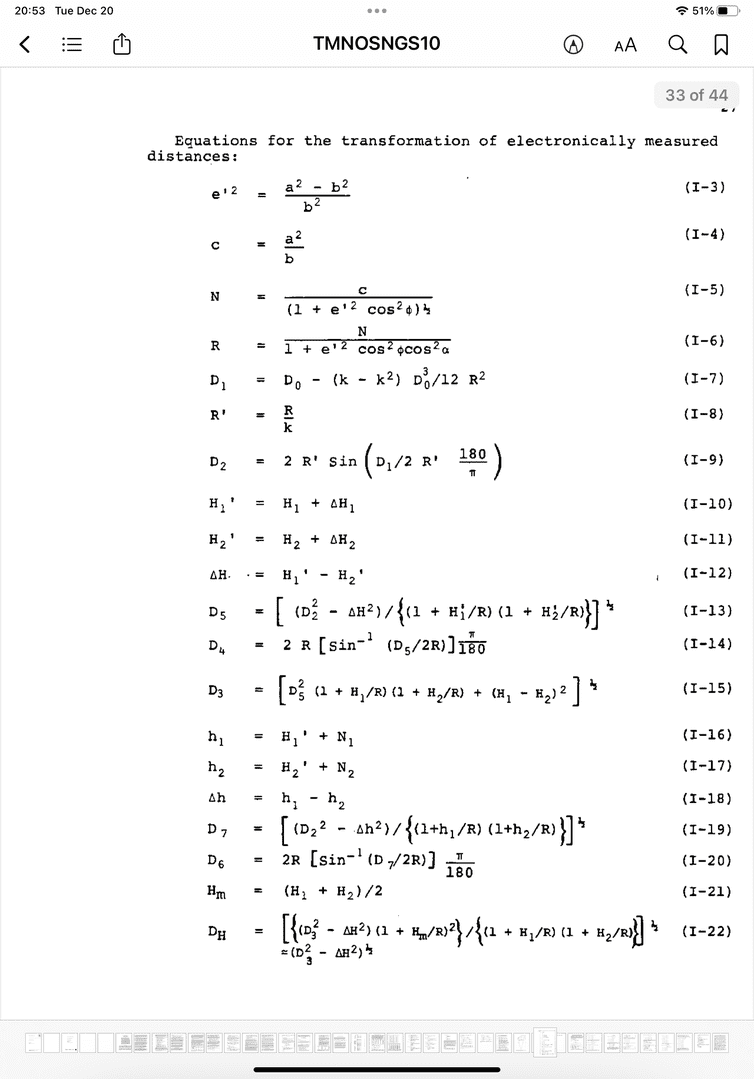
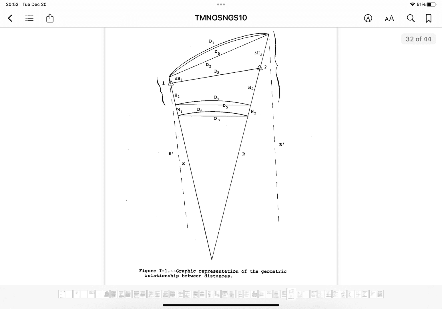
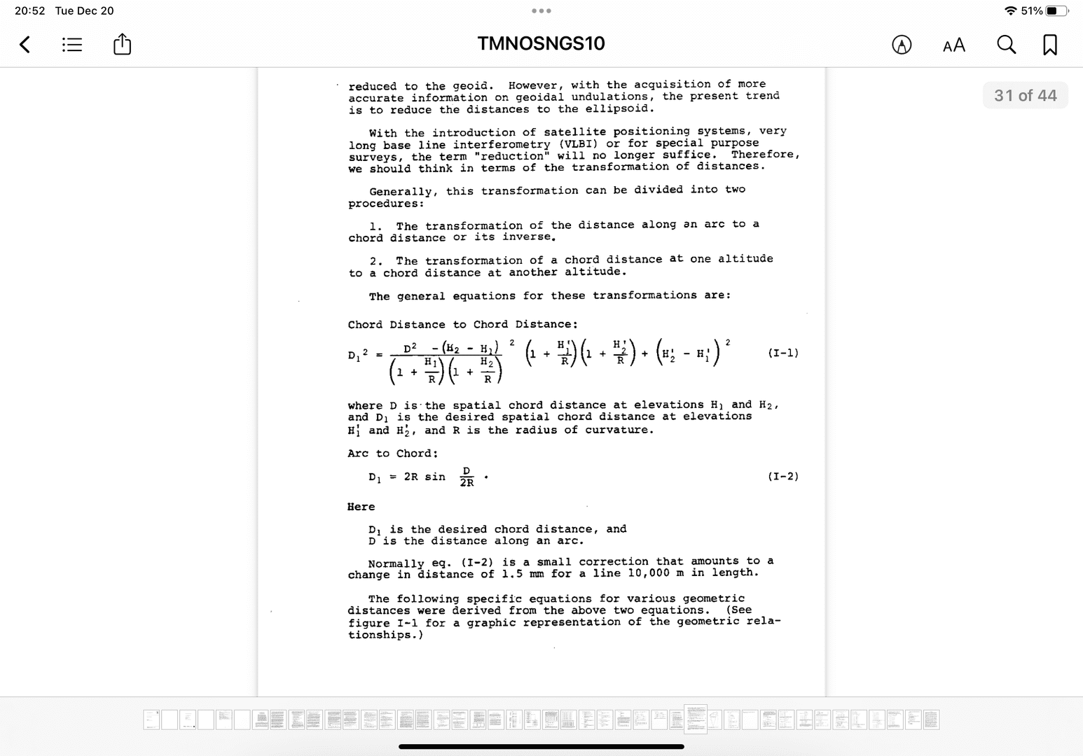
The images above are taken from an NOAA TM NOS NGS – 10 ??Use of Calibration Base Lines? by C. Fronczek.

I should have been a flat earth person then also never believed in gravity either and all of this would be simple.
But I still have other issues to figure out like as i get older why some things swell and others shrink and its all the wrong parts ????. Is any math equation able to fix this.
Love surveying love learning. Great place here for sure to be challenged and challenge others. That is what learning is all about.

@mightymoe Which is why I like surveying on the coast…differences of elevation of maybe 100′ with distances between two points about 300′
@rover83 finally someone gets it. Lol. Look you need to line up and join up for geodesist position. We need folks with your ability in that group. Ask not what your country can do for you but what you can do for your country. You probably have the skills and talent needed to join up.
Suppose the earth is a sphere radius of 3959 miles at sea level. Surveyors A and B both calculate its circumference, but surveyor B, an uplander, uses a radius that is 1,000 feet longer than the actual 3959 miles.
What is surveyor B’s precision?

B gets a circumference that is 6283.2 ft longer than A does, which is 1 part in 20,900 or 48 ppm longer than A.
I’m not sure how you are defining precision here. If that’s 3959.0000… then B can calculate to any precision he wants, but his accuracy is limited (if A is taken as correct). If that’s 3959 +/- 0.5 mile, then the precision is 1 part in 7918 or 126 ppm.
.
What is surveyor B’s precision?
surveyor B, an uplander,
Well, it depends…
a) B is not a “flatlander”, so there’s a strike.
b) B might still be a “troll”, but not a “flatlander”, so there’s another strike.
c) B might be a “Yooper”, so B’s precision depends on the ratio of: how many Busch Light/Old Milwaukee B has had, how hard B laughs every time he says “pp-em”, and what is the wind chill with respect to the depth of snow in the last 24 hours.
Answer: c
LOL!


Log in to reply.