
Activity Feed › Discussion Forums › Education & Training › Survey USA March 19 2011
Survey USA March 19 2011
Posted by foggyidea on January 26, 2011 at 1:20 pmI have volunteered to be the State Coordinator for MA.
I am interested in hearing from other State Coord’s or anyone with some ideas about promoting the Survey USA. I have read the NSPS materials and have some ideas myself, such as outdoor demonstrations of equipment and promoting the TrigStar program.
Mostly I see this as a press release effort in order to make surveyors available to the general public…..
Any ideas, comments???
Don
Noodles replied 13 years, 3 months ago 10 Members · 11 Replies- 11 Replies

Baton Rouge — January 21, 2011 — The Louisiana Society of Professional Surveyors announced that on Saturday, March 19, 2011 surveyors across the state will be hosting the National Society of Professional Surveyors Surveying USA event throughout Louisiana to kick off National Surveyor’s Week which starts on Sunday, March 20, 2011. Advanced Global Positioning System (GPS) equipment will be in use collecting data at sites throughout the state. In addition, surveyors across the entire nation will be joining in simultaneously. The goal of NSPS Surveying USA is to give the public an opportunity to observe local surveyors in action and to learn more about one of the world’s most ancient professions. Surveyors answer questions about the event and to discuss the role of the surveyor in the community. Anyone with a GPS unit (hand-held or otherwise) is welcome to join in the fun.
That’s directly from the Louisiana Land Surveyors website.
I like the idea of showing others what we do but I think that it could much farther reaching impact if it was concentrated on what we need, and specifically preserving many of the very useful marks that have not been included in the latest adjustments. Many of these are vertical marks with only a scaled lat/long.
I think thousands of occupations on these that day could let the NGS see a better picture on the geoid and their current calculations. We know that the NGS will likely never again mount a ground campaign. This would be our chance to do the grunt work for them.

i am going to occupy a station that we set. it is our goal to enter this occupation into opus db. i also heard rumor that ngs might use the data for densifying the future geoid model(s)

> I like the idea of showing others what we do but I think that it could much farther reaching impact if it was concentrated on what we need, and specifically preserving many of the very useful marks that have not been included in the latest adjustments. Many of these are vertical marks with only a scaled lat/long.
Looks like this is where I’ll be:
Survey America – On Saturday March 19th, join together with the MDLPP (Mason Dixon Line Preservation Partnership) and other across the country as a part of “Survey America” our objective will be to simultaneously occupy as many of the Mason and Dixon Milestones as possible. If you have access to a GPS unit, or multiple units, consider joining us on the line. We will be concentrating on the western end of the line, west of Hancock, MD.

I must be missing something… What is the goal of this project? People seem to be thinking that NGS is going to use the resultant data to “strengthen the geoid,” but if the observations are not performed to NGS specs I don’t think this will be the case. It seems to me that this project is to increase public awareness. Can anyone enlighten us?

Survey USA March 19 2011>Jim
I am going to use it for both purposes.
I hope to have surveyors statewide submit their data (or I will as coordinator) to the OPUS data base in order to intensify our network of points.
I hope to also make surveyors available to the general public for a fouer hour period on the Saturday prior to National Surveyors Week.
I also think that this can be a personal marketing opportunity for those firms that participate.
I think that the primary goal is Public Awareness…..
If you follow the specs for OPUS-DB. Minimum session length, take the pictures and such then it will get included in the national database. I have many of them.
I think I was an early adopter of OPUS-DB and my data generated some internal discussion on the value of the program. I submitted not only one OPUS-DB on a point but often 6 or 7 sessions. This gave them some statistics to look at the overall value of OPUS-DB.
OPUS-DB is the way that we can help maintain the system.
It’s a good thing and a valuable thing. Especially putting in marks that historically were not included at all in the adjustments. Some could be verticals with scaled lat/longs and some could be important land corners. Doesn’t really matter. Each fits a spot on the earth and using OPUS then these are as good as they get spatially wise.
I’m not big on the overall impact of public awareness but if it has impact in areas then that is a plus. I just would like to see it improve the overall framework of our cadastral network.
The NGS may not say but they certainly do look at all these OPUS-DB sheets. Trust me on that.

This came up at THe NYSAPLS Directors’ Meeting last week. It seems to be a promotional event, with a possible listing in the Guinees Book of World Records.
I have found a copy of the directions we discussed on the Texas society site, copied and pasted below for your information. It would seem the more regional and state society involvement, the better this will be.
KS
The National Society of Professional Surveyors (NSPS) has developed a program called Surveying USA to commemorate National Surveyors Week.
NSPS Surveying USA will be a one day simultaneous nationwide GPS observance of as many monuments as people can populate. Land surveyors are encouraged to take part, as well as non-surveyors utilizing hand-held GPS units. Early plans are for all states to be up and observing Saturday, March 19, 2011 at 11 a.m. Here’s more info on the program from Debi Anderson, NSPS Governor – Montana:
1) All states should be set up and start observing Saturday, March 19, 2011 at 11 a.m. Montana Time
2) Occupy ANY point you want or set one yourself. Remember, this is mostly for recognition of NSPS and Land Surveyors. It can be your states initial point, a historical monument, a flag pole in a school yard… etc. etc. etc. If you are observing a point for NGS or Height Modernization there will be specific directions forthcoming.
3) Occupy for a minimum of 1/2 hour (more is always better if you want to be noticed)
4) After your time is up send Lat/Longs (in degrees, minutes, seconds) along with description of point occupied and name of person observing to your state coordinator (or governor or me)Again, if you are observing points for Height Mod or something like that the requirements will be different.
Mostly, HAVE FUN and tell people who you are and that you are doing this nationwide in recognition of NSPS, National Surveyor’s Week, and surveyors.
I hope this helps… send this out to your state societies and chapters so that they will know what to expect.
11 a.m. (Montana Time, MDT) Saturday, March 19, 2011
Point Description
Observer
Lat/LongsDaylight Saving Time begins at 2 a.m. on March 13
10am PDT = 11am MDT = Noon CDT = 1pm EDT = 5pm GMTThanks everyone… this is going to be great and I continue to get calls and emails of people who want to participate.
All my best,
Debi Anderson
NSPS Governor Montana
Why did they have to pick they have to the day after my birthday (which is on a Friday night, no less) to have this thing… I’m saying conspiracy theory RIGHT NOW!!
We will be discussing this at our local meeting first part of Feb.
This is what our local NGS rep told us.
Calling all Surveyors with geodetic grade receivers…The National Society of Professional Surveyors (NSPS) has developed a program called Surveying the USA to commemorate National Surveyors Week. Please forward this email to other interested Surveyors.
More information on the survey from the NSPS webpage:
http://www.nspsmo.org/index.cfm?fuseaction=Page.viewPage&pageId=851
The checklist for Sending the GPS files into OPUS-Database are here:
http://www.nspsmo.org/_data/global/images/NSPS/observer%20checklist%20for%20OPUS.pdf
**************
THE SURVEY – Begin GPS observation on March 19th, 2011 at 10am pacific time. The following documents will help you plan your survey. The survey basically involves finding a benchmark accessible with GPS equipment, setting on it, and logging at least 4 hours of data, then sending that data into OPUS-DB for publishing. Spacing the observations on benchmarks about 10 miles apart would be most helpful. Also benchmarks located in hilly or mountainous terrain is desired. Repeat observations on the same benchmark by a different individuals is also desired. Each observer is responsible for publishing their own data into OPUS-Database following the simple details below.
**************
SEE THE ATTACHED WORD DOCUMENT DESCRIBING HOW TO USE OPUS-DATABASE FOR PUBLISHING OBSERVATIONS AND ONE METHOD FOR RESEARCHING BENCHMARKS IN YOUR COUNTY USING GOOGLE EARTH. THIS DOCUMENT ALSO DESCRIBES THE PROCEDURES AND THEY CAN BE FOUND AS WELL ON THE NGS OPUS WEBPAGE:It is recommended but not required that surveyors in Oregon set up on bench marks of record in the NGS database which can be searched for by County here:
http://www.ngs.noaa.gov/cgi-bin/ds_county.prl
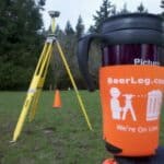
Have fun and don’t forget to charge the batteries!
NGS Oregon Advisor

PA Surveyors
Any surveyors in PA that are interested in joining in can contact me at the email address or phone number below.
Alan Chyko
State Coordinator
[email protected]
570-455-2999 (Office)
> Why did they have to pick they have to the day after my birthday (which is on a Friday night, no less) to have this thing… I’m saying conspiracy theory RIGHT NOW!!
Now I know when your birthday is!! Expect a Beerleg greeting!! 😛 😉
Admins Wife
Log in to reply.