
Activity Feed › Discussion Forums › Software, CAD & Mapping › Starnet 3D adjustment Advice

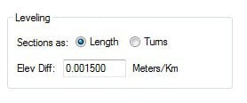
I have software that I wrote that converts Leica, Trimble, and topcon digital level formats into both a field book output and also least squares input files (both geolab and starnet). I weight by distance, although it is just as easy to weight by number of turns. In geolab I have to convert the distance into a weight by multiplying the distance by a factor that depends on what rod, what level, procedures, etc. In star*net the “factor” is assigned in the project options.
 Posted by: John Hamilton
I am a longtime (since 1986) Geolab user and a more recent star*net user, which I mainly use for elevation only adjustments (leveling projects), although I do sometimes use it for total station adjustments, but rarely for GPS. Many of the networks are simply too large in area for Star*Net to work properly. I have a project starting next week that has 600+ ground control points in an area of 14,500 square miles, and I did a project already this year that was about the same number of points over 46,000 sq miles. Geolab handles projects of this size and larger, no limit since it is doing the computations in an ECEF system.
I too discovered that you apparently cannot put elevation observations into a 3d star*net adjustment UNLESS all of the points have some type of horizontal observations as well. There may be a way to do it, but I have not yet found it. Seems very limiting.
Geolab, on the other hand, will take any mixture of H and V observations and perform an adjustment. I can have vertical only stations mixed with horizontal only and 3D stations. What geolab does is that it “fixes” the horizontal coordinates of the vertical only stations. I have done many combined leveling, total station, and GPS adjustments in Geolab with excellent results.
A related question…I only include in a leveling adjustment the points for which I want adjusted elevations, but not the turning points in between. I have seen that others include every single turn in the adjustment, which seems like a wasted effort to me.
Yes, this is the advice I was looking for with regards to the Starnet Adjustment.
With regards to the levelling. It is just recorded automatically by the digital level and subsequently process. I do not know of any instrument that can select the point as turning point and so called ‘ignore’ them.

Log in to reply.