
Activity Feed › Discussion Forums › GNSS & Geodesy › Optimal pole height for GNSS

Some readily available papers dealing with the issue of multipath and antenna height:
https://kb.unavco.org/assets/186/tblmtn.pdf
https://www.hindawi.com/journals/ijap/2017/1957572/#sec6
Of course, these studies were undertaken in open, non-obstructed sites. The UNAVCO site paper shows their near-surface mount.
I recollect visiting a number of near-surface antennas where people and vehicles seems to pass by and linger without much awareness of what they were doing.
As this photo shows (bottom of two), there are lots of problems with antenna installation and operation:
https://geodesy.noaa.gov/cgi-cors/corsage_2.prl?site=GODE

No need to clarify for me, I am well aware of exactly how the TCT was done and when, I used to try and tie in to those stations when I could (before HARN and CORS) as they were nominally more accurate than the triangulation stations around them.
https://celebrating200years.noaa.gov/magazine/tct/welcome.html#high
I wanted to do an experiment where me or someone else would occupy a few widely spaced TCT stations on the line that ran across the US on roughly the 39th parallel, and then do an adjustment of the TCT observations in the NSRS IDB between them to see if they really were 1 ppm. But, when I tried to get the data from the NSRS (I used to have telnet access), I was unable to get any vertical data (vertical angles). Only mark-to-mark distances, horizontal angles, astro azimuths, and astro positions. Without the vertical data I was unable to do a 3D adjustment, which is necessary when dealing with mark-to-mark distances.
This was probably 20 years ago, perhaps the vertical angle data is more readily available now.
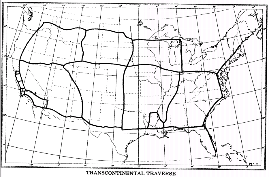
I occupied a few of the TCT stations in SW PA in the late 80’s for control on a bluebook project. But, that project is not even adjusted in the latest 2007 and 2011 adjustments because it was only tied to triangulation/traverse and no CORS or HARN. And it was single frequency only.
I knew you knew that GPS was not used.
Glad the 200th anniversary site you link is still available. Lots of good graphics.
Given the decades since I even looked at traditional geodetic data obtained using theodolites, EDM, etc. I cannot provide any real help. Maybe a real old time (Dave Doyle?) might answer.
I did notice the NGS site still includes the 1984! MTEN manual. It shows an example of an Abstract of Zenith Distances I copy here:
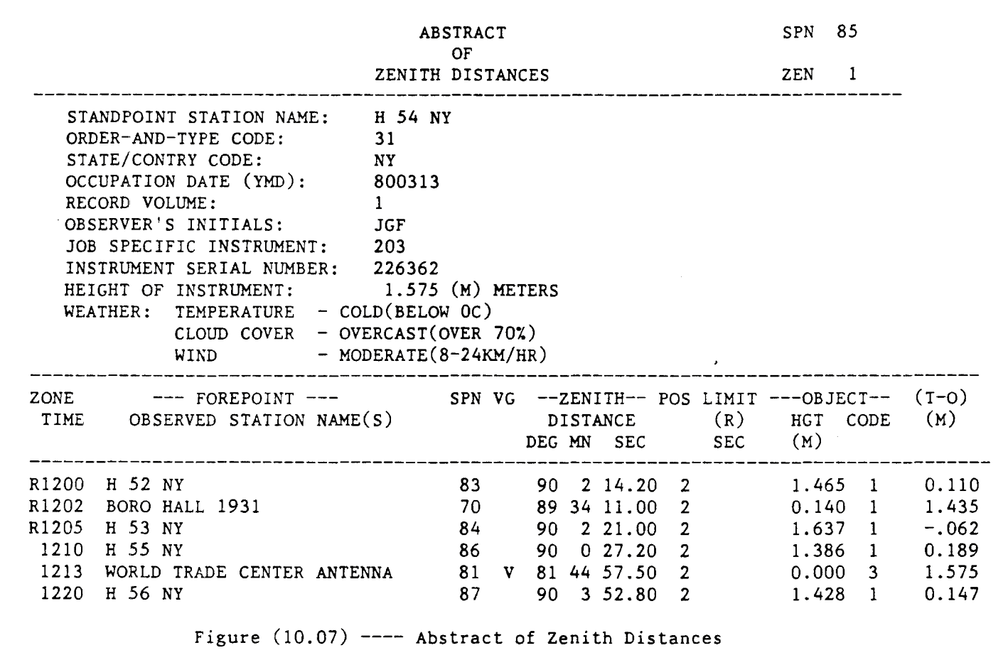
I assume these observations were included in the project blue book observation file. I do not know whether these records are available. Perhaps you should contact your NGS regional advisor?
HTH,
DMM

@cerolli Now that is thinking. Here not a big issue but a solo operator that does some rural boundary surveys was having issues because corn was so tall. I said get a taller rod. He said they only make a 2m rod for gps. I said just think a bit and it clicked i can use any rod. I once had the Trimble 4800 on a level rod to shoot centerline of a creek. We had it so high we had to get a special data collector cable made. For the TSC1. Back then and do some long cables for external batteries. Because the battery was part of the pole for that thing was a crazy contraption but it saved us traversing a mile.

Necessity is the mother of invention, for sure.


Log in to reply.