A few years ago, I was afraid that some of the "art" of surveying would be lost to new technical developments. I was concerned that there wouldn't be much required skill in operating a GPS receiver. It's pretty binary - fix or float, and there doesn't seem to be much a user can do to affect that. It's not like operating an optical instrument which seems to have a more synergistic exchange between machine and man. With optical equipment, you absolutely cannot ignore the significance of the quality of the instrument, but you also cannot discount the importance of a skilled operator behind it. Which is more important? Debatable.
But with GNSS, and RTK in particular, many have come to understand that the magic black box provides a position. Most of the time, it's a good position, sometimes it is not, but because it's magic in a black box, the user is separated from the result.
In some places this new era is acceptable. In open environments, procedures don't matter very much. Observation duration and age of the fix can be ignored and the magic black box can provide reliable positions.
Once the user presses the GNSS receivers into more hostile environments - under trees, near buildings, etc., good results are not a product of magic but of synergy. Is a good receiver more important than a knowledgeable operator or vice versa? Debatable. What could be said though is that the results will only be as good as the weakest link, whether that weak link is the receiver or the operator.
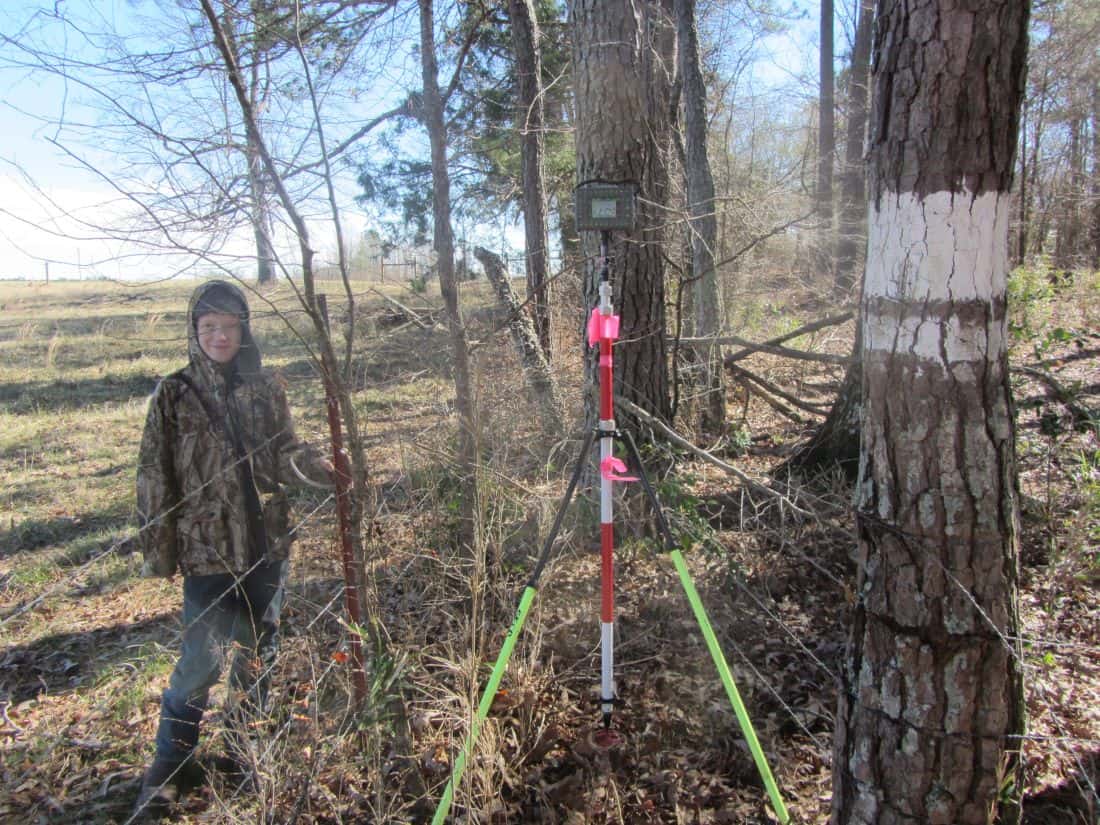
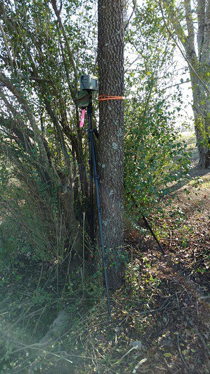
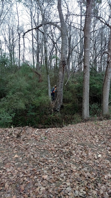
I've been using RTK under some incredibly dense canopy.
[USER=640]@John Hamilton[/USER] mentions in another thread that the fix (or convergence, I suppose, for an R-10) for a point under canopy dissipated after less than a minute. This is a good sign that the fix is bad. As the satellites move in their orbits and the multipath changes, it becomes less possible for a receiver to maintain a bad fix as the distance-distance intersections no longer intersect where they once did. This actually works to the operator's benefit as a long lasting fix can be evidence of a likely good fix. Even better is repeating the fix after a few minutes. I cannot speak to all receivers, but my own experience with my own receivers suggests that a bad fix cannot be repeated after 180 seconds. This means that if I have two fixes separated in time by 180 seconds that the fix is likely good. You mileage may (will) vary depending on the receiver being used.
What doesn't work is a 10 second observation from a single fix. In the open, such procedures may produce acceptable results. In the woods, a different approach must be taken. Post-processing base-rover vectors and comparing the results to real-time results is also very useful. Often the RTK processors will evaluate data differently from the engine in the post-processing software. When the two agree, the likelihood that the results are good increases dramatically.
If I were to sum it up, I'd say that there is as much need for the "art" of fieldwork when working with RTK as there ever was with an optical instrument, even if it is in an entirely different way. The profession will increasingly require professionals that understand how to deploy RTK in places previously thought impossible. Demands on quality will require the results to be good while market competition will require that surveys are completed more efficiently. Professionals that can deliver both quality and speed will, in my opinion, be in the best position for the future.
Shawn Billings, post: 413886, member: 6521 wrote: I cannot speak to all receivers, but my own experience with my own receivers suggests that a bad fix cannot be repeated after 180 seconds.
Trimble apparently agrees; their defaults for an Observed Control Point are 180 seconds and 180 epochs. As I understand it, the position converges for the entire three minutes, while the 180 measurements must each be within your defined tolerances (I stay with the defaults). In difficult canopy, it can be hard if not impossible to meet these criteria.
In truly difficult canopy 180 seconds may just be the start, I consider it to be a minimum because I have not seen a bad fix repeat itself after 180 seconds, but it isn't uncommon for me to stay for 4-8 minutes in thick canopy and occasionally longer. The extra time is required to meet my standards for number of independent fixes that are in agreement. If the receiver cannot acquire the number of fixes I require in 180 seconds, then I wait until it does.
Some might question at that point, "Why not a total station?" When one considers the time spent creating a control pair, setting up the shot (clearing brush between the control pair and to the target point), retrieving and setting up the total station, 3-8 minutes is pretty fast.
Beats the heck out of cutting line in the swamp.
It's hard to add alot to what Shawn has said. But, I'm gonna try...
With every GPS system I have ever used, my first order if business was to solve how to get it working in State Plane Bearings, and local scale factor. This, creates a form of Low Distortion Projection, (LDP). This makes my total station and my gps and the ground distances virtually identical.
Second, was to go and break the thing. (get a bad shot). Having said this, you really don't get to know a piece of equipment, till you have had it for a year or so.
As Shawn said above, not all shots need 180 seconds... Ie, points in the open field can be fine with short observation times. But, there is all those shots that have some obstructions, so maybe they need some number between 10 seconds, and 180 seconds. Now, we are back to the art form.... And the constellation of satellites IS a variable. So... The most prone time of day to get a bad shot, has a low satellite count, and poor satellite geometry.
So... I have gotten bad shots with all gps I've ever had. Get in a hurry, when sats are poor, with obstructions, and it's an ingredient for a bad shot.
There is no substitute for exercising intelligent, and diligent care, no matter the brand. You can do good work, with transit and tape. You can do good work with older gps. But, the amount of work you must do, to be certain that it's right, goes up at a steep rate. There is no getting away from being an intelligent, and wise user of our tools.
To utilize the tools at hand, and to stay aware of what is available, from various companies, is a challenge in this modern world.
What I bring to the table, is several years of experience, with what works, and what does not.
One piece of advice?
Get a demo.
Nate
Also those 15 foot range poles really help, just to get above some of the thicker branches and dense leaves.
Scott Ellis, post: 413982, member: 7154 wrote: Also those 15 foot range poles really help, just to get above some of the thicker branches and dense leaves.
With some of my older RTK gear, from various manufacturers, I would do this with good effect. I've not found a need for it in recent times though.
I have and use a 16' Pole. Especially good for house roof corners. And, some of the wild places I go. I have a light on the bottom, that lets me know when I have got the shot.
N
Shot this point with 13 satellites. Some of the raw data included below. I was only looking for horizontal. Looks pretty good to me. But welcome comments. Always trying to get better. 

Sent from my iPhone using Tapatalk
Is that Survey Pro? Is that an R10 or an R10 LT?
Looks like Carlson SurvCE and probably CHC's i80 if I were guessing.
Shawn is right. CHC i80 and a Carlson Surveyor 2 using VRS in this case.
Sent from my iPhone using Tapatalk
A good practice when shooting or setting corners is to re initialize on the point, to verify the first fix wasn't bad.
Jon Collins, post: 414035, member: 11135 wrote: A good practice when shooting or setting corners is to re initialize on the point, to verify the first fix wasn't bad.
Yes this is very good practice. I believe, from experience, that it's not quite enough to simply repeat a fix though.. It definitely reduces the likelihood of unintentionally accepting a bad fix, but until the satellites move substantially, it's quite possible for the processor to get the same wrong answer. With my RTK system, I've found that the conditions change enough in three minutes that it is extremely unlikely to repeat the same bad fix. The system I use will perform multiple re-initializations at the beginning of an observation. Most of the time, these multiple initializations will, by brute force, determine the most likely correct fix. Occasionally a bad fix will make it past this first test though (which may only take 10-30 seconds). If I recall correctly the longest period of time that I have observed a bad fix repeating was just over 2 minutes (about 126 seconds, if I remember correctly). So I've landed on 180 seconds as my minimum amount of time to elapse between the first fix and the final re-initialization. If both agree, then my experience has shown the fix to always be correct. Sometimes though, it takes longer for the RTK processors to get through my check processes, which is fine. If even more time transpires between that first fix and the last fix, that only adds to the confidence I have in my results.
For those who may want to develop their own experience, I would recommend setting up a rover in a challenging environment, and recording a single epoch shot when the receiver gets a fix. Reset the engine and repeat (no need to dump the antenna). Continue this process and observe how the various points compare. If there are any bad fixes, do they repeat in the same position (+/-5cm)? Do any repeating bad fixes occur if the time separation between them exceeds 180 seconds? Another interesting test is to see how long a bad fix will last. In this test you could setup the rover to collect automatically on a one second interval and leave the receiver unattended. Come back and see if there are any points that are obviously from a bad fix. How many points are there in the cluster around the bad fix. This will give you an idea of how long a bad fix can be tolerated by the receiver. In [USER=11897]@BushAxe[/USER] 's example above, he ran for 300 seconds. Is it possible that if the i80 was collecting from a bad fix that this bad fix could have been maintained for 5 minutes. I'd say that it is unlikely and that the fix would dissolve before the 5 minutes was up. But that's only a guess as I have no experience with the i80. With an old system I had, I recall a bad fix that lasted for just over 90 seconds and ruined 5 shots in an open area topo (the bad fix came from an initialization near a cluster of pine trees). I had to return to correct the five shots and learned a lesson about RTK use. If the fix gets dropped in an open area, you better check the last couple of shots to make sure it wasn't due to a stale fix that the processor eventually dropped because it was bad.
This is an example of how operators can become experts with their receivers. Much like a good instrument man with his trust theodolite or transit. Synergy.
Another thing to note about BushAxe's screen shot of the SurvCE screen is that the extreme spread may be a bit elevated compared to an open shot, but the fact that the extreme spread of the North and the East is about the same and that the standard deviation is about 1/2 of 1/2 of the extreme spread would indicate good statistics and with 300 epochs he has a good sample to evaluate. Stringing (where the scatter of the epochs starts to look like a line) would indicate extreme multipath and possibly even a bad fix. Again, these are things that a skilled operator, familiar with his system, can develop over time with a receiver, almost like a marriage.
Good results can be had in some miserable places given some experience and care. What BushAxe shows is a nice example, but I would not consider it to be heavy canopy. I believe that for many, many surveyors, the future will belong to those that can develop procedures to work in places like BushAxe shows and worse.
IF you want to SEE some of the mind blowing shots, taken by Javad users, go look at this thread, on the Javad forum:
https://support.javad.com/index.php?threads/where-have-you-been-with-your-ls-lately.1999/
You might have to log in, (I don't know) to see it. But, one thing I like. IF you push it too hard, and try something too hard, it simply does not get the shot.
Happy Friday to all.
N
Here's a few more. https://www.dropbox.com/s/k461tpye86dm90t/Javad%20Pics.zip?dl=0
Sorry guys, ignore the dropbox link. Nate said it's asking for info. I didn't know. Wendell, can you remove that post?

It's not just that it can get shots in tough places, it's the CONFIDENCE in those shots, that makes a surveyor sing! In the above photo, there are 2 pines. I'm taking this shot UNDER and between these pines. These pines are leafed out good, because they are not having to reach for sunshine.


