
Activity Feed › Discussion Forums › Education & Training › Geodesy for Dummies?

@geeoddmike Always wanting to absorb a little more I went to the USACE site to get that NAVSTAR GPS doc and ran into malware/possible virus problems. It requested an install of a slightly different version of Adobe Acrobat (even though I already have it) and without asking, installed a McAffee turd before I could stop it, clean it and reboot.
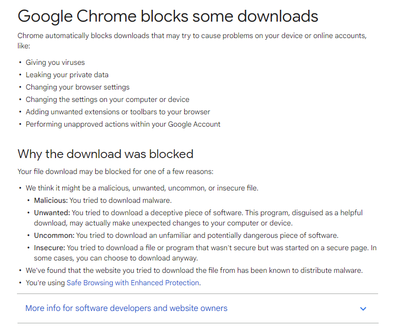
When I tried to get the doc a different way, Chrome gave me an error blocking it due to possible leaks and local machine shenanigans.
Do you know of a way to notify the Corps?
 dd
dd Posted by: @vh
Penn State Wilkes-Barre
BS in Civil. Extended coursework in survey. Other than a few seminars, no real GPS training.
I think they have a BS in surveying engineering. It has about 60 credits in survey, which is typical for a major, as there are math, science, engineering, and general education classes that are required for all majors.
I don’t go to this school, this is just based on what I found online, and what I know from talking to folks.
I think NOAA’s website is the place to start. It is free, and plenty of it starts at an intermediate level. There are some advanced classes that they say are graduate level, but they have a lot of simpler videos and classes to start with.
https://geodesy.noaa.gov/web/science_edu/online_lessons/index.shtml
There’s a lot more available than these lessons, but I think these lessons are a good starting point.

@dave-o The COE dose not care about browsers. I have used firefox for years and have had no issues downloading COE, NGS, etc documents.

Rather old thread.
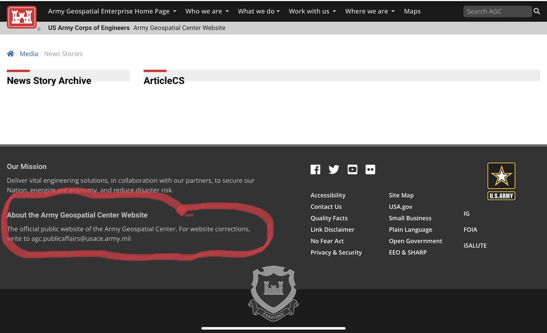
I was able to access the USACE EMs at: https://www.publications.usace.army.mil/usace-publications/engineer-manuals/ today (25 Feb 2022).
As for a contact email regarding USACE web pages, see:
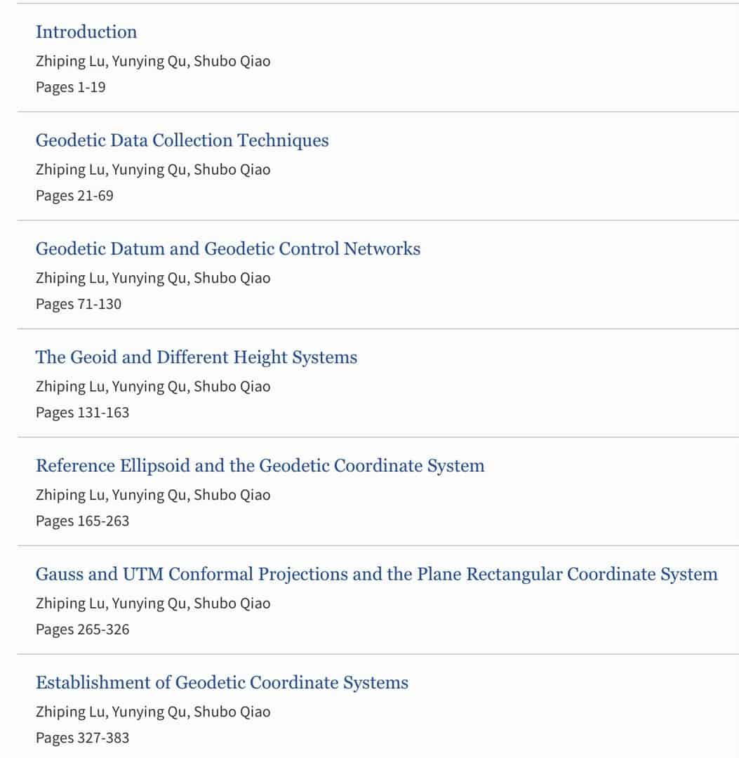
Since my original posts to this thread, I will add ??Geodesy:Introduction to Geodetic Datums and Geodetic Systems? by Zhiping Lu, et al published by Springer 2014. There is an ebook version as well as the possibility of buying chapters and not the whole text.
It is intended to be an undergraduate text. There are some notation and designations changes from those used in the US. I found the writing to be clear.
You might consider reading journals like the Journal of Geodesy, Journal of Applied Geodesy and Journal of Geodetic Science. They include ??open access? articles and quite expensive single articles.
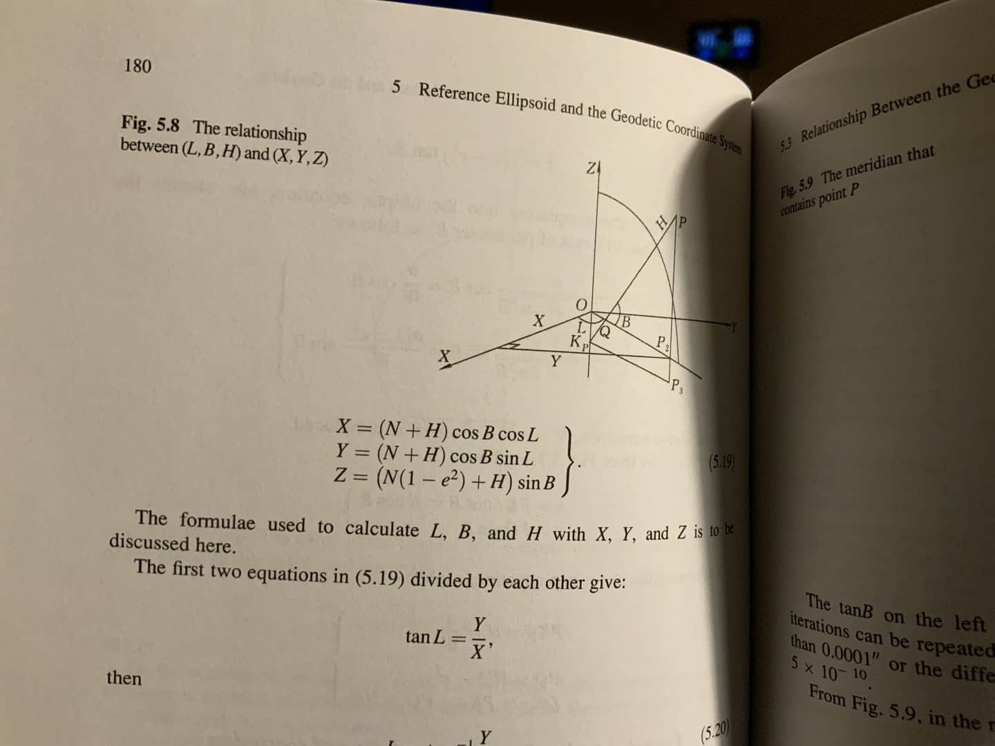
A sample from the recommended text:
@geeoddmike Thanks! I need much more technical and practical understanding in these.
I’m going to contact COE too on the weblink. I was able to get a couple other docs no problem but the “Navstar Global Positioning System Surveying” paper continued to give me problems. Our network threat protection even flagged it specifically as “can’t be downloaded securely” so I think something’s up.
Thanks again (all) for the great info.
dd Posted by: @vh
Having spent the last couple years concentrating on my license, most of my time and energy has been spent on legal principles, state regulations (Massachusetts), and standards of practice. Speaking with a friend of mine the other day who uses GNSS, specifically RTK, I??ve come to realize how little I actually understand of Geodesy. I??ve been doing static GPS for a while using OPUS with good results, but now I??m looking to get a little more involved.
Does anyone know of any course work in the northeast, maybe online, or decent reading material they can recommend? I??ve read some of the NOAA manuals, Basic Geodesy, Geodesy for the layman, etc.. , but maybe there??s a more recent text using examples from modern GPS applications. Thanks in advance.
-V
Consider joining the AAGS (American Association for Geodetic Surveying). I think you will find what you are looking for.
You will find a group of people who make their practice in geodesy and enjoy sharing their knowledge. Indeed, several wrote the books you might study.
JAC
While blundering about on the web, I happened upon a free digital copy of the University of Delft textbook, ??Surveying and Mapping? by Christian Tiberius, et al.
Skimming through it, I found a lot to like. It is intended for their upper-division undergraduate students. Writing is clear with numerous problem sets. The digital copy??s table of contents allows quick access to topics of interest.
Site for download or to purchase a printed copy is:
https://textbooks.open.tudelft.nl/textbooks/catalog/book/46
I find textbook and journal prices to be outrageous. Probably a function of my advanced age. The Delft folks have also made available some other noteworthy texts.
 Posted by: @geeoddmike
While blundering about on the web, I happened upon a free digital copy of the University of Delft textbook, ??Surveying and Mapping? by Christian Tiberius, et al.
There is quite a lot there and well written. Thanks for the link. It does seem to be incomplete in places, which probably accounts for the price.

@jacavell Why would you recommend AAGS ? I see nothing good about this org. Go to the web site and you will see nothing to help anybody in GPS let alone Geodesy. It’s just a name so they can rip you off for money.
JOHN NOLTON

GNSS is the most relevant toolset for modern geodetic surveying, but GPS/GNSS is not geodesy. Go back to Hosmer and the math greats first. Learn the craft and the use of tools comes easy.
FWIW, I have intermittently gathered links to geodesy-related subjects and posted them to my personal web page here: http://geodesyattamucc.pbworks.com/w/page/140697441/Links
Enjoy.
John, I have several reasons for recommending AAGS. I happen to be president this year and mentioning the organization that is made up primarily of the folks who do the geodetic research and write the journal articles that answer geodetic questions seemed like a good reference for someone looking for geodetic information or advice.
You are correct that the website doesn’t offer much education or the like. Most of the members are scientists or surveyors and not web designers, and AAGS isn’t selling any retail items, so it doesn’t have the “splash” most commercial sites do. We should work on that.
Like any good organization, AAGS does want to provide services that benefit all. Many if not most of our members work for or are retired from government agencies like NGS, NGA, military, or are researchers or faculty in universities. Many of the books one may use for reference were written by AAGS members. Many of the geodetic computer programs available for your use were written by or use the algorithms created by AAGS members.
Like any good organization, AAGS needs the capital to meet its expenses. There are only a few ways to do so for an NPO like AAGS.
- Raise dues without losing members
- increase membership
- Sell something
I have as a priority to increase membership significantly, (with luck raise it enough to consider reducing dues).
The AAGS publishes the Surveying and Land Information Sciences (SaLIS) journal. it is available online to members and several libraries subscribe and have hard copies for lending.
At this time, AAGS is working toward an app on the website, available to members, with the tentative name “Ask a Geodesist” where questions are vetted by a moderator and posed to volunteer AAGS members to post answers.
We have under development and nearly ready for prime time a geodetic certification project. This will consist of available tests that one can take and receive certification for that level of demonstrated geodetic competence. Along with that will be geodetic courses appropriate to the level of the certificates that one can take in preparation for a certification test.
So, YES, AAGS wants your money. More importantly, AAGS wants your participation and contribution. And, yes, we can do much better communicating through the website. All of the board members have a 1st job to do and we don’t have employed staff to lean on. But, like Avis used to say, “We try harder.”
JAC


Log in to reply.