
Activity Feed › Discussion Forums › Strictly Surveying › For a Luddite
For a Luddite
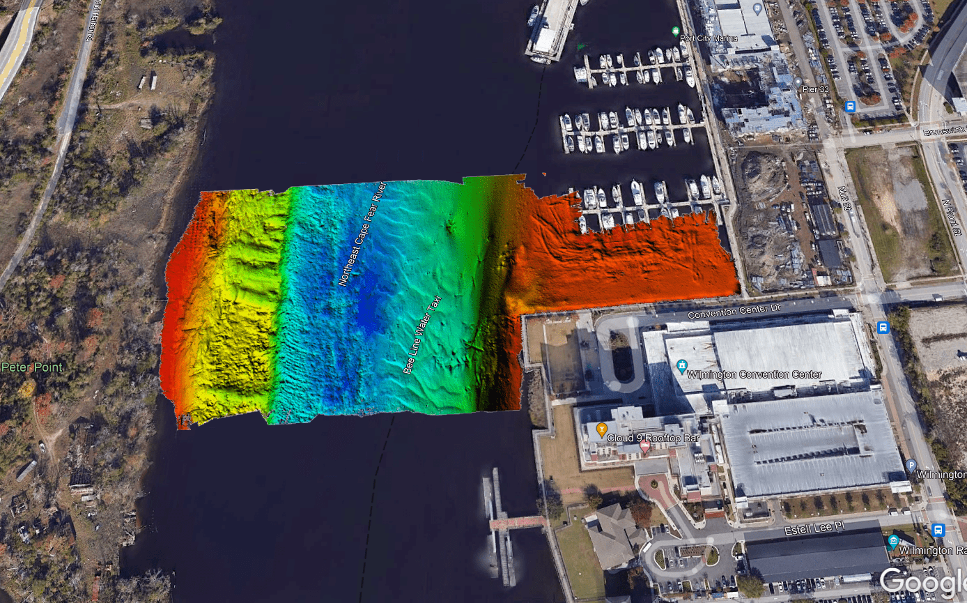
Posted by james-fleming on November 14, 2022 at 1:18 pmI do occasionally loves me some technology. Daily updates in .kmz format of my bathymetric survey subconsultant’s progress
 firestix replied 1 year, 5 months ago 5 Members · 10 Replies
- 10 Replies


That is pretty neat.

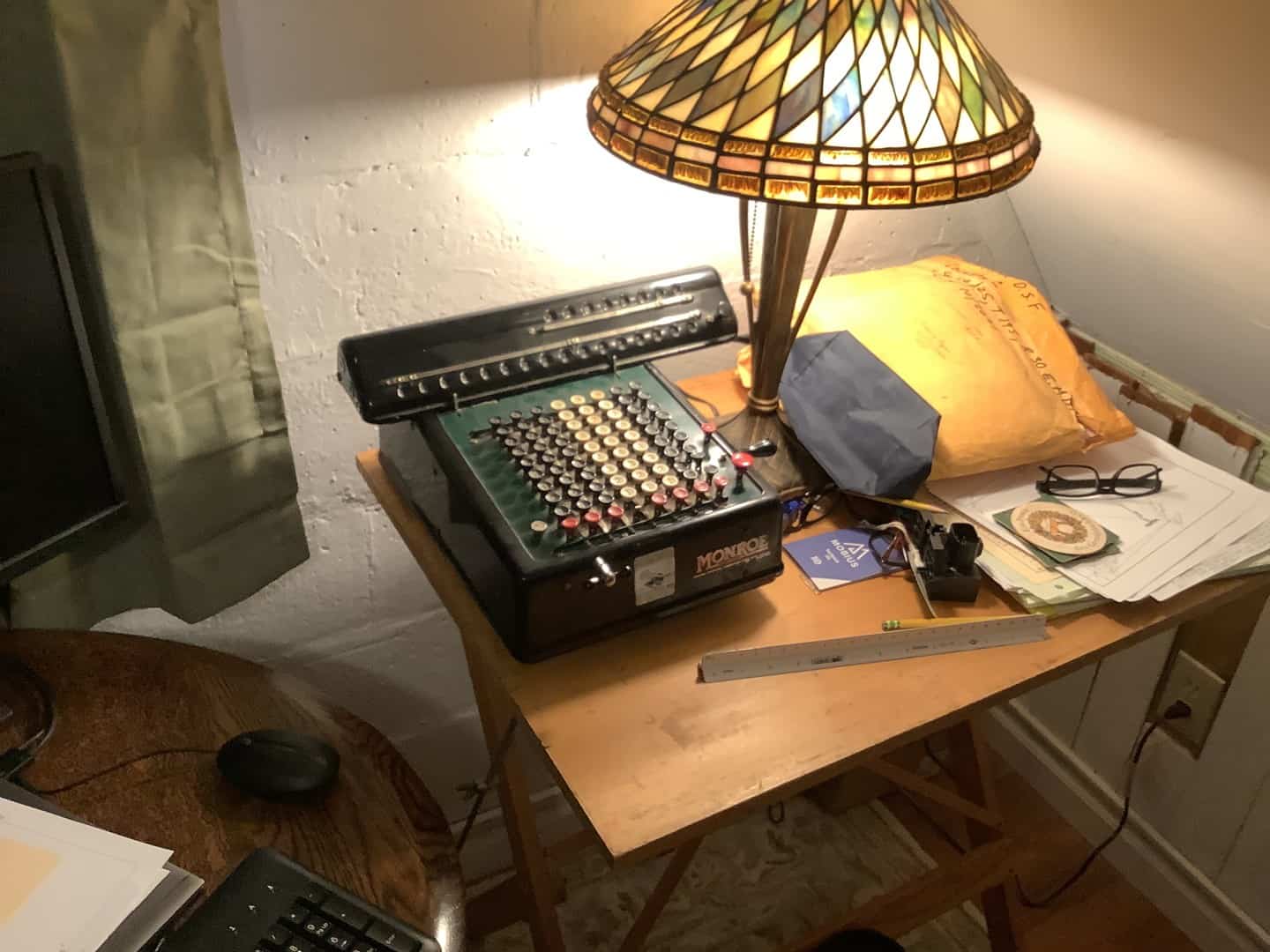


@dave-karoly We used to have a calculator like that; then my dad got a job.

I do occasionally loves me some technology. Daily updates in .kmz format of my bathymetric survey subconsultant’s progress
— attachment is not available —
Is that adjacent to the PPD building?

Thats super cool. We’re using ArcGIS Online web maps to track field progress. Client loves it, the office loves it, and the crews love it because when they recover a monument or finish a topo zone, they update the layer in realtime and everyone else can see. Minimizes duplication of effort.
“…people will come to love their oppression, to adore the technologies that undo their capacities to think.” -Neil Postman@rover83 This company has excellent client communications. We put a bunch of their daily updates together and sent it to our PM’s nationwide as an example
@firestix Your guess is as good as mine. Someone else is running the project, I’m just copied because it’s east of the Mississippi.
I used to work at an Surveying/Engineering firm right there on the river. Makes me wonder if they’re doing the hydro work. Either way, it’s nifty a bottom scan model.
@firestix It’s for an HDD bored fiber crossing. Our crew just wrapped up the land-side work over the weekend. My only experience with the site is I drive down the highway on the left on my way to Oak Island every couple of years
On your way down that highway … have you ever stopped at the battleship?


Log in to reply.