
Activity Feed › Discussion Forums › Strictly Surveying › Can you see the monuments?
-
Can you see the monuments?
Posted by not-my-real-name on September 1, 2016 at 10:44 pm cee-gee replied 7 years, 10 months ago 10 Members · 16 Replies
 -
16 Replies
-
The “plan” is dated 1933.
Historic Boundaries and Conservation Efforts -

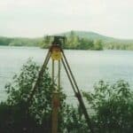
All I see is the stone wall and the lake. Natural monuments of sorts. Not much else there. Good luck with it. I have seen some like this and no, they are very pretty.
-

There might be LOTS of monuments out there, some of them might even be Corners too!
:innocent:
Loyal -
Loyal, post: 389235, member: 228 wrote: There might be LOTS of monuments out there, some of them might even be Corners too!
:innocent:
LoyalYou are such an optimist. I hope you are right. I’ll be digging it.
Historic Boundaries and Conservation Efforts -

At least those lots are roughly parallel and rectangular. Try that plat with a bunch of curved roads. We’ve got several around here.
-

not my real name, post: 389221, member: 8199 wrote:
Is that the actual survey or a re-creation of a survey by a city engineer? In my area the city engineers have reproduced an engineering document from the actual survey without all the survey information. Which often lacks the pertinent data.
-

Is it common to have plans/plats like that with no bearings?
-
Tommy Young, post: 389241, member: 703 wrote: At least those lots are roughly parallel and rectangular. Try that plat with a bunch of curved roads. We’ve got several around here.
With out the radius…You must work in Va
-
Seb, post: 389249, member: 7509 wrote: Is it common to have plans/plats like that with no bearings?
Yes.
-
After stalking the job on Google Maps, was Overlook Drive ever constructed?
Is that tree I have circled in red at the corner of the stone wall as shown on the top left of your image?

-

Seb, post: 389249, member: 7509 wrote: Is it common to have plans/plats like that with no bearings?
From that era, yes.
-
I seems Seb has done all the field work on Google Maps. Good work. Although I have seen other drafting board surveys like this one I am also familiar with survey work that is extremely precise and from a time much earlier than this plan.
The lots do appear to be parallel, but at some point the angle of the side lines changes. I was tasked with finding the boundaries of lots 14, 15 and 16. Then after looking into it a little I got a call that they wanted another surveyor.
It seems it used to be a trend to drafting board survey these lakeside camps. I think the surveyor planned his retirement that way by getting all the stake out work once the lots were built out.
Anyway I am no longer involved on this project. Thankfully this type of work would not be allowed today.
Historic Boundaries and Conservation Efforts -

I did a corner record with a west boundary line based off the mean high tide, where the mean high tide line was literally a synthesis of my creation. The mons were set on line on top of a bluff using a bearing bearing intersection with found mons.
We’ve also encountered a map similar as the one posted with no evidence of any survey records/activity to present day. Many maps with no bearings. That one turned into us holding the lines of occupation and based our BOB off of NAD 83 1st order mons. And a lot more. Not ideal by any means. -

The stone wall, the lake, and the roads are monuments. There may be court case cites by which you could justify an assumption that monuments were set by the original “surveyor” — whether what you find are or memorialize the positions of original monuments — could be a challenge.
Log in to reply.