
Ah, 1837 Galveston Map's Author is Texan !
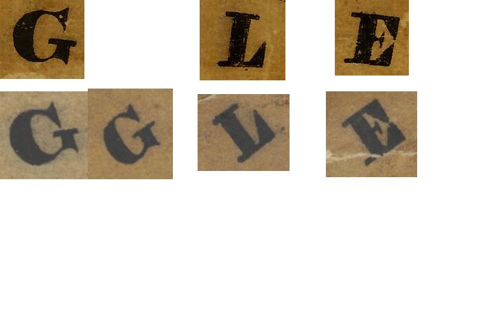
I suppose the key to solving certain mysteries is to always be willing to recognize the obvious answer when it is staring you in the face. That happened today around 5 o’clock as I was wrapping up the day’s work in the research room at the General Land Office. One of the loose ends from the Galveston project was the identity of the author of a certain map dated 1837 showing the survey of the West part of Galveston Island into lots.
In the last installment, I had begun to think it was drawn in New Orleans, which was concerning, both culturally and otherwise. In this installment, I realized as I was putting my papers back into the folder I’d walked in with that I was staring at a map hanging on the wall that was remarkably similar to the Galveston Island map.
It was the North arrow that caught my eye and made me look more carefully, identifying the draughtsman of the Galveston Island map as Stephen F. Austin’s son-in-law, James Franklin Perry. Mystery solved.
http://www.tshaonline.org/handbook/online/articles/fpe44


Log in to reply.