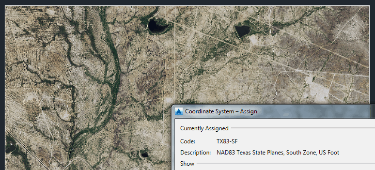
I work in Texas and add aerial imagery from the TNRIS website for my work.
With the 2012 imagery, we have no issues adding a TNRIS image, but with the brand new 2014 imagery, we have not found a solution for adding it into our drawings yet.
Basic Process for inserting 2012 AND 2014 imagery:
1ST: I check Drawing Settings to verify that the Projection is "State Plane 83", the Zone is "TX South", and that the Lat/Lon Datum is "NAD83".
2ND: I use the _MAPCSASSIGN command to check Coordinate System is TX83-SF.
3RD: Type in the command IINSERT, follow the file path to the image I want to insert, and make sure the Insertion dialog button is checked, click open.
2012 imagery Process:
- My Image Insertion window pops up and under the Transform tab, I verify the Coordinate system reported by Image, which is "UTM83-14". I then click over to the Transform tab and check that my scale is "1:1". Click okay and wait for the image to load, and then continue on with my work.
2014 imagery Process:
- Before the Image Insertion window pops up, Carlson/AutoCAD tells me "The coordinate system chosen for this image is invalid." I have two options to click OK or Details, and the Details basically says the same thing. After clicking on the OK button I then go to Image Insertion pop up window.
- After reading through the text document for the new imagery, I change the coordinate system code to UTM84-15N (Description: UTM-WGS 1984 datum, Zone 15 North, Meter; Cent. Meridian 93d W), and click okay.
- Again the same error message pops up saying "The coordinate system chosen for this image is invalid." And I have two options to click OK or Details. As soon as I click OK Carlson/AutoCAD appears to ignore the command and does nothing else, except waiting for a new command.
-I've tried different coordinate systems (within reasonable relation to my drawing settings of TX83- SF), and I'm getting the same results every time.
Here's a TNRIS website link: http://tnris.org/data-download/#!/quad/Tordillo%20Creek . We typically download the whole zipped file for the the quarter of the quad, and extract the data before beginning the image insertion process.
One thing that sticks out like sore thumb to me is contained within the 2014 imagery document describing the imagery, saying the following:
" Process_Description:
Following the receipt of the NAIP uncompressed geotiff
quarter quadrangles (QQs) at APFO via a contract
vehicle. Each NAD83 NAIP QQ image is transformed into
the Web Mercator Auxiliary Sphere (WMAS) projection.
This transformation was accomplished using ESRI
ArcGIS 10.1 Arctools with the datum recalculation
algorithm "NAD_1983_To_WGS_1984_5" and Nearest neighbor
resampling method. Then each NAIP image is clipped
with a 2 pixel margin on all four edges using a DOQQ
vector frame."
-Why would they do a datum recalculation from "NAD_1983_To_WGS_1984_5"?
And that the 2014 imagery does not have a False Easting or Northing, where the 2012 imagery does.
(from 2014 text doc:)
"['WGS_1984_Web_Mercator_Auxiliary_Sphere',
GEOGCS['GCS_WGS_1984',
DATUM['D_WGS_1984',
SPHEROID['WGS_1984',6378137.0,298.257223563]],
PRIMEM['Greenwich',0.0],
UNIT['Degree',0.0174532925199433]],
PROJECTION['Mercator_Auxiliary_Sphere'],
PARAMETER['False_Easting',0.0],
PARAMETER['False_Northing',0.0],
PARAMETER['Central_Meridian',0.0],
PARAMETER['Standard_Parallel_1',0.0],
PARAMETER['Auxiliary_Sphere_Type',0.0],
UNIT['Meter',1.0]]"
Any ideas on a solution for this??


