
Activity Feed › Discussion Forums › Strictly Surveying › Today’s Pincushion…

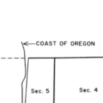
In Oregon per Or. law, on new subdivision plats, the platting surveyor is field checked by the county surveyor/ city surveyor, that monuments reported on the plat are +-0.10 or 1/10000 of the reported position.
This has removed the ability of the platting surveyor to tell what I call “white lies”. So we get ( in my geographic region) what I call “virtual pin cushions” found 5/8” rod with plastic cap xxxx flush per survey xxxx n28e 0.18’ from computed position. In my last life I would just say found and accepted with the record equal to the measured data on map. On my ‘stake out/ control sketch ‘ I would have two point numbers, one for record and one for computed. I would use the value the field conditions dictated. For example, If I was staking a wall along the line I would typically use the value that was most conservative to me and my client, if I was using the found point for general site control I would use the measured value…. either way I’m with Bionic man with insignificant numbers….only two surveyors find 0.18’ significant on a lot in a typical subdivision, basically because they judge their pecker size by their ability to measure. I personally am over that personal inadequacy and typically have my eyes open for more significant numbers.
i could go on about this topic because we have the habitual abusers that basically accept 1 plss corner and another for direction and call all other found monuments out of position. Once again because we can measure so well since the invent of electronics and computers these values form nothing more than what I consider the error ellipse of the new breed of land surveyors. For the most part measurement error reporting is much better than prior to the electronics.
My 2 cents, Jp

I would say that most of our issues have to do with the industry wide refusal to conform to the rules of significant digits. I know why we do not, it simply isn’t done that way. We publish all sorts of numbers, and we hope that the reader is able to understand what digits are significant and which are not.
Take the last example: “219.58 (R) – 219.57 (M)”.
If you are publishing to the hundredths, then you put down what you measured. It is what it is. We all know that 219.58=219.59 in the real world. But, it doesn’t quit feel right to say “219.58 (R&M)” when that isn’t the results you got in the field. Perhaps if we simply said “219.6 R&M” things would work out better. (And with the GPS used on many surveys, we would be fully justified in only publishing to the tenth of a foot.)
-All thoughts my own, except my typos and when I am wrong.If the actual pipe is in the deed how in the world would anyone set a pincushion? That is simply nuts.
The ones I have seen are the result of multiple surveyors attempting to find the same corner as described in different (or the same deed), and basically zero of them describe a bound (around here at least).
-All thoughts my own, except my typos and when I am wrong.Had another company come in and set a second punch in a 3″ Centerline surface monument set by us (that already had a perfectly fine punch).
I was less than impressed.
-All thoughts my own, except my typos and when I am wrong.
Looks like it’s clean up time.

Those virtual pin cushions are an awful practice. I never know what they are trying to say. Is the monument their corner, is it their computed position, or are they punting?
I think the “white lies” are misleading too though, reporting the record every time gives the strong impression that the measurement is controlling. If we fudge our measurements to match the record, it is easy to see how someone could come tho the conclusion that if the measurement doesn’t match, its not the corner.
I have always reported the actual measurements, and never have had to spend a significant amount of time explaining small differences. Monuments on the ground controlling is something that is easy for most to understand. Easier to understand than moving the corner they grew up believing in because I measured 2′ different than a surveyor did in 1898.
The majority of local governments I have encountered understand, at least in theory, the variations in measurements, and apply their regulations to the nominal area (or length), the area of the parcel when it was created. I did have one unpleasant encounter with one that didn’t, but standing my ground did wonders. If you are letting a planner, or title company dictate how you resolve your boundaries you are ceding your professional judgment to a non professional.
Off topic, but they actually check your measurements in the field?????
That’s terrible!!!
Long before GPS was a thing I was at one of those CE conferences and a couple of surveyors from another city were sharing my table and in a heated argument concerning a corner. Boiled down to the basic conflict, I gathered it was over .03’…………
I guess we just don’t care enough around here. Usually we accept monuments, there are some cases when it isn’t so, but not because of math.
Next week we will be pulling a 1″ pipe. Accepting the stone mound 30′ away.
I also have a 1-1/2″ pipe about 50′ from a set stone and rebar. That one also needs to disappear, although maybe it can be used as an accessory.
Thanks for your reply.
Yes. We actually field check the monuments in the field on new subdivisions.
My white lies thoughts go back to the days when we would steel tape long lines between monuments. If we did not measure “close to record” ( or if we thought the record surveyor was a cull) we would have to chain it again. It did not take me long to understand measurement error. Re-tapping with two dumb asses that couldn’t pick their nose the same way twice. I exagerate and there is a lot of art in surveying and some professionals have a very good way of presenting that art and others don’t.
You state that you always report your actual measurement. But what do you do when you are retracing a 1990’s subdivision that created a curvilinear road. Centerline and 2 right of ways complete with monuments. Now let’s say part of this road has a reverse curve with 0 tangent between curves and you find all 9 monuments that define the horizontal geometry breaks. You know as well as me that those 9 points are not going to fit. Maybe +- 0.05, 0.10 or maybe 0.25’. Are you going to come up with new geometry? Are you going to call a couple out of position to make the others fit record? It all depends right! Personally it is my opinion that curves were created in subdivisions for aesthetics more than for enginering purposes and “we once would loose our “error” in the curves” before everyone had the ability to measure so damn well :). All I am saying is that no one has written the new manual on how to report incidental error on our surveys. Until some wise one rises from the grave and adds a chapter to his 40 year old bible (Clark, Brown….) we are stuck debating the topic on a public forum. Not a good professional plan and reducing the acceptable error ellipse with every new change in technology is defently not a good path to go down. Leave the art and practice of surveying to the surveyor but for Gods sake let’s get together on what the minimum standard of practice is on the simple issues.
Thanks, Jp

A piece of data is collected. Perhaps by an electronic data collector or perhaps by pencil in a field book. That single piece of data may or may not be correct. Come back to that same monument on a different day at a different time of day with different environmental conditions and with different company-owned equipment. Repeat several times. Perhaps use a different employee a few times. The resultant data will vary considerably for just that single point. Expand this to a dozen or more monuments of different styles that are related (A boundary of a tract, for example). Run all the theoretical number crunching desired. Then cease to report gnat’s patootie bearings and distances.
A simple example using a total station setup with the exact same equipment but three different rodmen. The same data will not be produced by all three. One will almost always have a shorter distance from gun to rod than the other two. One will routinely have longer distances. The third may agree on distance with one of the others but will be leaning the rod a bit to the left (or right) consistently relative to either of the other two, thus producing different bearings. Switching to GPS doesn’t help because the same human frailties are involved.
Retracement work accentuates the foolishness of pretending one’s micro-measurement is superior. Claiming a hundredth or 3 0r 4 of measurement error and a small number of arc-seconds merely proves that your error ellipse and your choice of spot on the monument to shoot falls within the error ellipse of the tract creator and his choice of spot on the monument. This should be the norm when following modern work. Comparing micrometer tools to monuments originally measured in axe handle lengths, of course, will have vastly different results. When the results hit the monument, why reinvent the wheel?
Repeatability.
What I have learned here is that there is the Texas Method and there is the Everywhere Else Method. The Texas Method encourages the rewriting of the original description by every retracement surveyor forever and ever. The written location of the boundary is never settled because of the need to report different distances/bearings to prove the latest surveyor didn’t simply repeat the prior surveyor’s number. To use the same numbers makes the latest surveyor appear to be negligent.
Let’s leave the Texas Method in Texas as the entire property ownership system in Texas is comfortable with that chaos, whereas Everywhere Else is not.
When my neighbor’s deed says his tract is such and such by so and so and begins here and ends there, that is where it is. My description needs to match his description on our adjoining sides. Then my neighbor on my other side needs a description compatible with mine. They need to fit neatly. The rest of those involved in real property are counting on us to make it that way.

You have no clue how to Survey in Texas, why are you so obsessed with Texas Surveying?

imo, it’s only chaotic to those who obsessed with numbers. and, admittedly, the collective effort to perpetuate good language in the drafting of metes and bounds is a little lacking, but the bottom line, legally- as far as i understand it and practice it- is as such:
in the preamble to any legally valid description, there must be reference made to SOME vesting document. doesn’t have to be the most current (though it almost always is), but it does need to refer to a document that would allow the layperson to reference the description against a known quantity. jumping off from there is where you start seeing… chaos.
because as far as i’m concerned, if i go out and retrace a survey and find, substantially, the called for monuments/bounds in undisturbed condition and, generally, nothing to indicate any errors in the previous referenced deed in the preamble to my metes and bounds, then the language is- explicity- “BEING THAT SAME TRACT AS CONVEYED TO JOE SCHMO BY VOL, PG, DATED…” and commence to report my bearings and distances as measured on the date of my survey. title people here get that. MOST attorneys these days get that. eventually maybe more of the GIS gnats will get it, and i have no problem explaining to clients why the numbers aren’t exactly the same (it’s an included component of my fee, let’s say).
i also include a bearing and coordinate basis statement at the end of every description (as is required by statute) because, in fact, many of the deeds being retraced are based on solar shots or ancient compass readings or some other unknown (and often arbitrary) bearing, which i’m not about to hold just because it’s record. otherwise all this cash i’ve laid out for gear over the last howevermany years has largely been a waste of money.
- Posted by: @dmyhill
If the actual pipe is in the deed how in the world would anyone set a pincushion? That is simply nuts.
they’s better measurers, i reckon.

The important thing to notice in every description, original, re-written or ancient is what is called for and what is found for monuments.
“It is better to have measured wrong to the correct moment than it is to have measured exactly to the wrong location.” This is what I say as paraphrased from what Alan Greenspan said and mentioned in the sayings of that Supreme Court Justice.
https://www.webassign.net/question_assets/unccolphysmechl1/measurements/manual.html
A critical legal requirement in Texas is that the new property description and drawing properly note the existing neighboring property owners at the time of the survey and the legal documents that are on record of the property being surveyed that reflect the current owner claims.
This alone requires re-writing the description.
I believe that Everywhere there is that element of “I can measure better than you” attitude.
Then there has been that “My equipment is better than your” attitude.
Mostly it recent times it is falling prey to “My datum is better than yours” attitude.
What ugly attitude will rear its head next to muddle the puddle.

Today??s pin cushion. Notice the caps have the same number.


My math is better than yours!
 Posted by: @scott-ellis
The only problem with that is sometimes, on rare occasions all the iron rods are correct.
In fact, if they are all original they are indeed all correct!
So the reason I am surveying these properties is they plan on constructing a concrete drainage channel on the rear of the lots and I had to locate all monuments so I can replace them.
So once the ditch has been constructed do I replace both pins?
I plan on drilling holes and setting mag nails with washers in place of all of the pins found at their original locations.
Sorry about the late reply…
Oregon does require subdivision and partition plat monuments to measure within a tenth (or 1/10,000). See ORS 92.050(2), https://www.oregonlaws.org/ors/92.050 or ORS 92.060(4), https://www.oregonlaws.org/ors/92.060. My question is measure within a tenth of what?
My understanding is that field conditions have to match within a tenth of the measurements reported on the submitted subdivision or partition plat document. In other words, the field measurements and submitted paperwork need to be consistent.
I’ve never understood this requirement to apply to record information. I have seen some variation on interpreting this requirement. Some people do interpret it as applying to record information and match their work to record within a tenth.
What do you (or others, especially Oregon Surveyors) think?
If there is a 100′ x 500′ tract of land, it is up to the surveyor to determine where that exists on the ground. If there are existing monuments from when the tract was created, it is unlikely to exist as 100′ x 500′. Let’s say that the surveyor determines the tract to exist as 100.3′ x 499.8′. It seems that ORS 92 would require that the monuments as they exist in the field (100.3′ and 499.8′) be reported on the submitted subdivision or partition plat within a tenth. In other words, the submitted subdivision or partition plat must list values in the range 100.2-100.4′ x 499.7-499.9′ to comply with the ORS 92 requirement. I don’t see that the record of 100′ x 500′ has any relevancy to reporting the measurements and the requirements of ORS 92.
Virtual pin cushions and monumented pincushions seem to be the same thing to me, neither one is accepting the existing monument. Both are creating a new position for the corner. The only difference between real and virtual pincushions are that one monuments the new position on the ground and the other indicates that new position on the paper using the existing monument as a reference. I don’t think that ORS 92 requires surveyors to match record information within a tenth and create real or virtual pincushions. It seems if the surveyor determines that the property boundary is to accept the existing found 5/8″ rod with plastic cap xxxx flush per survey xxxx n28e 0.18′ from computed position they are free to do so. It seems that ORS 92 would require that they then report that accepted position within a tenth. ORS 92 would prevent accepting the found monument and reporting record and measured as the same.

Log in to reply.