
-
I need to extract crd file point data
Short: I need to extract the data out of a CRD file our septic designer gave me. He has been unwilling to assist me other than providing me with the CRD file which from my research suggests I need to purchase Carlson software to get the 10 or so points of data in the file :/
How can I either extract the point information in this file as text or convert it to something QGIS or GRASS can consume for free?
Background and more detail:
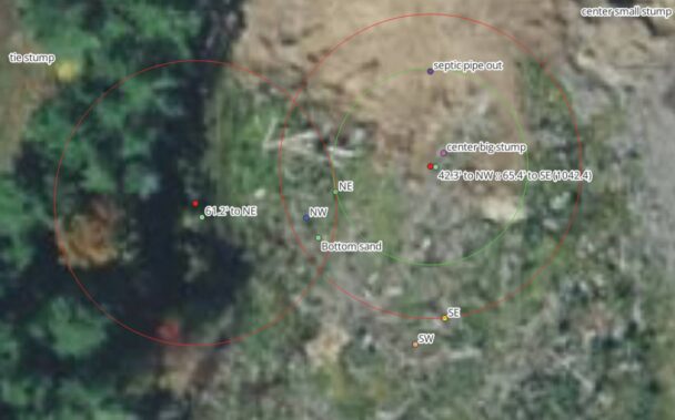
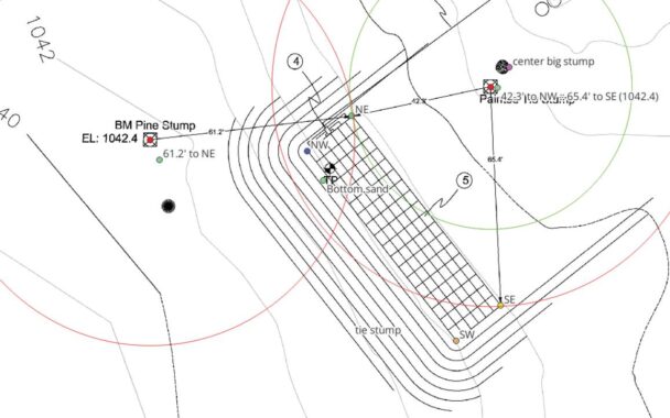
I work in GIS for a living and I am a computer programmer specializing in GIS applications and data processing. My other “Job” though is building our forever home. I have used my knowledge of GIS, orthogonal mapping, surveying, etc to make this process faster and more accurate while allowing me to plan things at home before going to the site.I am about to start the septic and wanted to confirm the stakes I have put in the ground using a combination of QGIS and my Emlid GPS devices are accurate to the drawings surveyed points.
I had to work backwards with just the drawings and survey the two known points then measure out from there in QGIS using symbology set to map units (ft in this case) to then find intersections of the symbology to set the points for the leach field … in short I think I am where I need to be but wanted to confirm and requested the northing / easting / elipsoid / elevations etc from the designer for his two known points so I could hard code them into my Base unit while over top the known points. But all I was provided was the binary CRD file.

Log in to reply.