
Describing a road in a Plat – Best practices
I have moved to working in an office where I am the only licensed surveyor, and with COVID, the only person with any surveying experience sitting in the office. This limits my interaction with others. I especially miss this when creating legal descriptions.
I am writing a legal description of Landis Court SW, as shown on the attached picture. Through some yet to be determined operation, it is being transferred to municipality ownership.
Now, the limits of what exactly are Landis Court SW are not implicitly defined, but I think I am just going to do a metes and bounds around the boundary, including the fillets along Chatterton Ave SW and the cul-de-sac.
Anyone want to argue for using the centerline with some language that includes the fillets and cul-de-sac?
(I had nothing to do with the creation of this plat, BTW.)
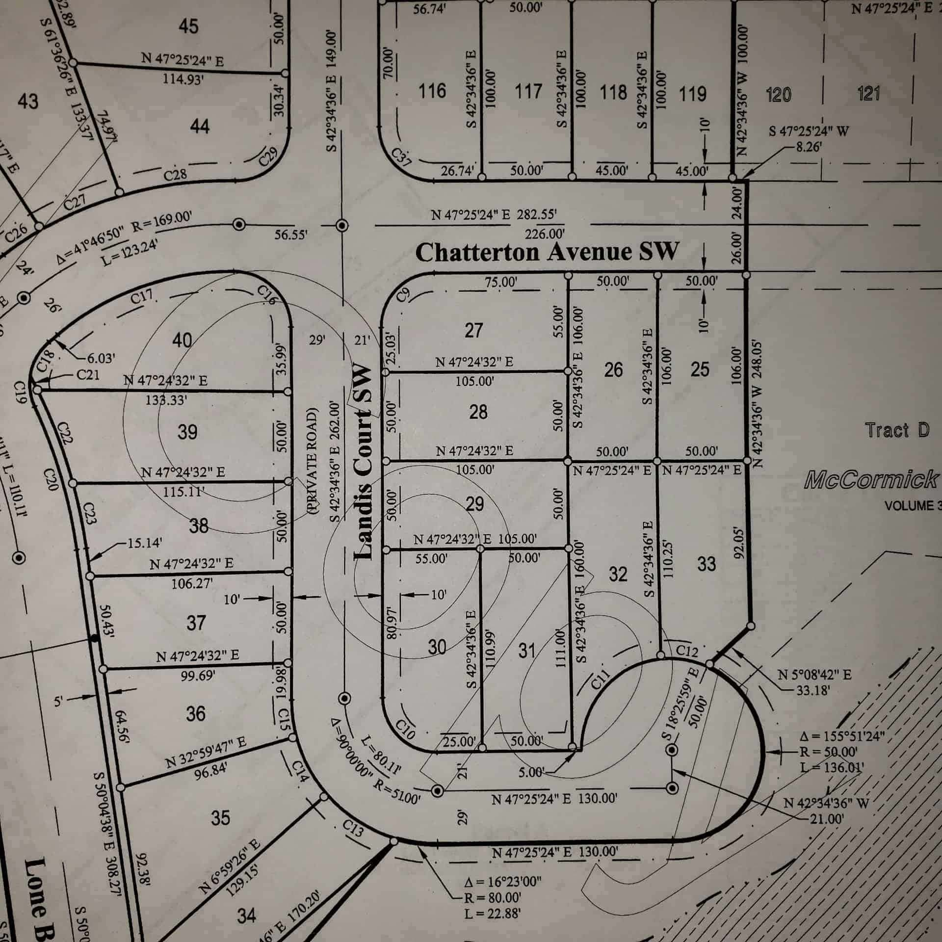
If anyone wants to look at the original: McCormick Meadows, Div 2, P153 V33, Records of Kitsap County.

Log in to reply.